Search
Search Results
Date:
1960
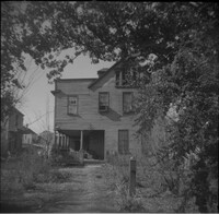
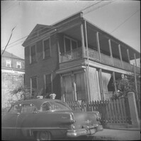
Description:
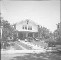
Original 11 George Street, since demolished and currently the site of a parking lot.
Date:
1960
Description:
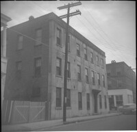
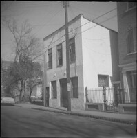
12 George Street, since demolished.
Date:
1960
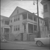
Description:
14-16 Wentworth Street, later demolished. Also features partial view of 18 Wentworth Street (left) and 10 Wentworth Street (right).
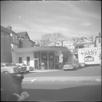
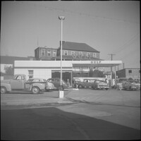
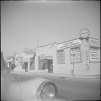
Description:
Gas station at the northwest corner of Wentworth Street and East Bay Street.
Date:
1960
Description:
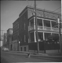
Left to right: 23 Society Street and 25 Society Street, later demolished. The houses were at the southwest corner of Society Street and East Bay Street.
Date:
1960
Description:
Left to right: 23 Society Street, 25 Society Street, and partial view of 27 Society Street. All were later demolished.
Date:
1960
Description:
27 Society Street flanked by partial views of 25 Society Street (left) and 29 Society Street. 25 and 27 Society Street were later demolished.
Date:
1960
Description:
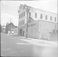
Humble Oil gas station (288 Meeting Street), located at the southeast corner of Meeting Street and George Street. Later demolished.
Date:
1960
Description:
Gulf gas station located at 299 East Bay Street, northwest corner of East Bay Street and Society Street.
Date:
1960
Description:
309 East Bay Street (Watson's Grocery), located at the southwest corner of East Bay and Laurens Street, before demolition. (The house at 116 Anson Street was moved to this site with the current address 39 Laurens Street.)
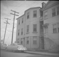
Date:
1960
Description:
32 Anson Street, which had been located at the northeast corner of Anson and Hasell Streets, later demolished. 45 Hasell Street at right.
Date:
1960
Description:
32 Anson Street, which had been located at the northeast corner of Anson and Hasell Streets, later demolished.
Date:
1960
Description:
Likely the 320 block of East Bay Street, east side of street, houses since demolished.
Date:
1960
Description:
322 East Bay Street (right), 324 East Bay Street (middle), partial view of 326 East Bay Street (left), since demolished.
Date:
1960
Description:
Possibly an outbuilding to 325 East Bay Street, since demolished.
Date:
1960
Description:
325 East Bay Street, since demolished.
Date:
1960
Description:
325 East Bay Street, since demolished.
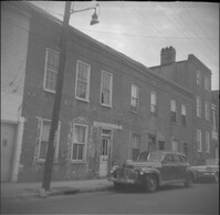
Date:
1960
Description:
Businesses located at the northeast corner of East Bay Street and Vernon Street: Milbren's Laundry and Dry Cleaning (334 East Bay Street) and Fort Sumter Paper Co. (336 East Bay Street), since demolished.
Date:
1960
Description:
Fort Sumter Paper Co. (336 East Bay Street) and Sam Solomon Co. (338 East Bay Street), since demolished.
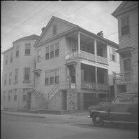
Date:
1960
Description:
36-40 Anson Street, later demolished. 34 Anson Street at far right.
Date:
1960
Description:
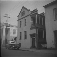
45 Wentworth Street, later demolished.
Date:
1960
Description:
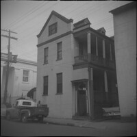
45 Wentworth Street, later demolished.
Date:
1960
Description:
45 Anson Street, later demolished.
Date:
1960
Description:
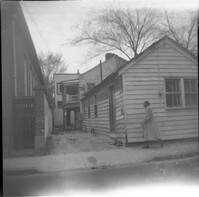
Northeast corner of Hasell Street and Anson Street, the site where 46 Anson Street once stood. Now a parking lot
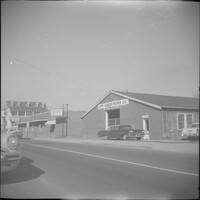
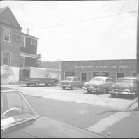
Date:
1960
Description:
Charleston Automotive Services (63 Hasell Street), now a parking lot.
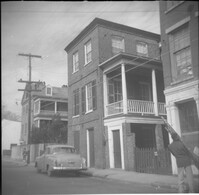
Date:
1960
Description:
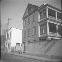
Right to left: 64 Anson Street (later demolished), 66 Anson Street (Chazal House), and 72 Anson Street (Kohne-Leslie House).
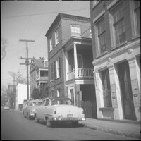
Date:
1960
Description:
Right to left: 64 Anson Street (later demolished) and 66 Anson Street (Chazal House).
Date:
1960
Description:
Right to left: 64 Anson Street (later demolished) and 66 Anson Street (Chazal House).
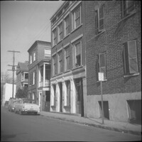
Date:
1960
Description:
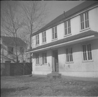
65-67 Hasell Street (USO Building).
Date:
1960
Description:
68 Anson Street, later demolished.
Date:
1960
Description:
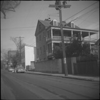
Right to left: 72 Anson Street (Kohne-Leslie House) and the original house at 74 Anson Street before its demolition.
Date:
1960
Description:
Right to left: 72 Anson Street (Kohne-Leslie House) and the original house at 74 Anson Street before its demolition.
Date:
1960
Description:
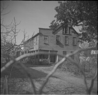
74 Anson Street before its demolition. (The house originally at 15 Wall Street was moved to the site in 1966.)
Date:
1960
Description:
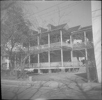
76 Anson Street before its demolition, located at the southeast corner of Anson and Laurens Streets.
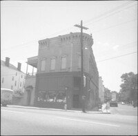
Date:
1960
Description:
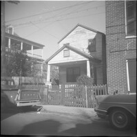
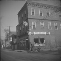
78 Anson Street (Royal Food Market), corner store located at the northeast corner of Anson and Laurens Streets, before its demolition.
Date:
1960
Description:
78 Anson Street (Royal Food Market), corner store located at the northeast corner of Anson and Laurens Streets, before its demolition.
Date:
1960
Description:
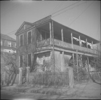
The original house at 82 Anson Street, later demolished to clear the lot for the relocation of the house at 86 Anson Street (Mary Smith House).
Date:
1960
Description:
The original house at 82 Anson Street, later demolished to clear the lot for the relocation of the house at 86 Anson Street (Mary Smith House).
Date:
1960
Description:
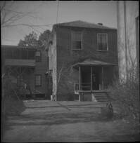
Unidentified house on East Bay Street, east side of street, likely within the 320 block, since demolished.
Date:
1960
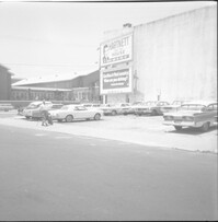
Description:
Northeast corner of Hasell Street and Meeting Street. Parking lot and building with billboards advertising "Hartnett for House" and Paul Motor Co.