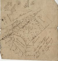
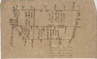
400 acre plot of David Elliot that includes what appears to be a marsh called Great Bay, no land types or detail. Names associated with this plat are David Elliot, Washington, Henry Sattus and J. Hardwick. Notable geographic locations include Georgetown and Great Bay.
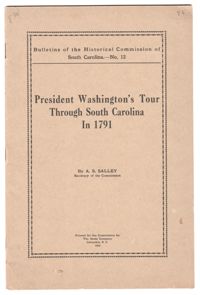
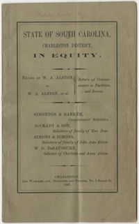
A pamphlet by A. E. Salley using Washington's travels through South Carolina to highlight genealogy of South Carolinian families and the histories of their plantations. Salley also uses the footnotes to correct errors other historians made when interpreting Washington's travel diary.
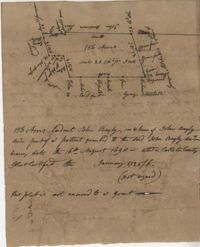
Copy of plat of 300 acres of land situated in Craven County on the north side of the Santee River bounding north east on Bennett's land and the other sides on vacant land. Names associated with this plat are Susannah Williams, Thomas Ferguson, Moses Bennett, and Benjamin [?]. Notable geographic locations include the Santee River, Craven County [now in parts of Berkeley, Charleston, Georgetown, and Williamsburg counties], and Georgetown.
A cash book for Robert F.W. Allston for the years 1823-1843. The book includes account transactions conducted by Allston including payment of overseer wages, the hiring out of enslaved people, transportation, taxes, governesses, nurses, crops, sundries, and cloth distributed to slaves. This book also includes accounts between Allston and other individuals including the Estate of Charlotte A. Allston (primarily for the purchases of blankets, shoes, and cloth for enslaved people) and an account with Mary P. Jones. The last several pages of the book contain cash ledgers. Allston explicitly notes accounting related to Matanza Plantation, later known as Chicora Wood. Other account records do not explicitly state plantation sites.
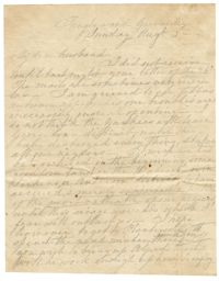
A handwritten, four-page letter from Emma Alston to her husband, Charles Alston, in which she laments the ongoing Civil War and specifically worries about their ability to maintain their enslaved workers. She advises him on which enslaved people to bring to Georgetown and the possibility of hiring out Jack, a blacksmith.
Plan of approximately 1500 acres on Black River near Georgetown part now belonging to Kinloch and Gadsden. Names associated with this plat are Gadsden, Kinloch, Alston, Thomas Gadsden, James Lloyd, and Morreau [?] Sarrazin.