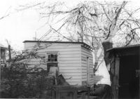
Lot on site affected by the widening of U.S. Route 17. Small house in background, obscured by trees. Presumably located in Mount Pleasant or vicinity. Surveyor notations on back of photo: "Dkt.: 10.597. Property owner: Mrs. Nancy T. McRae. Tract: 64. Station: 409+40 Lt. Date: Sept. 17, 1968." [See collection description for explanation of surveyor notations.]
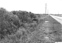
Lot on site affected by the widening of U.S. Route 17. Presumably located in Mount Pleasant or vicinity. Surveyor notations on back of photo: "Dkt.: 10.597. Property owner: O.D. Hamlin. Tract: 110. Station: 479± - 487± Rt. Date: Sept. 17, 1968." [See collection description for explanation of surveyor notations.]
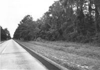
Lot on site affected by the widening of U.S. Route 17. Presumably located in southern Charleston County. Surveyor notations on back of photo: "Dkt.: 10.600. Property owner: The Summerville Land Corp., Inc. Tract: 8. Station: 570± Rt. Date: Sept. 18, 1968." [See collection description for explanation of surveyor notations.]
Structure on site affected by the construction of the Crosstown. Address: 3 Todd Street. On property of previous photos 413-415. Surveyor notations on back of photo: "Dkt.: 10.524. Property owner: John W. Bonaparte, et al. Tract: 118. Station: 87+35 Rt. Date: Dec. 1, 1964. In R/W - Bought." [See collection description for explanation of surveyor notations.]
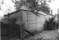
Rear view of structure on site affected by the construction of the Crosstown. Address: 81 Kracke Street. Surveyor notations on back of photo: "Dkt.: 10.524. Property owner: Jerry M. Devoe. Tract: 69. Station: 77+40 Lt. Date: Oct. 14, 1964. In R/W - Bought." [See collection description for explanation of surveyor notations.]
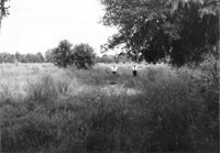
Lot on site affected by the widening of U.S. Route 17. Presumably located in southern Charleston County. Surveyor notations on back of photo: "Dkt.: 10.600. Property owner: R. Arnold Postell. Tract: 16. Station: 630± Rt. Date: Sept. 18, 1968." [See collection description for explanation of surveyor notations.]
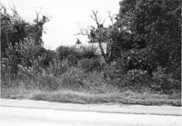
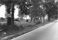
Lot on site affected by the widening of U.S. Route 17. Sign posted to tree: This land cleared by Atlantic Land Corp. Presumably located in southern Charleston County. Surveyor notations on back of photo: "Dkt.: 10.600. Property owner: Arthur J. Stark. Tract: 1. Station: 515± Lt. Date: Sept. 18, 1968." [See collection description for explanation of surveyor notations.]
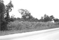
Lot on site affected by the widening of U.S. Route 17. Presumably located in southern Charleston County. Surveyor notations on back of photo: "Dkt.: 10.600. Property owner: Gas Lines, Inc. & Arthur J. Stark. Tract: 1-A. Station: 506± Lt. Date: Sept. 18, 1968." [See collection description for explanation of surveyor notations.]
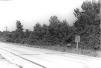
Lot on site affected by the widening of U.S. Route 17. Posted sign says: Speed checked by radar. Presumably located in Mount Pleasant or vicinity. Surveyor notations on back of photo: "Dkt.: 10.439. Property owner: Francis F. Coleman, et al. Tract: 13. Station: 243+73 to 247+33 Rt. Date: Jul. 22, 1965. Taken from Rt. 17 - west side of property showing along front." [See collection description for explanation of surveyor notations.]
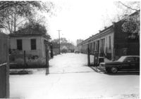
Looking down driveway between City Garage and building with gas pump, on site affected by the construction of the Crosstown. Address: 134 Line Street. Surveyor notations on back of photo: "Dkt.: 10.524. Property owner: City of Charleston. Tract: 128. Station: 91+00 CL Rt. Date: Dec. 2, 1964. Panoramic view." [See collection description for explanation of surveyor notations.]