Page 257 of the City Engineer's Plat Book with two plats. Plat 1 shows lots located between St. Margaret Street and Grove Street. Plat 2 shows lots located along Marsh Street and Concord Street, near where they intersect with Laurens Street.
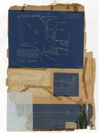
Page 256 of the City Engineer's Plat Book with four plats. Plat 1 shows land located between Elliot Street and Boundary Street, near Mill Street, Bee Street, President Street, and Doughty Street. It also shows several streams, a mill pond, and a large stretch of marsh land. Plat 2 shows a lot on Brigade Street. The third plat shows a lot and building located on the corner of Grove Street and Russell Street. The fourth plat shows lots located near the intersection of Grove Street and Tracy Street.
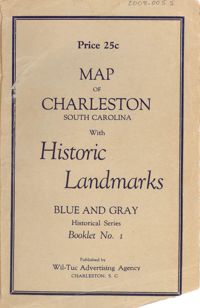
Map of the Charleston peninsula featuring points of interest. Cover title: Map of Charleston, South Carolina with historic landmarks. Blue and gray historical series, booklet no. 1. Published by Wil-Tuc Advertising Agency. Map measures 21” x 6.25” folded to create 13 pages measuring 6.25” x 3.5.