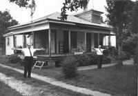
House on site affected by the widening of U.S. Route 17. Presumably located in southern Charleston County. Surveyor notations on back of photo: "Dkt.: 10.600. Property owner: Malsey Lawrence, Estate. Tract: 4. Station: 516±80 Rt. Date: Sept. 18, 1968." [See collection description for explanation of surveyor notations.]
Rear view of house and structure under construction on site affected by the widening of U.S. Route 17. Presumably located in Mount Pleasant or vicinity. Surveyor notations on back of photo: "Dkt.: 10.597. Property owner: James Gailliard. Tract: 101. Station: 465±60 Rt. Date: Sept. 17, 1968." [See collection description for explanation of surveyor notations.]
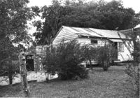
House (rear view, partially obscured by bushes) on site affected by the widening of U.S. Route 17. Presumably located in Mount Pleasant or vicinity. Surveyor notations on back of photo: "Dkt.: 10.597. Property owner: Charles Dingle. Tract: 98. Station 461±50 Rt. Date: Sept. 17, 1968." [See collection description for explanation of surveyor notations.]
House and lot on site affected by the widening of U.S. Route 17. Wire fence in foreground. Presumably located in Mount Pleasant or vicinity. Surveyor notations on back of photo: "Dkt.: 10.597. Property owner: James Gailliard. Tract: 101. Station: 465±60 Rt. Date: Sept. 17, 1968." [See collection description for explanation of surveyor notations.]
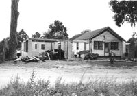
House and structure under construction on site affected by the widening of U.S. Route 17. Presumably located in Mount Pleasant or vicinity. Surveyor notations on back of photo: "Dkt.: 10.597. Property owner: Arthur Gailliard. Tract: 100. Station: 465± Rt. Date: Sept. 17, 1968." [See collection description for explanation of surveyor notations.]
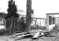
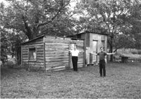
Sheds on site affected by the widening of U.S. Route 17. Presumably located in Mount Pleasant or vicinity. Surveyor notations on back of photo: "Dkt.: 10.597. Property owner: F. Gregorie, Estate. Tract: 93. Station: 460± Rt. Date: Sept. 17, 1968." [See collection description for explanation of surveyor notations.]
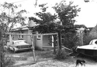
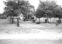
House and lot on site affected by the widening of U.S. Route 17. Presumably located in Mount Pleasant or vicinity. Surveyor notations on back of photo: "Dkt.: 10.597. Property owner: Cleveland German. Tract: 89. Station: 450±25 Rt. Date: Sept. 17, 1968." [See collection description for explanation of surveyor notations.]
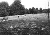
Lot on site affected by the widening of U.S. Route 17. Presumably located in southern Charleston County. Surveyor notations on back of photo: "Dkt.: 10.600. Property owner: John D. Postell, Jr. Tract: 15. Station: 620± Rt. Date: Sept. 18, 1968." [See collection description for explanation of surveyor notations.]
Lot on site affected by the widening of U.S. Route 17. Presumably located in southern Charleston County. Surveyor notations on back of photo: "Dkt.: 10.600. Property owner: Thomas H. Lemacks. Tract: 19. Station: 611± Lt. Date: Sept. 18, 1968." [See collection description for explanation of surveyor notations.]
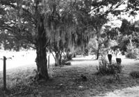
Lot on site affected by the widening of U.S. Route 17. Presumably located in southern Charleston County. Surveyor notations on back of photo: "Dkt.: 10.600. Property owner: Fred Stewart. Tract: 1-B. Station: 509± Lt. Date: Sept. 18, 1968." [See collection description for explanation of surveyor notations.]