Search
« Previous |
21 - 30 of 63
|
Next »
Search Results
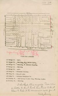
- Description:
- Map of area bounded by Society, Meeting, George, and King Street.
- Description:
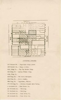
- Map of area bounded by Market, King, Princess, and Archdale Street.
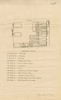
- Description:
- Map of area bounded by Jacob's Alley, Archdale, Clifford, and King Street.
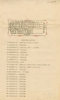
- Description:
- Map of area bounded by Clifford, King, Beresford, and Archdale Street.
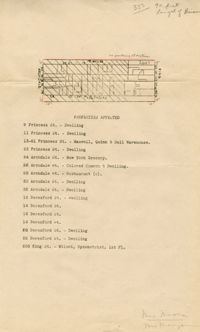
- Description:
- Map of area bounded by Princess, King, Beresford, and Archdale Street.
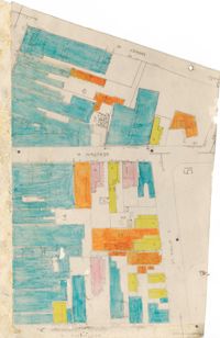
- Description:
- Map of area bounded by Market Street, Meeting Street, Horlbeck Street, and King Street.
- Description:
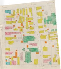
- Color-coded map of area bounded by Wentworth Street, Coming Street, George Street, and Glebe Street.
- Description:
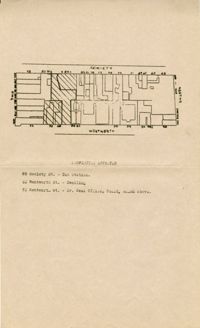
- Map of area bounded by Society Street, Meeting Street, Wentworth Street, and King Street.
- Description:
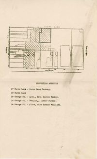
- Map of area bounded by George Street, King Street, Burns Lane, and Meeting Street.
- Description:
- Color-coded map of area near where Market Street and Beaufain Street meet..