Search
« Previous |
301 - 350 of 413
|
Next »
Search Results
Date:
1960
Description:
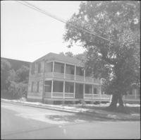
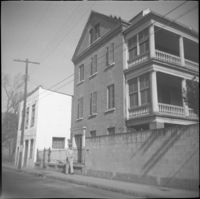
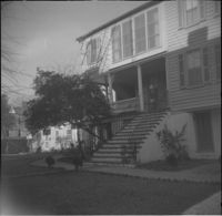
60 Anson Street (Robert M. Venning House), located at the southeast corner of Anson and Society Streets.
Date:
1960
Description:
61 Laurens Street, which had originally located at 114 Anson Street.
Date:
1960
Description:
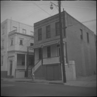
61 Society Street. Partial view of 59 Society Street at left.
Date:
1960
Description:
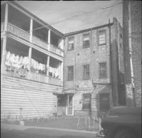
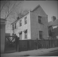
61 Charlotte Street.
Date:
1960
Description:
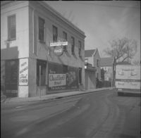
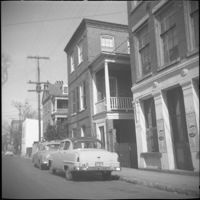
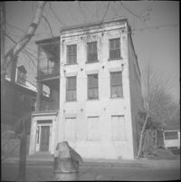
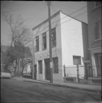
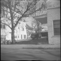
61 Anson Street (Kestler's Market), corner store located at the northwest corner of Anson and Society Streets.
Date:
1960
Description:
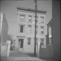
62 Society Street (Hieronymus-Tiedeman House).
Date:
1960
Description:
62 Hasell Street.
Date:
1960
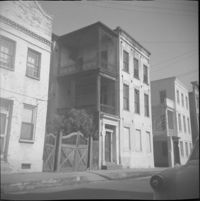
Description:
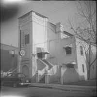
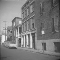
63-65 Society Street (St. Paul’s Catholic Church [German Church], later American Legion Palmetto Post 112). 61 Society Street also in view (at left).
Date:
1960
Description:
63-65 Society Street (St. Paul’s Catholic Church [German Church], later American Legion Palmetto Post 112).
Date:
1960
Description:
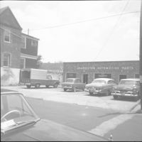
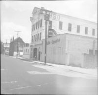
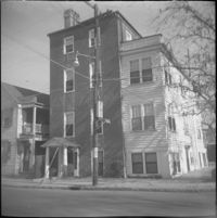
Charleston Automotive Services (63 Hasell Street), now a parking lot.
Date:
1960
Description:
63 Charlotte Street.
Date:
1960
Description:
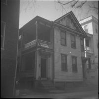
63 and 65 Anson Street (Susan Robinson Dependencies).
Date:
1960
Description:
63 Anson Street (Susan Robinson Dependency).
Date:
1960
Description:
Right to left: 64 Anson Street (later demolished), 66 Anson Street (Chazal House), and 72 Anson Street (Kohne-Leslie House).
Date:
1960
Description:
Right to left: 64 Anson Street (later demolished) and 66 Anson Street (Chazal House).
Date:
1960
Description:
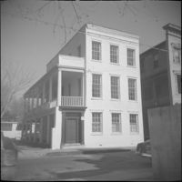
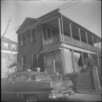
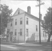
64 Hasell Street (Benjamin Smith House).
Date:
1960
Description:
Right to left: 64 Anson Street (later demolished) and 66 Anson Street (Chazal House).
Date:
1960
Description:
64 Society Street.
Date:
1960
Description:
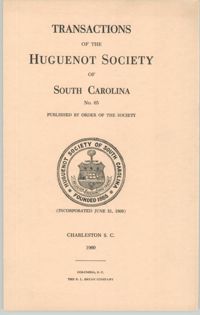
The Transactions of the Huguenot Society No.66 contains published articles on genealogy and history, memorials, and annual reports from its officers for the year 1960-1961.
Date:
1960
Description:
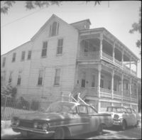
65-67 Hasell Street (USO Building).
Date:
1960
Description:
66 Society Street (Hieronymous-Roper House).
Date:
1960
Description:
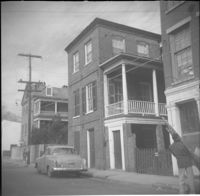
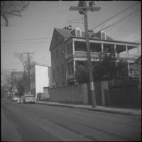
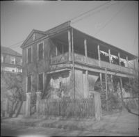
66 Hasell Street (Lazarus-Gadsden Building). Partial view of 64 Hasell Street at right.
Date:
1960
Description:
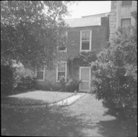
66 Society Street (Hieronymous-Roper House), flanked by 66½ Society Street (left) and 64 Society Street (right).
Date:
1960
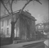
Description:
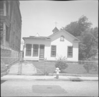
67 Anson Street (St. Stephen's Episcopal Church.
Date:
1960
Description:
67 Anson Street (St. Stephen's Episcopal Church.
Date:
1960
Description:
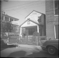
68 Anson Street, later demolished.
Date:
1960
Description:
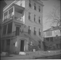
71 Anson Street (Thomas Doughty House).
Date:
1953, 1899, 1945, 1882, 1781, 1765, 1955, 1849, 1859, 1954, 1956, 1957, 1958, 1959, 1960, 1961, 1861, 1856, 1869, 1898, 1963, 1866, 1896, 1837, 1835, 1784, 1897, 1842, 1794, and 1795
Description:
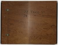
Compilation of original deeds, titles, and other documents related to the transfer, sale, and ownership of the double tenement at 72-74 Tradd Street, known as the Fotheringham-McNeil Tenements. Documents span from 1765 to 1961, likely representing the entire history of the ownership of the double tenement throughout that time period. Also includes blueprints and photographs. (NOTE: Fotheringham has also been spelled Fotheringham.)
Date:
1960
Description:
Right to left: 72 Anson Street (Kohne-Leslie House) and the original house at 74 Anson Street before its demolition.
Date:
1960
Description:
Right to left: 72 Anson Street (Kohne-Leslie House) and the original house at 74 Anson Street before its demolition.
Date:
1960
Description:
Original house with the address 73 Anson Street, demolished in 1963.
Date:
1960
Description:
74 Anson Street before its demolition. (The house originally at 15 Wall Street was moved to the site in 1966.)
Date:
1960
Description:
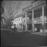
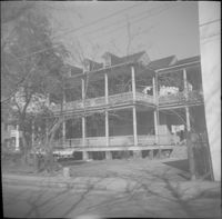
75 Anson Street (Joseph Legare House) before the removal of the third story ca. 1969.
Date:
1960
Description:
76 Anson Street before its demolition, located at the southeast corner of Anson and Laurens Streets.
Date:
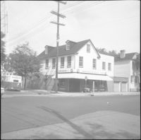
1960
Description:
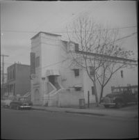
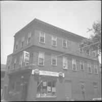
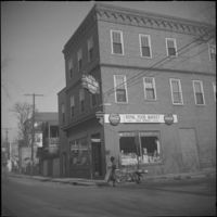
78 Anson Street (Royal Food Market), corner store located at the northeast corner of Anson and Laurens Streets, before its demolition.
Date:
1960
Description:
78 Anson Street (Royal Food Market), corner store located at the northeast corner of Anson and Laurens Streets, before its demolition.
Date:
1960
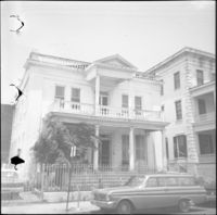
Description:
79 Anson Street (Daniel Legare House).
Date:
1960
Description:
79 Anson Street (Daniel Legare House).
Date:
1960
Description:
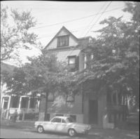
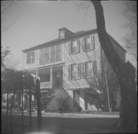
8 George Street (Sarah Daniell Lawrence House).
Date:
1960
Description:
8 Wentworth Street.
Date:
1960
Description:
The original house at 82 Anson Street, later demolished to clear the lot for the relocation of the house at 86 Anson Street (Mary Smith House).
Date:
1960
Description:
The original house at 82 Anson Street, later demolished to clear the lot for the relocation of the house at 86 Anson Street (Mary Smith House).
Date:
1960
Description:
Right to left: 84 Anson Street before demolition and 86 Anson Street (Mary Smith House) before its relocation to its current address (82 Anson Street).
Date:
1960
Description:
86 Anson Street (Mary Smith House) prior to its relocation to its current address (82 Anson Street).
Date:
1960
Description:
89 Alexander Street at the southwest corner of Alexander and Charlotte Streets.
Date:
1960
Description:
90 Alexander Street at the southeast corner of Alexander and Charlotte Streets.
Date:
1960
Description:
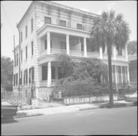
George Street elevation of 91 Anson Street (St. John's Reformed Episcopal Church).
Date:
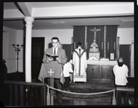
1960
Description:
A photograph of Albert Sottile Jr. reading at a Mass in the lower chapel of the Cathedral of St. John the Baptist.
Date:
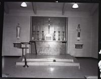
1960
Description:
A photograph of the altar inside the Church of the Nativity.
Date:
1960 and 1969
Description:
Black-and-white photograph of the interior of El Ghriba Synagogue in Djerba.


![[Der grosse Gebetssaal der Wundervollen ist ein schönes Beispiel andalusischer Architekture]](https://iiif.library.cofc.edu/iiif/2/24786/full/200,/0/default.jpg)