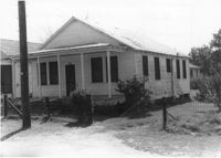
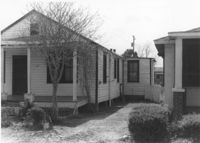
House on site affected by the construction of Interstate 26 (I-26). Building address number 2209. [2209 Delano.] Surveyor notations on back of photo: "Dkt.: 10.490. Property owner: Dantzler H. Gardner, Est. Tract: 81. Station: 5824+00 Lt. Date: March 22, 1962. In R/W - Bought." [See collection description for explanation of surveyor notations.]
House (rear view) on site affected by the construction of Interstate 26 (I-26). [Building address number 2209. 2209 Delano.] Surveyor notations on back of photo: "Dkt.: 10.490. Property owner: Dantzler H. Gardner, Est. Tract: 81. Station: 5824+00 Lt. Date: March 22, 1962. In R/W - Bought." [See collection description for explanation of surveyor notations.]
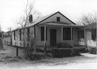
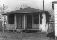
House on site affected by the construction of Interstate 26 (I-26). [Address 2213 Delano.] Surveyor notations on back of photo: "Dkt.: 10.490. Property owner: Cath. Mason Lewis. Tract: 83. Station: 5824+00 on CL. Date: March 22, 1962. In R/W - Bought." [See collection description for explanation of surveyor notations.]
House (rear view) on site affected by the construction of Interstate 26 (I-26). [Address 2213 Delano.] Surveyor notations on back of photo: "Dkt.: 10.490. Property owner: Cath. Mason Lewis. Tract: 83. Station: 5824+00 on CL. Date: March 22, 1962. In R/W - Bought." [See collection description for explanation of surveyor notations.]
House on site affected by the construction of Interstate 26 (I-26). [Address 2213 Delano.] Surveyor notations on back of photo: "Dkt.: 10.490. Property owner: Cath. Mason Lewis. Tract: 83. Station: 5824+00 on CL. Date: March 22, 1962. In R/W - Bought." [See collection description for explanation of surveyor notations.]
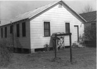
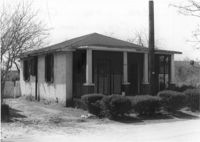
House on site affected by the construction of Interstate 26 (I-26). Building address number 2215. [2215 Delano.] Surveyor notations on back of photo: "Dkt.: 10.490. Property owner: Cath. Mason Lewis. Tract: 84. Station: 5824+00 Rt. Date: March 22, 1962. In R/W - Bought." [See collection description for explanation of surveyor notations.]
House (rear view) on site affected by the construction of Interstate 26 (I-26). [Building address number 2215. 2215 Delano.] Surveyor notations on back of photo: "Dkt.: 10.490. Property owner: Cath. Mason Lewis. Tract: 84. Station: 5824+00 Rt. Date: March 22, 1962. In R/W - Bought." [See collection description for explanation of surveyor notations.]
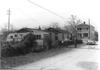
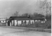
House, trailer, and street on site affected by the construction of Interstate 26 (I-26). Surveyor notations on back of photo: "Dkt.: 10.490. Property owner: Jacob Myers, et al. Tract: 86-A. Station: 5823+90 Rt. Date: March 22, 1962. Proximity to house. Owner to move trailer." [See collection description for explanation of surveyor notations.]
House on site affected by the construction of Interstate 26 (I-26). Surveyor notations on back of photo: "Dkt.: 10.490. Property owner: Jacob Myers, et al. Tract: 86-A. Station: 5823+90 Rt. Date: March 22, 1962. Proximity to house." [See collection description for explanation of surveyor notations.]
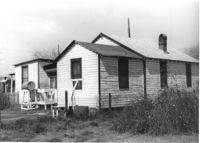
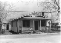
House on site affected by the construction of Interstate 26 (I-26). Surveyor notations on back of photo: "Dkt.: 10.490. Property owner: Geo. L. Robertson [George L. Robertson]. Tract: 87. Station: 5825+30 Rt. Date: March 22, 1962. In R/W - Bought." [See collection description for explanation of surveyor notations.]
Limit your search
SCDOT Photographs: Properties in the Right-of-Way✖[remove]492