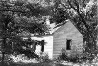
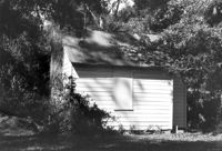
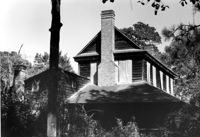
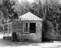
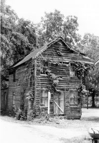
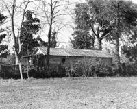
Old Rectory - Outbuilding #1, ca. 1855 - Pivotal to Historic District. View of Front elevation. Pinopolis Historic District South. Pinopolis, S.C.;5" x 7" B/W photo. Box 3, Folder 1-10-1 (II). One copy.
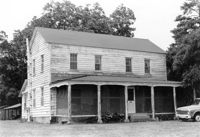
Harriet C. Wilson House, ca. 1905 - Pivotal to Historic District. View of Front elevation. Pinopolis Historic District South. Pinopolis, S.C.;5" x 7" B/W photo. Box 3, Folder 1-10-1 (II). One copy.
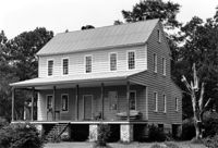
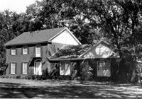
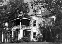
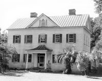
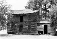
Lucas House, ca. 1835 - Pivotal to Historic District. View of South (Front) elevation. Pinopolis Historic District North. Pinopolis, S.C.;5" x 7" B/W photo. Box 3, Folder 1-10-1 (II). One copy.
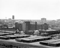
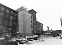
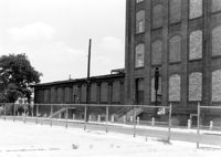
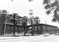
Cigar Factory, 701 East Bay Street. General View of NE (Front and Side) elevation. Charleston, S.C.;8" x 10" B/W photo. Box 9, Folder 2-1-221. One copy.
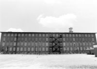
Cigar Factory, 701 East Bay Street. View of East (Front) elevation, looking North. Charleston, S.C.;7" x 10" B/W photo. Box 9, Folder 2-1-221. One copy.
Barnwell House (Prospect Hill Plantation), Sugar Hill Road. View of East (Side) elevation. Hollywood, S.C.;8" x 10" B/W photo. Box 16, Folder 2-11-5. One copy.
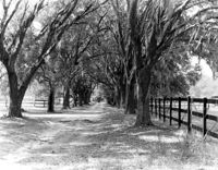
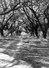
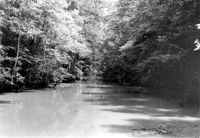
Wedge Plantation (William Lucas House), Wedge Plantation Road. View of Oak Allee. McClellanville, S.C.;8" x 10" B/W photo. Box 15, Folder 2-10-6. One copy.
Cigar Factory, 701 East Bay Street. View of single story addition to main building, NW (Rear) elevation, looking South. Charleston, S.C.;7" x 10" B/W photo. Box 9, Folder 2-1-221. One copy.
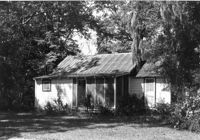
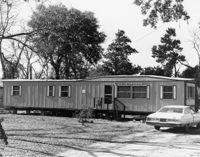
Unidentified House, ca. Mid 20th century - Non-contributory to Historic District. Front and Side elevations. Pinopolis, S.C.;5" x 7" B/W photo. Box 3, Folder 1-10-1 (II). One copy.
Cigar Factory, 701 East Bay Street. General View of Main Entrance (from Columbus Street), South (Side) elevation. Charleston, S.C.;7" x 10" B/W photo. Box 9, Folder 2-1-221. One copy.
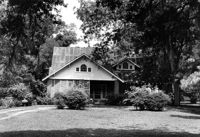
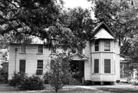
John Grant House, ca. 1901 - Pivotal to Historic District. View of front and Side elevations. Pinopolis Historic District South. Pinopolis, S.C.;5" x 7" B/W photo. Box 3, Folder 1-10-1 (II). One copy.
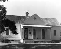
Post Office Building, ca. 1970 - Non-contributory to Historic District. Front and Side elevations. Pinopolis, S.C.;5" x 7" B/W photo. Box 3, Folder 1-10-1 (II). One copy.
Isaac Porcher Office, ca. 1844 - Pivotal to Historic District. View of Side elevation. Pinopolis, S.C.;5" x 7" B/W photo. Box 3, Folder 1-10-1 (II). One copy.
C.M. Loftan House (ca. 1911), Oak Street. View of Front elevation. McClellanville Historic District. McClellanville, S.C.;6.5" x 10" B/W photo. Box 14, Folder 2-10-5. One copy.
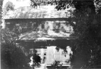
How Tavern. View of North (Front) elevation. Cainhoy (Huger vicinity, Lewisville, Louisville), S.C.;8" x 10" B/W photo. Box 4, Folder 1-12-3. One copy.
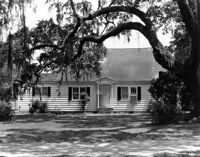
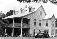
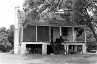
William Cain House, ca. 1834 - Pivotal to Historic District. View of Side and Front elevations. Pinopolis Historic District North. Pinopolis, S.C.;5" x 7" B/W photo. Box 3, Folder 1-10-1 (II). One copy.
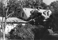
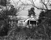
Unidentified House, ca. Early 20th century - Contributory to Historic District. Front elevation. Pinopolis, S.C.;5" x 7" B/W photo. Box 3, Folder 1-10-1 (II). One copy.
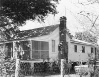
Unidentified House, ca. 1910 - Contributory to Historic District. Front elevation. Pinopolis Historic District South. Pinopolis, S.C.;5" x 7" B/W photo. Box 3, Folder 1-10-1 (II). One copy.
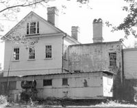
Barnwell House (Prospect Hill Plantation), Sugar Hill Road. View of NW (Side and Rear) elevation. Hollywood, S.C.;10" x 8" B/W photo. Box 16, Folder 2-11-5. One copy.
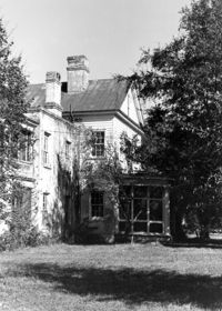
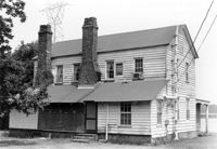
Barnwell House (Prospect Hill Plantation), Sugar Hill Road. View of NW (Rear and Side) elevation. Hollywood, S.C.;8" x 10" B/W photo. Box 16, Folder 2-11-5. One copy.
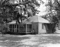
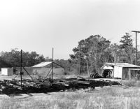
Wedge Plantation (William Lucas House), Wedge Plantation Road. Outbuilding #2 - View of Rear and Side elevation. McClellanville, S.C.;8" x 10" B/W photo. Box 15, Folder 2-10-6. One copy.
Henry M. Loftan, Jr. House (ca. 1901). View of Front elevation. McClellanville Historic District. McClellanville, S.C.;6.5" x 10" B/W photo. Box 14, Folder 2-10-5. One copy.
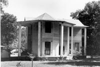
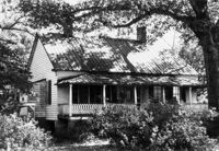
Barnwell House (Prospect Hill Plantation), Sugar Hill Road. View of South (Front) elevation. Hollywood, S.C.;8" x 10" B/W photo. Box 16, Folder 2-11-5. One copy.
Wedge Plantation (William Lucas House), Wedge Plantation Road. Main House - View of Front addition. McClellanville, S.C.;10" x 8" B/W photo. Box 15, Folder 2-10-6. One copy.
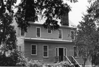
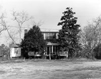
Mary Lesesne House (B.C. Cox House), ca. 1790. View of NW (Front and Side) elevation. Cainhoy, S.C.;6.5" x 9.5" B/W photo. Box 4, Folder 1-12-3. One copy.
Unidentified - House. Pivotal to Historic District. View of Side and Front elevation. Labeled as, "Heirs of J.S. Sanders". Cainhoy, S.C.;8" x 10" B/W photo. Box 4, Folder 1-12-3. One copy.
Unidentified - House. Contributing to Historic District. View of Front elevation. Labeled as, "Owned by Rachel M. Humphrey". Cainhoy, S.C.;8" x 10" B/W photo. Box 4, Folder 1-12-3. One copy.
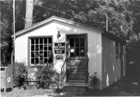
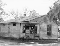
Village Store and Blacksmith Shop, ca. 1873. View of NW (Front and Side) elevation. Cainhoy, S.C.;10" x 6.5" B/W photo. Box 4, Folder 1-12-3. One copy.
Unidentified - House. View of Front elevation. Labeled as, "Iseman D. Ward, Jr. and Carol Smoak - owners". Cainhoy, S.C.;8" x 10" B/W photo. Box 4, Folder 1-12-3. One copy.
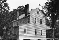
Mary Lesesne House (B.C. Cox House), ca. 1790. View of SE (Rear and Side) elevation. Cainhoy, S.C.;6.5" x 10" B/W photo. Box 4, Folder 1-12-3. One copy.
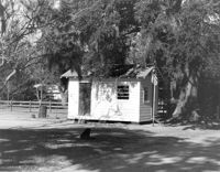
Unidentified - Storage Shed. View of Side and Front elevation. Labeled as "Owned by Rachel M. Humphrey". Cainhoy, S.C.;8" x 10" B/W photo. Box 4, Folder 1-12-3. One copy.