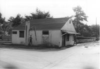
House on site affected by the widening of State Road 13 (Remount Road). 1548 Remount Road. Surveyor notations on back of photo: "Dkt.: 10.562. Property owner: Harry R. Parkinson, et al. Tract: 61. Date: Jul. 19, 1967." [See collection description for explanation of surveyor notations.]
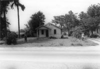
House on site affected by the widening of State Road 13 (Remount Road). 1552 Remount Road. Surveyor notations on back of photo: "Dkt.: 10.562. Property owner: Robert W. Kimbel. Tract: 60. Date: Jul. 19, 1967." [See collection description for explanation of surveyor notations.]
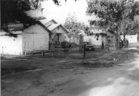
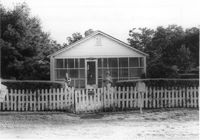
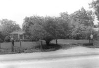
Houses on site affected by the widening of State Road 13 (Remount Road). Surveyor notations on back of photo: "Dkt.: 10.562. Property owner: James R. Robinson, Estate. Tract: 41. Date: Jul. 19, 1967." [See collection description for explanation of surveyor notations.]
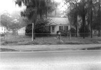
House on site affected by the widening of State Road 13 (Remount Road). Surveyor notations on back of photo: "Dkt.: 10.562. Property owner: Olivia Fleisher Estate. Tract: 38. Date: Jul. 19, 1967." [See collection description for explanation of surveyor notations.]
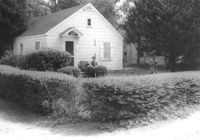
House on site affected by the widening of State Road 13 (Remount Road). Surveyor notations on back of photo: "Dkt.: 10.562. Property owner: Mrs. J.L. McFadyen. Tract: 69. Date: Jul. 19, 1967." [See collection description for explanation of surveyor notations.]
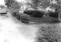
House on site affected by the widening of State Road 13 (Remount Road). Surveyor notations on back of photo: "Dkt.: 10.562. Property owner: M.R. Wilson. Tract: 25. Date: Jul. 12, 1967." [See collection description for explanation of surveyor notations.]
House on site affected by the widening of State Road 13 (Remount Road). (1488 Remount Road.) Surveyor notations on back of photo: "Dkt.: 10.562. Property owner: Mrs. J.L. McFadyen. Tract: 69. Date: Jul. 19, 1967." [See collection description for explanation of surveyor notations.]
House on site affected by the widening of State Road 13 (Remount Road). Surveyor notations on back of photo: "Dkt.: 10.562. Property owner: Charles R. Roberson. Tract: 36. Date: Jul. 19, 1967." [See collection description for explanation of surveyor notations.]
House on site affected by the widening of State Road 13 (Remount Road). Surveyor notations on back of photo: "Dkt.: 10.562. Property owner: Charles R. Roberson. Tract: 36-A. Date: Jul. 19, 1967." [See collection description for explanation of surveyor notations.]
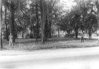
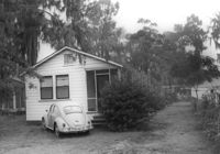
House on site affected by the widening of State Road 13 (Remount Road). Surveyor notations on back of photo: "Dkt.: 10.562. Property owner: Joseph W. Cooper. Tract: 9. Date: Jul. 12, 1967." [See collection description for explanation of surveyor notations.]
Right of way--South Carolina--Charleston County, Highway planning--South Carolina--Charleston County, Vernacular architecture--South Carolina--Charleston County, Lost architecture--South Carolina--Charleston County, Dwellings--South Carolina--Charleston County✖[remove]23
Charleston County (S.C.)--Buildings, structures, etc.✖[remove]23