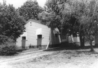
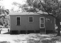
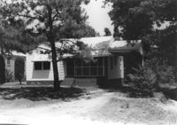
House on site affected by the construction of Interstate 26 (I-26). Partially obscured by trees. Surveyor notations on back of photo: "Dkt.: 10.480. Property owner: C.G. Hudson. Tract: 250. Station: 5706+30 Lt. Date: May 31, 1961. In R/W - Bought." [See collection description for explanation of surveyor notations.]
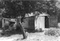
Sheds in dilapidated condition on site affected by the construction of Interstate 26 (I-26). Surveyor notations on back of photo: "Dkt.: 10.480. Property owner: C.G. Hudson. Tract: 250. Station: 5706+30 Lt. Date: May 31, 1961. In R/W - Bought." [See collection description for explanation of surveyor notations.]
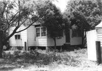
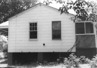
House (corner view, rear) on site affected by the construction of Interstate 26 (I-26). Partially obscured by trees. Surveyor notations on back of photo: "Dkt.: 10.480. Property owner: C.G. Hudson. Tract: 250. Station: 5706+30 Lt. Date: May 31, 1961. In R/W - Bought." [See collection description for explanation of surveyor notations.]
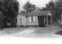
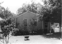
House on site affected by the construction of Interstate 26 (I-26). Surveyor notations on back of photo: "Dkt.: 10.480. Property owner: C.G. Hudson. Tract: 251. Station: 5706+70 Lt. Date: May 31, 1961. In R/W - Bought." [See collection description for explanation of surveyor notations.]
House (rear view) on site affected by the construction of Interstate 26 (I-26). Surveyor notations on back of photo: "Dkt.: 10.480. Property owner: C.G. Hudson. Tract: 251. Station: 5706+70 Lt. Date: May 31, 1961. In R/W - Bought." [See collection description for explanation of surveyor notations.]
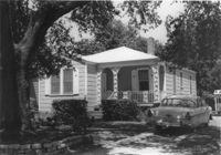
House on site affected by the construction of Interstate 26 (I-26). Surveyor notations on back of photo: "Dkt.: 10.480. Property owner: Juanita Miller. Tract: 252. Station: 5705+15 Rt. Date: May 31, 1961. In R/W - Bought." [See collection description for explanation of surveyor notations.]
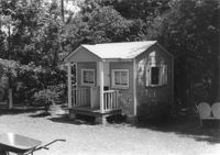
Child's playhouse or small guest house, on site affected by the construction of Interstate 26 (I-26). Surveyor notations on back of photo: "Dkt.: 10.480. Property owner: Juanita Miller. Tract: 252. Station: 5707+65 Rt. Date: May 31, 1961. In R/W - Bought." [See collection description for explanation of surveyor notations.]
House (rear view) on site affected by the construction of Interstate 26 (I-26). Surveyor notations on back of photo: "Dkt.: 10.480. Property owner: Juanita Miller. Tract: 252. Station: 5705+15 Rt. Date: May 31, 1961. In R/W - Bought." [See collection description for explanation of surveyor notations.]
House on site affected by the construction of Interstate 26 (I-26). Surveyor notations on back of photo: "Dkt.: 10.480. Property owner: Mouzon Taylor. Tract: 253. Station: 5707+55 Rt. Date: May 31, 1961. In R/W - Bought." [See collection description for explanation of surveyor notations.]
House (side view) on site affected by the construction of Interstate 26 (I-26). Surveyor notations on back of photo: "Dkt.: 10.480. Property owner: Mouzon Taylor. Tract: 253. Station: 5707+55 Rt. Date: May 31, 1961. In R/W - Bought." [See collection description for explanation of surveyor notations.]
Limit your search
SCDOT Photographs: Properties in the Right-of-Way✖[remove]377