Search
« Previous |
1,451 - 1,500 of 1,613
|
Next »
Search Results
Date:
1977-1983
Description:
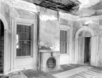
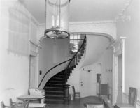
274 Calhoun Street, Daniel Cannon House, ca. 1802. Interior View - 1st Floor. Hall - Detail of stair hall. 4" x 5" B/W photo.
Date:
1977-1983
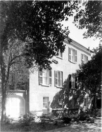
Description:
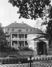
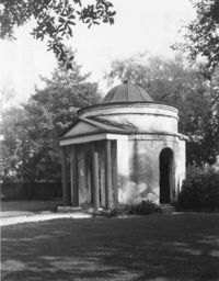
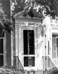
350 Meeting Street, Joseph Manigault House, ca. 1816. Gatehouse - View of South (Front) elevation. 4" x 5" B/W photo.
Date:
1977-1983
Description:
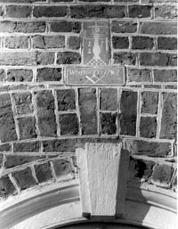
Berkeley County, St. Stephen's Church, ca. 1767. Detail View of plaque bearing mason's name (Wm. Axson) and Freemason symbol, East (Rear) elevation (located above central window). 4" x 5" B/W photo.
Date:
1977-1983
Description:
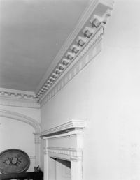
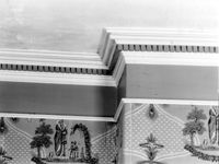
48 Elizabeth Street, Aiken-Rhett House, ca.1818. Main House - Interior View. 1st Floor - NW Gallery, Detail of cornice. 4" x 5" B/W photo.
Date:
1977-1983
Description:
48 Elizabeth Street, Aiken-Rhett House, ca.1818. Main House - Interior View. 1st Floor - NW Gallery, East wall. 4" x 5" B/W photo.
Date:
1977-1983
Description:
48 Elizabeth Street, Aiken-Rhett House, ca.1818. Main House - Interior View. 1st Floor - NW Gallery, looking NW. 4" x 5" B/W photo.
Date:
1977-1983
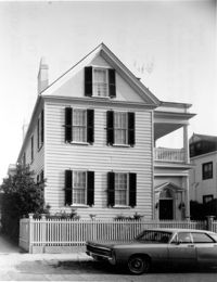
Description:
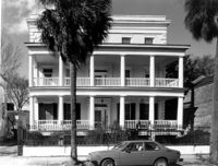
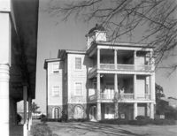
64 Hasell Street, Benjamin F. Smith House, ca. 1843. Main House - View of South (Front) elevation. 4" x 5" B/W photo.
Date:
1977-1983
Description:
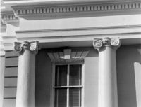
82 - 86 Broad Street, ca 1753. Detail View of columns (West end), South (Rear) elevation. 4" x 5" B/W photo.
Date:
1977-1983
Description:
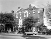
78 East Bay Street, Vanderhorst Row, ca. 1800. View of NW (Side and Front) elevation. 4" x 5" B/W photo.
Date:
1977-1983
Description:
Charleston County, Seaside Plantation (Locksley Hall), ca. 1810. View of SE (Front and Side) elevation. 4" x 5" B/W photo.
Date:
1977-1983
Description:
Charleston County, Seaside Plantation (Locksley Hall), ca. 1810. View of West (Side) elevation. 4" x 5" B/W photo.
Date:
1977-1983
Description:
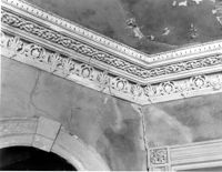
80 Meeting Street, St. Michael's Episcopal Church, ca. 1751. Interior View - Detail of Nave cornice showing soffitt. 4" x 5" B/W photo.
Date:
1977-1983
Description:
342 Meeting Street, Second Presbyterian Church, ca. 1811. Detail View of central door, West (Front) elevation. 4" x 5" B/W photo.
Date:
1977-1983
Description:
80 Meeting Street, St. Michael's Episcopal Church, ca. 1751. Interior View - Nave, West (Front) elevation. 4" x 5" B/W photo.
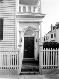
Date:
1977-1983
Description:
32 South Battery, Magwood-Moreland House, ca. 1827. Detail View of entry, North (Front) elevation. 4" x 5" B/W photo.
Date:
1977-1983
Description:
32 South Battery, Magwood-Moreland House, ca. 1827. View of NW (Front and Side) elevation. 4" x 5" B/W photo.
Date:
1977-1983
Description:
18 Bull Street, William Blacklock House, ca. 1800. Main House - View of SE (Front and Side) elevation 4" x 5" B/W photo.
Date:
1977-1983
Description:
18 Bull Street, William Blacklock House, ca. 1800. Main House - View of West (Side) elevation 4" x 5" B/W photo.
Date:
1977-1983
Description:
32 South Battery, Magwood-Moreland House, ca. 1827. View of North (Front) elevation. 4" x 5" B/W photo.
Date:
1977-1983
Description:
St. Margaret, West End, William Lowndes House, date unknown. View of North (Rear) elevation. 4" x 5" B/W photo.
Date:
1977-1983
Description:
54 Tradd Street, William Vanderhorst House, ca. 1740. Main House - View of North (Rear) elevation. 4" x 5" B/W photo.
Date:
1977-1983
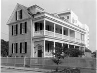
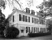
Description:
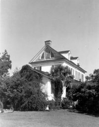
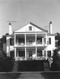
20 South Battery, Stevens-Lathers House, ca. 1843. Main House - View of South (Front) elevation. 4" x 5" B/W photo.
Date:
1977-1983
Description:
2 Amherst Street, Christopher Belser House, ca. 1804. View of NW (Side and Rear) elevation. 4" x 5" B/W photo.
Date:
1977-1983
Description:
2 Amherst Street, Christopher Belser House, ca. 1804. View of NE (Side and Rear) elevation. 4" x 5" B/W photo.
Date:
1977-1983
Description:
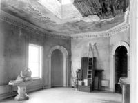
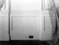
Orangeburg County, Rocks Plantation (The Rocks), ca. 1805. Main House - Interior View. 1st Floor - SE Room, Detail of wainscot. 4" x 5" B/W photo.
Date:
1977-1983
Description:
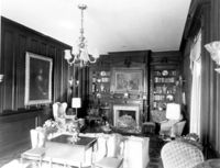
108 Beaufain Street, John Steinmeyer House, ca. 1840. Interior View - 1st Floor, East Room, North elevation. 4" x 5" B/W photo.
Date:
1977-1983
Description:
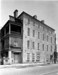
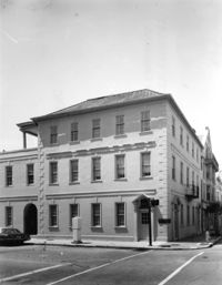
409 King Street, Radcliffe-Aimar Building, ca. 1808. View of South (Side) elevation. 4" x 5" B/W photo.
Date:
1977-1983
Description:
14 George Street, Middleton-Pinckney House, ca. 1796. View of North (Rear) elevation. 4" x 5" B/W photo.
Date:
1977-1983
Description:
14 George Street, Middleton-Pinckney House, ca. 1796. View of West (Side) elevation. 4" x 5" B/W photo.
Date:
1977-1983
Description:
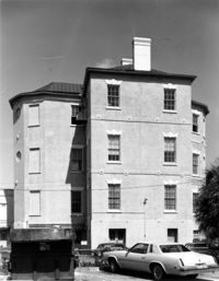
350 Meeting Street, Joseph Manigault House, ca. 1816. Main House - View of NW corner (Rear and Side) elevation 4" x 5" B/W photo.
Date:
1977-1983
Description:
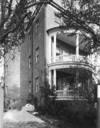
350 Meeting Street, Joseph Manigault House, ca. 1816. Main House - View of NE (Rear and Side) elevation. 4" x 5" B/W photo.
Date:
1977-1983
Description:
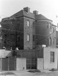
350 Meeting Street, Joseph Manigault House, ca. 1816. Main House - View of NW (Rear and Side) elevation. 4" x 5" B/W photo.
Date:
1977-1983
Description:
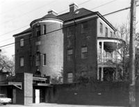
350 Meeting Street, Joseph Manigault House, ca. 1816. Gatehouse - View of NW (Rear and Side) elevation. 4" x 5" B/W photo.
Date:
1977-1983
Description:
635 East Bay Street, Faber-Ward House, ca. 1832. Main House - View of NW (Rear and Side) elevation 4" x 5" B/W photo.
Date:
1977-1983
Description:
Georgetown County, Arcadia Plantation, ca. 1794. View of West (Front) elevation. 4" x 5" B/W photo.
Date:
1977-1983
Description:
286 Calhoun Street, Jonathan Lucas House, ca. 1809. Main House - Interior View. 1st Floor - Main Hall, Detail of arch and hall cornice. 4" x 5" B/W photo.
Date:
1977-1983
Description:
106 Tradd Street, Colonel John Stuart House, ca. 1772. Main House - Detail View of Garden Entry, West (Side) elevation. 4" x 5" B/W photo.
Date:
1977-1983
Description:
286 Calhoun Street, Jonathan Lucas House, ca. 1809. Main House - Detail View of 1st and 2nd Floor entries, South (Front) elevation. 4" x 5" B/W photo.
Date:
1977-1983
Description:
286 Calhoun Street, Jonathan Lucas House, ca. 1809. Main House - Interior View. 1st Floor - SE Room, North elevation. 4" x 5" B/W photo.
Date:
1977-1983
Description:
286 Calhoun Street, Jonathan Lucas House, ca. 1809. Main House - Interior View. 1st Floor - Main Hall, South elevation. 4" x 5" B/W photo.
Date:
1977-1983
Description:
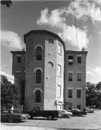
17 Lockwood Drive (formerly, Calhoun Street, West End), West Point Rice Mill, ca. 1860. View of East (Front) elevation. 4" x 5" B/W photo.
Date:
1977-1983
Description:
49 Broad Street, Benjamin Smith Building, ca. 1740. View of East (Side) elevation. 4" x 5" B/W photo.
Date:
1977-1983
Description:
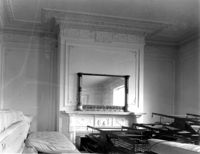
Charleston County, William Seabrook-Dodge Plantation, ca. 1810. Interior View. 2nd Floor - SE Room, Detail of cornice. 4" x 5" B/W photo.
Date:
1977-1983
Description:
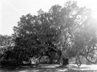
Charleston County, William Seabrook-Dodge Plantation, ca. 1810. View of live oak tree. 4" x 5" B/W photo.
Date:
1977-1983
Description:
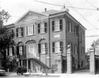
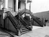
188 Meeting Street, Market Hall, ca. 1841. Main Hall - Detail View of stairs and ironwork, NW (Front and Side) elevation 4" x 5" B/W photo.
Date:
1977-1983
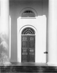
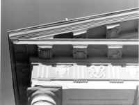
Description:
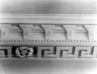
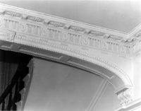
188 Meeting Street, Market Hall, ca. 1841. Main Hall - Detail View of cornice and column cap, West (Front) elevation. 4" x 5" B/W photo.
Date:
1977-1983
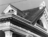
Description:
14 Lamboll Street, Patrick O'Donnell Tenement, ca. 1850. Detail View of roof. 4" x 5" B/W photo.
Date:
1977-1983
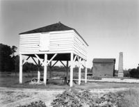
Description:
Georgetown County, Mansfield Plantation, ca. 1780. Winnowing House - View of Front elevation (Rice Threshing Mill in background). 4" x 5" B/W photo.
Date:
1977-1983
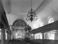
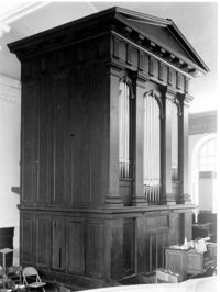
Description:
126 Coming Street, Cathedral Church of St. Luke and St. Paul, ca. 1816. Interior View - Detail View of organ, from balcony. 4" x 5" B/W photo.
Date:
1977-1983
Description:
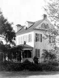
6 Glebe Street, St. Philip's Parsonage House (Bishop Robert Smith House), ca. 1770. View of East (Side) elevation. 4" x 5" B/W photo.