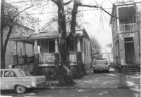
House on site affected by the construction of the Crosstown. Address: 10 Todd Street. Surveyor notations on back of photo: "Dkt.: 10.524. Property owner: Gabriel W. Bonaparte. Tract: 122. Station: 88+65 Rt. Date: Dec. 2, 1964. In R/W - Bought." [See collection description for explanation of surveyor notations.]
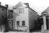
House on site affected by the construction of the Crosstown. Address: 9 Todd Street. Surveyor notations on back of photo: "Dkt.: 10.524. Property owner: Daniel Frasier. Tract: 121. Station: 87+90 Lt. Date: Dec. 2, 1964. Partially in R/W." [See collection description for explanation of surveyor notations.]
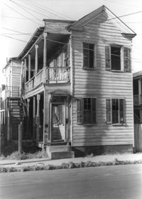
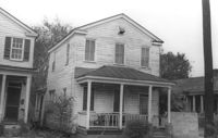
House on site affected by the construction of the Crosstown. Address: 7 Todd Street. Surveyor notations on back of photo: "Dkt.: 10.524. Property owner: Daniel Frasier. Tract: 120. Station: 87+90 Lt. Date: Dec. 2, 1964. In R/W - Bought." [See collection description for explanation of surveyor notations.]
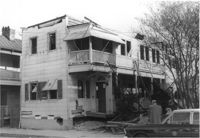
Structure on site affected by the construction of the Crosstown. Address: 3 Todd Street. On property of previous photos 413-415. Surveyor notations on back of photo: "Dkt.: 10.524. Property owner: John W. Bonaparte, et al. Tract: 118. Station: 87+35 Rt. Date: Dec. 1, 1964. In R/W - Bought." [See collection description for explanation of surveyor notations.]
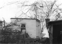
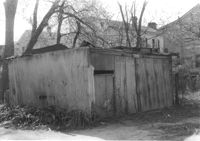
Shed on site affected by the construction of the Crosstown. Address: 119 Sheppard Street. Surveyor notations on back of photo: "Dkt.: 10.524. Property owner: Scott M. Boyle. Tract: 139. Station: 17+25 Rt. N.B. lane. Date: Dec. 2, 1964. Outside R/W." [See collection description for explanation of surveyor notations.]
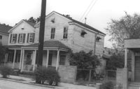
House (corner view) on site affected by the construction of the Crosstown. Address: 123 Sheppard Street. View of street corner. Surveyor notations on back of photo: "Dkt.: 10.524. Property owner: Salem Baptist Church. Tract: 137. Station: 16+60 CL Rt. N.B. lane. Date: Dec. 2, 1964. In R/W - Bought." [See collection description for explanation of surveyor notations.]
House on site affected by the construction of the Crosstown. Address: 123 Sheppard Street. Surveyor notations on back of photo: "Dkt.: 10.524. Property owner: Salem Baptist Church. Tract: 137. Station: 16+60 CL Rt. N.B. lane. Date: Dec. 2, 1964. In R/W - Bought." [See collection description for explanation of surveyor notations.]
House on site affected by the construction of the Crosstown. Address: 126 Sheppard Street. Surveyor notations on back of photo: "Dkt.: 10.524. Property owner: Nathaniel M. Johnson. Tract: 134. Station: 16+70 Lt. S.B. lane. Date: Dec. 2, 1964. In R/W - Bought." [See collection description for explanation of surveyor notations.]
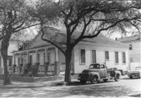
House on site affected by the construction of the Crosstown. Address: 157 President Street. Surveyor notations on back of photo: "Dkt.: 10.524. Property owner: Willie Brooks, et al. Tract: 36. Station: 69+00 Lt. Date: Oct. 14, 1964. In R/W - Bought." [See collection description for explanation of surveyor notations.]
House on site affected by the construction of the Crosstown. Address: 157 President Street. Surveyor notations on back of photo: "Dkt.: 10.524. Property owner: Willie Brooks, et al. Tract: 36. Station: 69+00 Lt. Date: Oct. 14, 1964. In R/W - Bought." [See collection description for explanation of surveyor notations.]