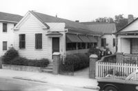
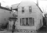
House on site affected by the construction of the Crosstown. Address: 125 Bogard Street. Surveyor notations on back of photo: "Dkt.: 10.524. Property owner: Mattie Jackson. Tract: 47. Station: 72+65 Lt. Date: Oct. 14, 1964. In R/W - Bought." [See collection description for explanation of surveyor notations.]
House on site affected by the construction of the Crosstown. Address: 125 Bogard Street. Surveyor notations on back of photo: "Dkt.: 10.524. Property owner: Mattie Jackson. Tract: 47. Station: 72+65 Lt. Date: Oct. 14, 1964. In R/W - Bought." [See collection description for explanation of surveyor notations.]
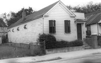
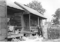
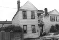
House on site affected by the construction of the Crosstown. Address: 161 Line Street. (Possibly a freedman's cottage with altered entry and porch.) Surveyor notations on back of photo: "Dkt.: 10.524. Property owner: Christopher C. Polite, Est. Tract; 94. Station: 81+90 CL. Date: Dec. 1, 1964. In R/W - Bought." [See collection description for explanation of surveyor notations.]
House (rear view) on site affected by the construction of the Crosstown. Address: 161 Line Street. Surveyor notations on back of photo: "Dkt.: 10.524. Property owner: Christopher C. Polite, Est. Tract; 94. Station: 81+90 CL. Date: Dec. 1, 1964. In R/W - Bought." [See collection description for explanation of surveyor notations.]
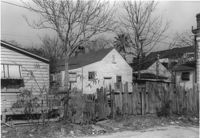
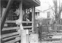
Porch of house with laundry hanging, and lot strewn with scrap wood, on site affected by the construction of the Crosstown. Address: 12 Norman Street. Surveyor notations on back of photo: "Dkt.: 10.524. Property owner: James Alston. Tract: 19. Station: 68+10 Lt. Date: Oct. 13, 1964. Portion in R/W to be removed by property owner." [See collection description for explanation of surveyor notations.]
House on site affected by the construction of the Crosstown. Address: 18-20 Wescott Street. Surveyor notations on back of photo: "Dkt.: 10.524. Property owner: Ralph E. Thornley, et al. Tract: 11. Station: 62+10 Lt. Date: Oct. 13, 1964. Portion in R/W to be removed. [See collection description for explanation of surveyor notations.]
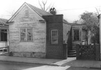
House on site affected by the construction of the Crosstown. Address: 181 Spring Street. Surveyor notations on back of photo: "Dkt.: 10.524. Property owner: Cecelia Elizabeth Cook, Est. Tract: 17. Station: 64+10 Rt. Date: Oct. 13, 1964. Partially In R/W - Bought." [See collection description for explanation of surveyor notations.]
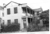
House on site affected by the construction of the Crosstown. Address: 193 Spring Street. Surveyor notations on back of photo: "Dkt.: 10.524. Property owner: Louise A. Robertson. Tract: 13. Station: 23+75 Rt. (Spring Street). Date: Oct. 13, 1964. Portion in R/W to be removed." [See collection description for explanation of surveyor notations.]
House on site affected by the construction of the Crosstown. Address: 193 Spring Street. Surveyor notations on back of photo: "Dkt.: 10.524. Property owner: Louise A. Robertson. Tract: 13. Station: 23+75 Rt. (Spring Street). Date: Oct. 13, 1964. Portion in R/W to be removed." [See collection description for explanation of surveyor notations.]
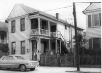
House on site affected by the construction of the Crosstown. Address: 3 Todd Street. Surveyor notations on back of photo: "Dkt.: 10.524. Property owner: John W. Bonaparte, et al. Tract: 118. Station: 87+75 Rt. Date: Dec. 1, 1964. In R/W - Bought." [See collection description for explanation of surveyor notations.]