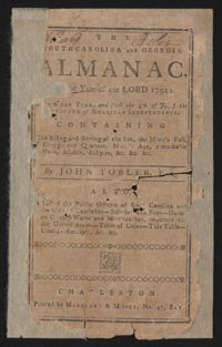
This is a Sandy Island plantation journal written inside of The South Carolina and Georgia Almanac for the year 1792. The plantation journal documents the planting of crops (rice, corns, and potatoes), the maintenance of ditches and drains, slave records, complications with the hiring of an overseer, livestock, and business relations with Laurel Hill Plantation.
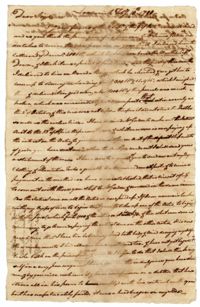
A letter from Elias Ball IV at Limerick Plantation to Elias "Wambaw" Ball III exiled in Bristol, England on James Gordon receiving rice, charters send to Comingtee Plantation to receive rice, a frost ruining a supply of rice, a request for "negro" clothing and plantation tools and Elias Ball IV's feelings on laboring.
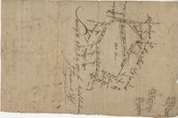
82 Acre plat of land, shows some trees with minimal notation. Names associated with this plat are John Green and Anthony Mitchell. Notable geographic locations include Waccamaw Neck.
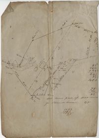
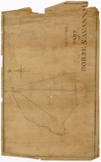
Plat of 130 acres on the Pee Dee River. Explains the plat and the surrounding area, drawing itself has little detail. Names associated with this plat are William Swinton, Joseph LaBruce, John White, James St. John, Elias Hopkin, and Thomas [?]. Notable geographic locations include the Pee Dee River, Black River, Weehaw Plantation, Kensington Plantation, Weehaw Creek, Georgetown, and Craven County [now in parts of Berkeley, Charleston, Georgetown, and Williamsburg counties].
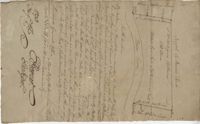
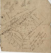
Plat of 383 acres on Mary Creek Swamp belonging to Joseph Coachman. Details include the property lines, the location of the swamp, and location of a few trees. Names associated with this plat are Joseph Coachman, J. Hardwick, John LaBruce, Cattle, and Ralph Izard.
400 acre plot of David Elliot that includes what appears to be a marsh called Great Bay, no land types or detail. Names associated with this plat are David Elliot, Washington, Henry Sattus and J. Hardwick. Notable geographic locations include Georgetown and Great Bay.
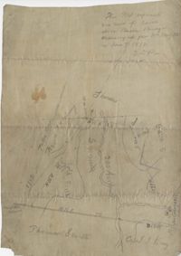
Plat of 200 acres above Bacon Bridge surveyed for William Drayton. Details include the property lines, trees, the location of the swamp, a field, a canal and roads. Names associated with this plat are Joseph Coachman, William Drayton, Thomas, Thomas Smith, J.J. Keersy [?], Chandless, Gales, and J.H. Waring. Notable geographic locations include Mary Creek Swamp [?], Broad Road, and Bacon Bridge.
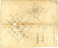
Papers consist of technical and mechanical drawings, formulae and notes, and other items. Drawings in pencil and ink (some hand-colored) depict a marsh plow, a windmill, a canal, Dutch yachts, an Amsterdam canoe (pontoon?), a trunk (irrigation device), a chakram (water-raising machine of India), a "double canoe" of Polynesia, a Venetian well (or cistern), a rice mill, a horse hoe, a gunpowder mill, a Welsh carr (carriage), the "bear" (plowing device?), and other devices. Some of these drawings may have been sent to Thomas Pinckney by William Vans Murray (U.S. foreign minister at The Hague in the 1790's). Several drawings (of the double canoe, Venetian well, chakram, the bear, and Amsterdam canoe) are accompanied by notes and descriptions. Formulae and instructions are for making cement for china, cottonseed oil, paints, oil compost, milk paint, and other products. Other items include a printed description of "Goodsell's Patent Hemp and Flax Dresser, & Grain Thrasher," a printed description of Benjamin B. Bernard's threshing machine (ca. 1808), a print depicting three bridges (bears the printed signature of Lewis Wernwag), a printed article entitled "Remarks on the Culture of Barrilla," a copy of a letter (1802) to Henry Laurens from N. & D. (Nathan and David) Sellers concerning a rolling screen for cleaning rice, and newspaper clippings.
A letter from Elias Ball IV at Limerick Plantation to Elias "Wambaw" Ball III exiled in Bristol, England on an account between the Balls and James Gordon, Elias Ball IV's tiredness, the rice and corn crops, planting 225 acres of rice at Comingtee Plantation, and debt.