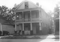
House on site affected by the construction of the Crosstown. Address: 147 President Street. Surveyor notations on back of photo: "Dkt.: 10.524. Property owner: Frank Chinners. Tract: 31. Station: 67+60 Rt. Date: Oct. 13, 1964. Partially In R/W - Bought." [See collection description for explanation of surveyor notations.]
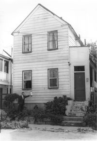
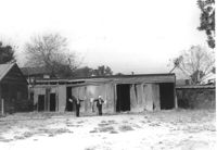
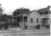
House on site affected by the construction of the Crosstown. Address: 9 Presidents Place. Surveyor notations on back of photo: "Dkt.: 10.524. Property owner: Mary Robinson, Est. Tract: 8. Station: 63+40 Rt. Date: Oct. 13, 1964. In R/W - Bought." [See collection description for explanation of surveyor notations.]
House on site affected by the construction of the Crosstown. Address: 9 Presidents Place. Surveyor notations on back of photo: "Dkt.: 10.524. Property owner: Mary Robinson, Est. Tract: 8. Station: 63+40 Rt. Date: Oct. 13, 1964. In R/W - Bought." [See collection description for explanation of surveyor notations.]
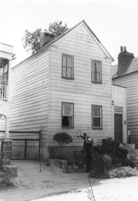
House on site affected by the construction of the Crosstown. Address: 11 Presidents Place. Surveyor notations on back of photo: "Dkt.: 10.524. Property owner: Lucille Smalls. Tract: 9. Station: 63+10 Rt. Date: Oct. 13, 1964. In R/W - Bought." [See collection description for explanation of surveyor notations.]
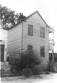
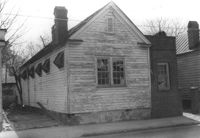
Structure and lot on site affected by the construction of the Crosstown. Address: 160 Cannon Street. Surveyor notations on back of photo: "Dkt.: 10.524. Property owner: Mabel M. Cecil McIherney. Tract: 7. Station: 62+75 CL Lt. Date: Oct. 13, 1964. Portion In R/W - Bought." [See collection description for explanation of surveyor notations.]
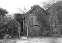
House on site affected by the construction of the Crosstown. Address: 161 Line Street. (Possibly a freedman's cottage with altered entry and porch.) Surveyor notations on back of photo: "Dkt.: 10.524. Property owner: Christopher C. Polite, Est. Tract; 94. Station: 81+90 CL. Date: Dec. 1, 1964. In R/W - Bought." [See collection description for explanation of surveyor notations.]
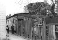
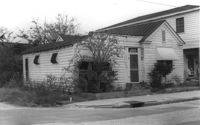
House (freedman's cottage) on site affected by the construction of the Crosstown. Address: 3 Rosemont Street. Surveyor notations on back of photo: "Dkt.: 10.524. Property owner: Christopher Ward. Tract: 54. Station: 71+70 Rt. Date: Oct. 14, 1964." [See collection description for explanation of surveyor notations.]
Rear view of house on site affected by the construction of the Crosstown. Address: 3 Rosemont Street. Wood fence in foreground. Surveyor notations on back of photo: "Dkt.: 10.524. Property owner: Christopher Ward. Tract: 54. Station: 71+70 Rt. Date: Oct. 14, 1964. Portion in R/W to be removed by property owner." [See collection description for explanation of surveyor notations.]
House on site affected by the construction of the Crosstown. Address: 159 President Street. Surveyor notations on back of photo: "Dkt.: 10.524. Property owner: James E. Campbell. Tract: 37. Station: 69+30 Lt. Date: Oct. 14, 1964. Partially in R/W." [See collection description for explanation of surveyor notations.]
House (corner view) on site affected by the construction of the Crosstown. Address: 120 Bogard Street. View of street corner. Surveyor notations on back of photo: "Dkt.: 10.524. Property owner: James Green. Tract: 59. Station: 79+25 Lt. Date: Oct. 14, 1964. In R/W - Bought." [See collection description for explanation of surveyor notations.]