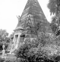
Magnolia Cemetery, Huguenin Avenue and Algonquin Road. William B. Smith Mausoleum. View of Side and Front elevation. Charleston, S.C.;8" x 8" B/W photo. Box 5, Folder 2-1-3. One copy.
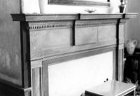
Lawson's Pond Plantation, Lawson Pond Lane. Interior View - Detail of mantle in East Front Room. NW elevation. Cross, SC.;6.5" x 9.5" B/W photo. Box 2, Folder 1-4-3. One copy.
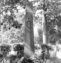
Magnolia Cemetery, Huguenin Avenue and Algonquin Road. Tombstone of Micah Jenkins. View of Front elevation. Charleston, S.C.;8" x 8" B/W photo. Box 5, Folder 2-1-3. One copy.
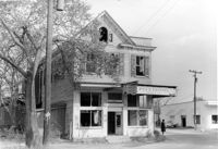
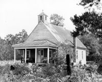
Firetag's Store (Mappus' Store, Six Mile Store) - View of NE (Front and Side) elevation. North Charleston, S.C.;6.5" x 10" B/W photo. Box 5, Folder 2-1-7. One copy.
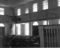
Johns Island Presbyterian Church, 2550 Bohicket Road. Church - Interior View. Sanctuary, Front elevation. Johns Island, S.C.;8" x 10" B/W photo. Box 12, Folder 2-5-4. One copy.
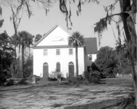
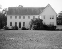
Johns Island Presbyterian Church, 2550 Bohicket Road. Church - View of Front elevation. Johns Island, S.C.;8" x 10" B/W photo. Box 12, Folder 2-5-4. Two copies.
Johns Island Presbyterian Church, 2550 Bohicket Road. Church - View of Front elevation. Johns Island, S.C.;8" x 10" B/W photo. Box 12, Folder 2-5-4. One copy.
Johns Island Presbyterian Church, 2550 Bohicket Road. Church - View of Front elevation. Johns Island, S.C.;8" x 10" B/W photo. Box 12, Folder 2-5-4. One copy.
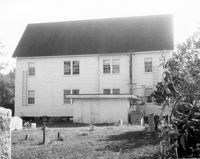
Johns Island Presbyterian Church, 2550 Bohicket Road. Church - View of Rear elevation. Johns Island, S.C.;8" x 10" B/W photo. Box 12, Folder 2-5-4. One copy.
Limit your search
Photos from the Records of The Historic Preservation Planner, BCD-COG✖[remove]985