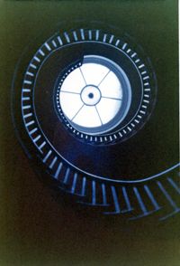
Lowndes Grove Plantation, 260 St. Margaret Street. Main House - Interior View. Detail of Flying Staircase, from ground, looking up. Charleston, S.C. NOTE: Print severely faded, color digitally restored.;5" x 3.5" Color photo. Box 8, Folder 2-1-148. One copy.
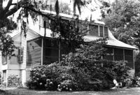
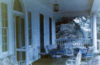
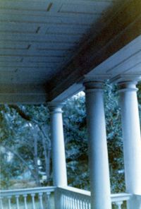
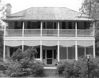
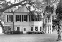
Lowndes Grove Plantation, 260 St. Margaret Street. Main House - View of 2nd Floor Porch, NW (Front and Side) elevation. Charleston, S.C. NOTE: Print severely faded, color digitally restored.;3.5" x 5" Color photo. Box 8, Folder 2-1-148. One copy.
Lowndes Grove Plantation, 260 St. Margaret Street. Main House - Detail View of 2nd Floor Porch, SW elevation. Charleston, S.C. NOTE: Print severely faded, color digitally restored.;5" x 3.5" Color photo. Box 8, Folder 2-1-148. One copy.
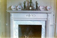
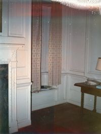
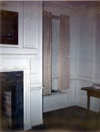
Lowndes Grove Plantation, 260 St. Margaret Street. Main House - Interior View. Detail of Mantle. Charleston, S.C. NOTE: Print severely faded, color digitally restored.;3.5" x 5" Color photo. Box 8, Folder 2-1-148. One copy.
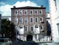
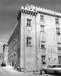
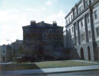
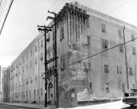
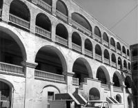
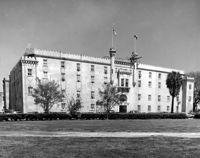
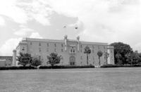
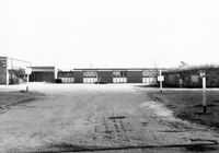
Old Citadel (South Carolina State Arsenal, Embassy Suites Hotel), 337 Meeting Street. View of SW (Front and Side) elevation. Charleston, S.C.;10" x 8" B/W photo. Box 5, Folder 2-1-5. One copy.
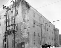
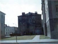
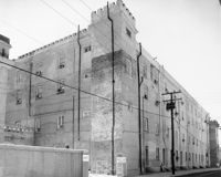
Old Citadel (South Carolina State Arsenal, Embassy Suites Hotel), 337 Meeting Street. View of NW (Side and Rear) elevation. Charleston, S.C.;8" x 10" B/W photo. Box 5, Folder 2-1-5. One copy.
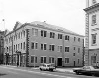
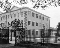
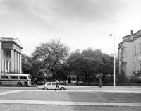
Charleston County Courthouse, 77 Meeting Street. View of NE (Side and Front) elevation. Charleston, S.C.;8" x 10" B/W photo. Box 5, Folder 2-1-8. One copy.
Old Citadel (South Carolina State Arsenal, Embassy Suites Hotel), 337 Meeting Street. View of NW (Side and Rear) elevation. Charleston, S.C.;8" x 10" B/W photo. Box 5, Folder 2-1-5. One copy.
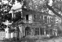
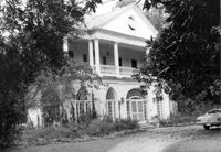
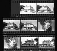
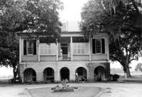
Lowndes Grove Plantation, 260 St. Margaret Street. Main House - View of SW (Side and Rear) elevation. Charleston, S.C.;6.5" x 10" B/W photo. Box 8, Folder 2-1-148. One copy.
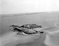
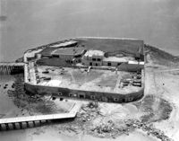
Old Citadel (South Carolina State Arsenal, Embassy Suites Hotel), 337 Meeting Street. View of Interior Courtyard. Charleston, S.C.;8" x 10" B/W photo. Box 5, Folder 2-1-5. One copy.
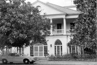
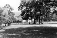
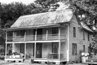
Lowndes Grove Plantation, 260 St. Margaret Street. Main House - View of North (Front) elevation. Charleston, S.C.;6.5" x 10" B/W photo. Box 8, Folder 2-1-148. One copy.
Charleston County Courthouse, 77 Meeting Street. View from Washington Square Park - NE (Front and Side) elevation. Charleston, S.C.;8" x 10" B/W photo. Box 5, Folder 2-1-8. One copy.
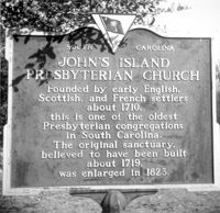
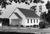
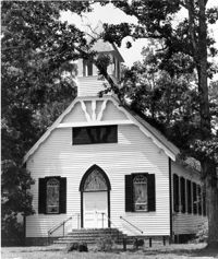
Johns Island Presbyterian Church, 2550 Bohicket Road. Church and Educational Building - View of Front and Side elevation (from street). Johns Island, S.C.;6.5" x 10" B/W photo. Box 12, Folder 2-5-4. One copy.
Johns Island Presbyterian Church, 2550 Bohicket Road. Church and Educational Building - View of Front and Side elevation (from street). Johns Island, S.C.;6.5" x 10" B/W photo. Box 12, Folder 2-5-4. One copy.
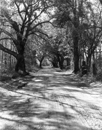
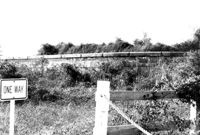
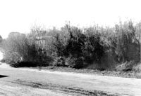
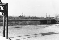
Lowndes Grove Plantation, 260 St. Margaret Street. View of Entry Gate and Ashley River, SW elevation. Charleston, S.C.;6.5" x 10" B/W photo. Box 8, Folder 2-1-148. One copy.
Johns Island Presbyterian Church, 2550 Bohicket Road. Education Building - Front elevation. Johns Island, S.C.;6.5" x 10" B/W photo. Box 12, Folder 2-5-4. One copy.
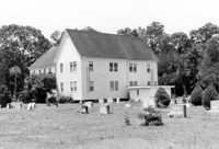
Johns Island Presbyterian Church, 2550 Bohicket Road. Cemetery and Church - Rear and Side elevation. Johns Island, S.C.;6.5" x 10" B/W photo. Box 12, Folder 2-5-4. One copy.
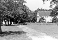
Johns Island Presbyterian Church, 2550 Bohicket Road. Education Building and Church - South elevation. Johns Island, S.C.;6.5" x 10" B/W photo. Box 12, Folder 2-5-4. One copy.
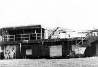
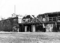
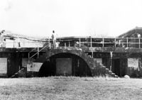
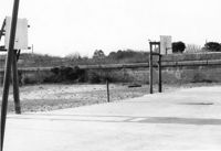
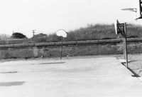
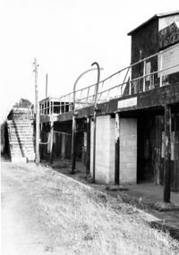
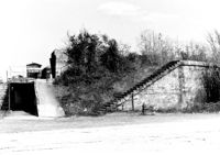
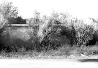
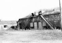
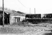
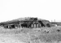
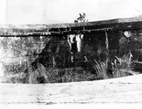
Battery Thomson, 2013 I'on Avenue. View of Armaments Section, North (Front) elevation. Sullivans Island, S.C.;6.5" x 10" B/W photo. Box 16, Folder 2-13-7. One copy.
Battery Thomson, 2013 I'on Avenue. View of Gun Platform, North (Front) elevation. Sullivans Island, S.C.;6.5" x 10" B/W photo. Box 16, Folder 2-13-7. One copy.
Lowndes Grove Plantation, 260 St. Margaret Street. Main House - View of NW (Front and Side) elevation. Charleston, S.C.;6.5" x 10" B/W photo. Box 8, Folder 2-1-148. One copy.
Lowndes Grove Plantation, 260 St. Margaret Street. Main House - View of NE (Front and Side) elevation. Charleston, S.C.;6.5" x 10" B/W photo. Box 8, Folder 2-1-148. One copy.
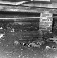
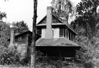
Lowndes Grove Plantation, 260 St. Margaret Street. Kitchen House - View of North (Front) elevation. Charleston, S.C.;10" x 6.5" B/W photo. Box 8, Folder 2-1-148. One copy.
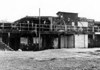
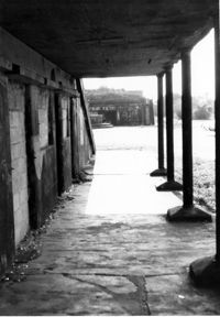
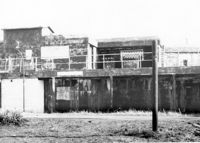
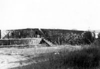
Battery Gadsden (Charleston County Public Library, Edgar Allen Poe Branch), 1921 I'on Avenue. View of East and Middle Wings, South (Rear) elevation. Sullivans Island, S.C.;6.5" x 10" B/W photo. Box 16, Folder 2-13-6. One copy.
Battery Gadsden (Charleston County Public Library, Edgar Allen Poe Branch), 1921 I'on Avenue. View of East Wing, South (Rear) elevation. Sullivans Island, S.C.;6.5" x 10" B/W photo. Box 16, Folder 2-13-6. One copy.
Battery Thomson, 2013 I'on Avenue. View of Observation Post, North (Front) elevation. Sullivans Island, S.C.;6.5" x 10" B/W photo. Box 16, Folder 2-13-7. One copy.
Battery Thomson, 2013 I'on Avenue. View of North (Front) elevation, looking West. Sullivans Island, S.C.;10" x 6.5" B/W photo. Box 16, Folder 2-13-7. One copy.
Battery Thomson, 2013 I'on Avenue. View of North (Front) elevation, looking East. Sullivans Island, S.C.;10" x 6.5" B/W photo. Box 16, Folder 2-13-7. One copy.
Battery Thomson, 2013 I'on Avenue. View of North (Front) elevation, looking West. Sullivans Island, S.C.;6.5" x 10" B/W photo. Box 16, Folder 2-13-7. One copy.
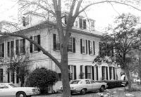
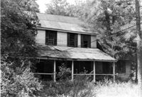
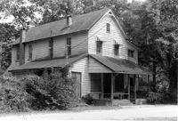
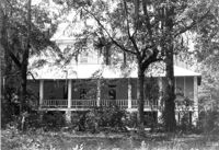
William Cain House - Main House. View of East (Side) elevation. Pinopolis Historic District North. Pinopolis, S.C.;6.5" x 9.5" B/W photo. Box 4, Folder 1-10-1 (III). One copy.
Old Citadel (South Carolina State Arsenal, Embassy Suites Hotel), 337 Meeting Street. View of SW (Front and Side) elevation. Charleston, S.C.;3.5" x 5" B/W photo. Box 5, Folder 2-1-5. Two copies.
Old Citadel (South Carolina State Arsenal, Embassy Suites Hotel), 337 Meeting Street. View of SW (Front and Side) elevation. Charleston, S.C.;8" x 10" B/W photo. Box 5, Folder 2-1-5. Three copies.
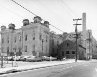
Old Citadel (South Carolina State Arsenal, Embassy Suites Hotel), 337 Meeting Street. View of NE (Rear and Side) elevation. Charleston, S.C.;8" x 10" B/W photo. Box 5, Folder 2-1-5. Two copies.
Old Citadel (South Carolina State Arsenal, Embassy Suites Hotel), 337 Meeting Street. View of NE (Rear and Side) elevation. Charleston, S.C.;8" x 10" B/W photo. Box 5, Folder 2-1-5. One copy.
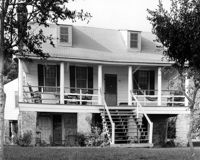
Dr. Morton Waring House - Main House. View of North (Front) elevation. Pinopolis Historic District South. Pinopolis, S.C.;6.5" x 9.5" B/W photo. Box 4, Folder 1-10-1 (III). One copy.
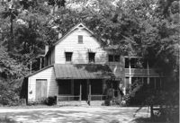
Harlock Webb Harvey Store and Home. View of Side and Front elevations. Pinopolis, S.C.;6.5" x 9.5" B/W photo. Box 4, Folder 1-10-1 (III). Three copies.
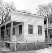
Old Carroll House (Carroll Place), Junction of Quaker and Wire Roads. View of North (Front) elevation. St. George, S.C.;8" x 10" B/W photo. Box 20, Folder: Miscellaneous Photos: Unidentified Images. One copy.
Rockville Historic District - Hagood House (Micah Jenkins House), Grace Chapel Road. View of South (Front) elevation. Wadmalaw Island, S.C.;8" x 10" B/W photo. Box 17, Folder 2-14-16. One copy.
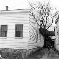
T. Hayne Stall House. Contact Sheet 1 - View of Front and Side elevations. Stallsville Area. Summerville, S.C.;7.5" x 2.25" B/W photo. Box 17, Folder 3-1-1. One Copy.
Battery Gadsden (Charleston County Public Library, Edgar Allen Poe Branch), 1921 I'on Avenue. View of West Wing, North (Front) elevation - looking East. Sullivans Island, S.C.;6.5" x 10" B/W photo. Box 16, Folder 2-13-6. One copy.
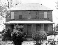
Charles Stevens House (Northampton Plantation House), 2008 Pinopolis Road. View of Front (?) elevation. Pinopolis, S.C.;6.5" x 9.5" B/W photo. Box 3, Folder 1-9-1 (I). One copy.
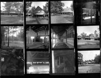
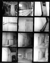
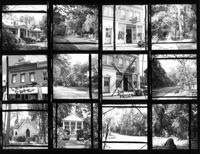
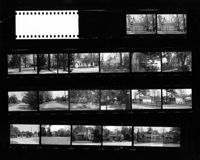
Stallsville. Contact Sheet with multiple views of various houses, commercial buildings, and roads. Summerville, S.C.;8" x 10" B/W photo. Box 3, Folder 3-1-1. One copy.
Washington Square Park, NE corner of Broad and Meeting Streets. View of West (Meeting Street) elevation. Charleston, S.C.;8" x 10" B/W photo. Box 5, Folder 2-1-8. One copy.
Robert Marion, Sr. House. View of Front elevation. Pinville Historic District. St. Stephen, S.C.;8" x 10" B/W photo. Box 3, Folder 1-9-1 (I). One copy.
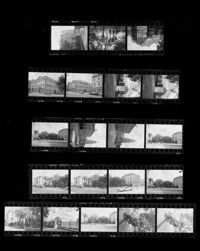
Charleston County Courthouse, 77 Meeting Street. Contact Sheet - Views of the Courthouse and Washington Square Park. Charleston, S.C.;10" x 8" B/W photo. Box 5, Folder 2-1-8. One copy.
Battery Gadsden (Charleston County Public Library, Edgar Allen Poe Branch), 1921 I'on Avenue. View of Edge of 1st Gun Platform from East end (visible on right side of image), North (Front) elevation. Central building unidentified. Sullivans Island, S.C.;6.5" x 10" B/W photo. Box 16, Folder 2-13-6. One copy.
Battery Gadsden (Charleston County Public Library, Edgar Allen Poe Branch), 1921 I'on Avenue. View of West Wing and 4th Gun Platform from East end, NE (Side and Front) elevation. Sullivans Island, S.C.;6.5" x 10" B/W photo. Box 16, Folder 2-13-6. One copy.
Battery Gadsden (Charleston County Public Library, Edgar Allen Poe Branch), 1921 I'on Avenue. View of West Wing and 4th Gun Platform from East end, NE (Side and Front) elevation. Sullivans Island, S.C.;6.5" x 10" B/W photo. Box 16, Folder 2-13-6. One copy.
Battery Gadsden (Charleston County Public Library, Edgar Allen Poe Branch), 1921 I'on Avenue. View of 4th Gun Platform from East end, NE (Front and Side) elevation. Sullivans Island, S.C.;6.5" x 10" B/W photo. Box 16, Folder 2-13-6. One copy.
Battery Gadsden (Charleston County Public Library, Edgar Allen Poe Branch), 1921 I'on Avenue. View of 1st Gun Platform from East end, SE (Side and Rear) elevation. Sullivans Island, S.C.;6.5" x 10" B/W photo. Box 16, Folder 2-13-6. One copy.
Battery Gadsden (Charleston County Public Library, Edgar Allen Poe Branch), 1921 I'on Avenue. View of 4th Gun Platform from East end, North (Front) elevation. Sullivans Island, S.C.;6.5" x 10" B/W photo. Box 16, Folder 2-13-6. One copy.
Battery Gadsden (Charleston County Public Library, Edgar Allen Poe Branch), 1921 I'on Avenue. View of 1st Gun Platform and East Wing, South (Rear) elevation. Sullivans Island, S.C.;6.5" x 10" B/W photo. Box 16, Folder 2-13-6. One copy.
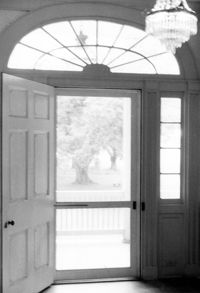
The Grove Plantation (Ernest F. Hollings ACE Basin National Wildlife Refuge). Interior View - 2nd Floor. Detail of Front Door. Adams Run, S.C.;10" x 6.5" B/W photo. Box 15, Folder 2-11-1. One copy.
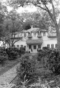
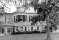
The Grove Plantation (Ernest F. Hollings ACE Basin National Wildlife Refuge). View of the North (Rear) elevation. Adams Run, S.C.;6.5" x 10" B/W photo. Box 15, Folder 2-11-1. One copy.
The Grove Plantation (Ernest F. Hollings ACE Basin National Wildlife Refuge). View of East (Side) elevation. Adams Run, S.C.;6.5" x 10" B/W photo. Box 15, Folder 2-11-1. One copy.
The Grove Plantation (Ernest F. Hollings ACE Basin National Wildlife Refuge). View of West (Side) elevation. Adams Run, S.C.;6.5" x 10" B/W photo. Box 15, Folder 2-11-1. One copy.
Cathedral of St. Luke and St. Paul, 126 Coming Street. Contact Sheet 8 - Views of Educational Building and Church. Charleston, S.C.;1" x 6" B/W photo. Box 20, Folder: Miscellaneous Photos: Scanned Contact Sheets. One copy.
Fireproof Building (South Carolina Historical Society), 100 Meeting Street. View of SW (Side and Front) elevation. Charleston, S.C.;3.5" x 5" B/W photo. Box 5, Folder 2-1-1. One copy.