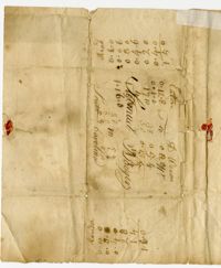
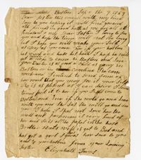
The Surveyor's Notebook, 1767, is a bound volume kept by or for a member of the Ball family containing field notes, tables, conversions of liquid, cloth measures, and a description of rules of "three direct" and "three inverse."
Plat of 1000 acres is surrounded by vacant land. Names associated with this plat are John Stuart. Notable geographic locations include Berkeley County and St. Stephen's Parish.
True copy of Peter Sinkler plat contains 310 acres in Craven County [now in parts of Berkeley, Charleston, Georgetown, and Williamsburg counties] bounding northwest on land of Isaac Porcher and Rene Pyre, southeast on land of Robert Taylor and Rene Ravenel, and northwest on Santee River. Names associated with this plat are Peter Sinkler, Robert Taylor, Ephraim Mitchell, Rene Pyre, Isaac Porcher, Rene Ravenel, John Brernon, and Henry Mowlon. Notable geographic locations include St. James Parish, the Santee River and Craven County.
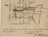
Plan of a tract of 1000 acres of land in Wall Eye Swamp in Craven County [now in parts of Berkeley, Charleston, Georgetown, and Williamsburg counties]. Names associated with this plat are Samuel Cooper, James Sinkler, Peter Sinkler, Isham Moore, John Bremar, and William Bull.