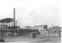
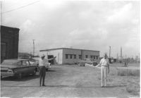
Virginia-Carolina Chemical Corp. structures on site affected by the construction of Interstate 26 (I-26). [VC Chemical Corp. was located on King Street Extn.] Surveyor notations on back of photo: "Dkt.: 10.490. Property owner: V.C. Chemical Co. Tract: 1. Station: 5800+00 Rt. Date: September 11, 1962. Second shot relating to picture #1 [photo 1017]." [See collection description for explanation of surveyor notations.]
Virginia-Carolina Chemical Corp. structures on site affected by the construction of Interstate 26 (I-26). [VC Chemical Corp. was located on King Street Extn.] Surveyor notations on back of photo: "Dkt.: 10.490. Property owner: V.C. Chemical Co. Tract: 1. Station: 5800+00 Rt. Date: September 11, 1962. For information only. Outside R/W. To be moved by VC." [See collection description for explanation of surveyor notations.]
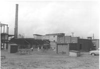
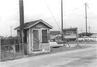
Virginia-Carolina Chemical Corp. structures on site affected by the construction of Interstate 26 (I-26). [VC Chemical Corp. was located on King Street Extn.] Surveyor notations on back of photo: "Dkt.: 10.490. Property owner: V.C. Chemical Co. Tract: 1. Station: 5898+70 Rt. Date: September 11, 1962. Showing 2 small buildings taken in R/W." [See collection description for explanation of surveyor notations.]
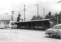
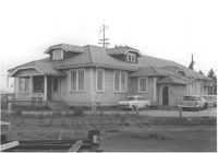
Koppers Company building and car port on site affected by the construction of Interstate 26 (I-26). Surveyor notations on back of photo: "Dkt.: 10.490. Property owner: Koppers Co. Tract: 137. Station: 5848+50 Rt. Date: August 29, 1962. To be moved by SCHD [SC Highway Department]." [See collection description for explanation of surveyor notations.]
Koppers Company building no. 21 on site affected by the construction of Interstate 26 (I-26). Surveyor notations on back of photo: "Dkt.: 10.490. Property owner: Koppers Co. Tract: 137. Station: 5847+00 Rt. Date: August 29, 1962. In R/W - Bought." [See collection description for explanation of surveyor notations.]
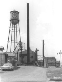
Koppers Company buildings and structures on site affected by the construction of Interstate 26 (I-26). Surveyor notations on back of photo: "Dkt.: 10.490. Property owner: Koppers Co. Tract: 137. Station: 5847±. Date: August 29, 1962. Guys to be relocated." [See collection description for explanation of surveyor notations.]
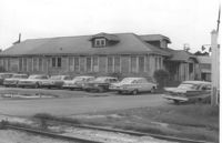
Koppers Company building on site affected by the construction of Interstate 26 (I-26). Surveyor notations on back of photo: "Dkt.: 10.490. Property owner: Koppers Co. Tract: 137. Station: 5848+00 on CL. Date: August 29, 1962. In R/W - Bought." [See collection description for explanation of surveyor notations.]
Koppers Company building on site affected by the construction of Interstate 26 (I-26). Surveyor notations on back of photo: "Dkt.: 10.490. Property owner: Koppers Co. Tract: 137. Station: 5848+00 on CL. Date: August 29, 1962. In R/W - Bought." [See collection description for explanation of surveyor notations.]
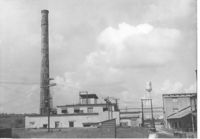
Virginia-Carolina Chemical Corp. building on site affected by the construction of Interstate 26 (I-26). [VC Chemical Corp. was located on King Street Extn.] Surveyor notations on back of photo: "Dkt.: 10.490. Property owner: V.C. Chemical Co. Tract: 1. Station: 5798+20 Rt. Date: September 11, 1962. Wash room. Outside R/W." [See collection description for explanation of surveyor notations.]
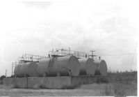
Virginia-Carolina Chemical Corp. tanks on site affected by the construction of Interstate 26 (I-26). [VC Chemical Corp. was located on King Street Extn.] Surveyor notations on back of photo: "Dkt.: 10.490. Property owner: V.C. Chemical Co. Tract: 1. Station: 5803+20 on CL. Date: September 11, 1962. In R/W. Bought. Tank 'farm.'" [See collection description for explanation of surveyor notations.]
Right of way--South Carolina--Charleston County, Highway planning--South Carolina--Charleston County, Industrial buildings--South Carolina--Charleston County✖[remove]25