Page 246 of the City Engineer's Plat Book with one plat. The plat shows lots located between Rutledge Avenue and the Ashley River. Groups of lots are labelled with red letters. The plat also shows Darlington Avenue, Ashley Avenue, Piedmont Avenue, Hester Street, Clemson Street, Maple Street, Peachtree Street, Poplar Street, Pendleton Street, and Sans Souci Street.
Page 250 of the City Engineer's Plat Book with one plat. The plat shows lots between Romney Street and Williman Street, and east of Meeting Street. The plat also shows Isabella Street.
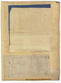
Page 215 of the City Engineer's Plat Book with two plats. Plat 1 shows land located between Calhoun Street and Bull Street, and between Lynch Street and Rutledge Street. Plat 2, located inside a folding insert, shows land along Moultrie Street. Plat 2 also includes Hanover Street, Hill Street, Huger Street, Nassau Street, Meeting Street, Hampton Street, King Street, a lot labeled "Chas. Gas Light Co.," labels for high land, labels for marsh land, and a structure located on Hampton Street.
Page 252 of the City Engineer's Plat Book with two plats. Plat 1 shows lots on and near Lenwood Street, between South Bay Street and Boulevard Drive. Plat 2 shows lots located on and near the intersection of Huger Street and Rutledge Avenue.
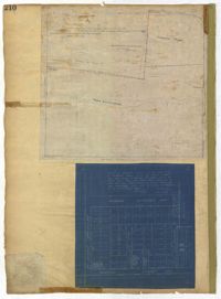
Page 210 of the City Engineer's Plat Book with two plats. Plat 1 features land set aside for a park, located between Lynch Street and Rutledge Street, and between Bennett Street and Calhoun Street. Plat 2 shows lots located between Simons Street and Gordon Street, near where they intersect with Rutledge Avenue.