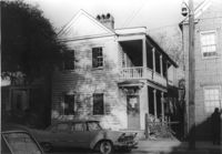
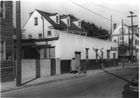
House on site affected by the construction of the Crosstown. Address: 502 Rutledge Avenue. Surveyor notations on back of photo: "Dkt.: 10.524. Property owner: Anna R.D. Hollings, Est. Tract: 115. Station: 86+00 Rt. Date: Dec. 1, 1964. In R/W - Bought." [See collection description for explanation of surveyor notations.]
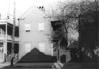
House on site affected by the construction of the Crosstown. Address: 500 Rutledge Avenue. Surveyor notations on back of photo: "Dkt.: 10.524. Property owner: James F. Simmons. Tract: 116. Station: 85+90 Rt. Date: Dec. 1, 1964. In R/W - Bought." [See collection description for explanation of surveyor notations.]
House on site affected by the construction of the Crosstown. Address: 500 Rutledge Avenue. Surveyor notations on back of photo: "Dkt.: 10.524. Property owner: James F. Simmons. Tract: 116. Station: 85+90 Rt. Date: Dec. 1, 1964. In R/W - Bought." [See collection description for explanation of surveyor notations.]
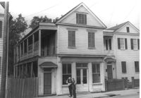
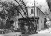
House on site affected by the construction of the Crosstown. Address: 182 Spring Street. First floor appears to have been a store. Surveyor notations on back of photo: "Dkt.: 10.524. Property owner: A.J.R. Kornahrens. Tract: 27. Station: 65+75 Rt. Date: Oct. 13, 1964. In R/W - Bought." [See collection description for explanation of surveyor notations.]
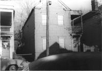
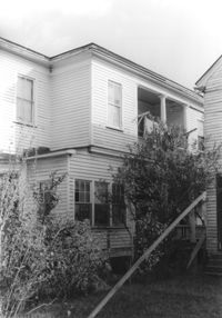
Carl's House (rear and side view) on site affected by the construction of the Crosstown. Address: 493 Rutledge Avenue. Looking towards street corner. Surveyor notations on back of photo: "Dkt.: 10.524. Property owner: Elise C. Goldberg, et al. Tract: 105. Station: 84+40 Rt. Date: Dec. 1, 1964. In R/W - Bought." [See collection description for explanation of surveyor notations.]
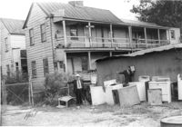
Structure (shed?) (rear view), with several household appliances (stoves?) in the yard, on site affected by the construction of the Crosstown. Address: 11 Presidents Place. Surveyor notations on back of photo: "Dkt.: 10.524. Property owner: Star Gospel Mission. Tract: 15. Station: 24+50 Rt. (Spring Street). Date: Oct. 13, 1964. Portion in R/W to be removed." [See collection description for explanation of surveyor notations.]
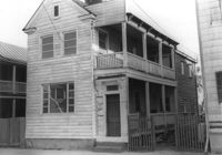
House (side view, rear) on site affected by the construction of the Crosstown. Address: 110 Sheppard Street. Surveyor notations on back of photo: "Dkt.: 10.524. Property owner: Alma L. Browning, et al. Tract: 147. Station: 19+95 CL S.B. lane. Date: Dec. 2, 1964. In R/W - Bought." [See collection description for explanation of surveyor notations.]
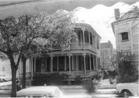
House on corner of Sheppard and Ashe Street, on site affected by the construction of the Crosstown. Address: 125 Sheppard Street. Surveyor notations on back of photo: "Dkt.: 10.524. Property owner: Joseph A. Moore, et al. Tract: 130. Station: 91+90 Rt. Date: Dec. 2, 1964. In R/W - Bought." [See collection description for explanation of surveyor notations.]
House on site affected by the construction of the Crosstown. Address: 122 Sheppard Street. View at street corner. Surveyor notations on back of photo: "Dkt.: 10.524. Property owner: Archie B. Hollins. Tract: 136. Station: 17+40 Lt. S.B. lane. Date: Dec. 2, 1964. In R/W - Bought." [See collection description for explanation of surveyor notations.]
House on site affected by the construction of the Crosstown. Address: 12 Todd Street. Surveyor notations on back of photo: "Dkt.: 10.524. Property owner: Buster Jones, et al. Tract: 123. Station: 88+65 CL Rt. Date: Dec. 2, 1964. In R/W - Bought." [See collection description for explanation of surveyor notations.]