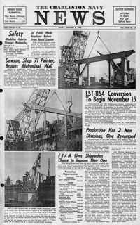
Newspaper printed for the civilian employees of the Charleston Naval Shipyard starting on January 8th 1960. This volume covers from January 8th 1960 to December 23rd 1960.
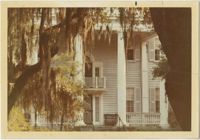
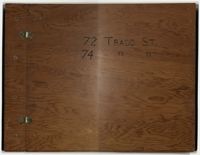
Compilation of original deeds, titles, and other documents related to the transfer, sale, and ownership of the double tenement at 72-74 Tradd Street, known as the Fotheringham-McNeil Tenements. Documents span from 1765 to 1961, likely representing the entire history of the ownership of the double tenement throughout that time period. Also includes blueprints and photographs. (NOTE: Fotheringham has also been spelled Fotheringham.)
The Transactions of the Huguenot Society No.66 contains published articles on genealogy and history, memorials, and annual reports from its officers for the year 1960-1961.
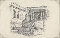
Black-and-white postcard with a reproduction of a sketch by Hans Bulow of the exterior of St. Thomas Synagogue in Charlotte Amalie on the island of Saint Thomas in the U.S. Virgin Islands.
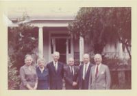
Color photograph depicting image of six people standing in front of McLeod Plantation. Writing on back of image reads, "McLeod house James Island, 1960. L-R -(?) Rose M.L.Barnwell, Dr. E.H. Barnwell (?) W.E. McLeod (?)."
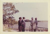
Color photograph of four men looking over rooftop of building. Writing on back of image reads, "Country Club 1960. W.E. McLeod pointing. Others not remembered."
House on site affected by the construction of Interstate 26 (I-26). Sign posted in ground: Worms for sale. Surveyor notations on back of photo: "Dkt.: 10.471. Property owner: F.R. Shutt, et al. Tract: 92. Station: 5376+10 Rt. Date: Aug. 23, 1960. In R/W - Bought." [See collection description for explanation of surveyor notations.]
House on site affected by the construction of Interstate 26 (I-26). Surveyor notations on back of photo: "Dkt.: 10.471. Property owner: W.L. McDonald, et al. Tract: 38. Station: 5326+00 Rt. Date: Aug. 23, 1960. In R/W - Bought." [See collection description for explanation of surveyor notations.]
House on site affected by the construction of Interstate 26 (I-26). Surveyor notations on back of photo: "Dkt.: 10.471. Property owner: Isabella W. Meany. Tract: 98. Station: 5378+80 Rt. Date: Aug. 23, 1960. In R/W - Bought." [See collection description for explanation of surveyor notations.]
![[Ben Ezra Synagogue, Cairo]](https://iiif.library.cofc.edu/iiif/2/47346/full/200,/0/default.jpg)
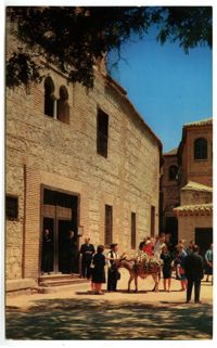
![[Der grosse Gebetssaal der Wundervollen ist ein schönes Beispiel andalusischer Architekture]](https://iiif.library.cofc.edu/iiif/2/24786/full/200,/0/default.jpg)