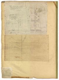
Page 132 of the City Engineer's Plat Book with two plats. Plat 1 features a plan for the College of Charleston, showing buildings labelled "Charleston College," "Library," "Lodge," and "Charleston Orphan House." Streets on this plat include George Street, Smith Street, College Street, Calhoun Street, St. Philips Street, and Vanderhorst Street. Plat 2 shows lots located near the intersection of Montague Street and Lynch Street.
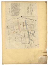
Page 23 of the City Engineer's Plat Book with one plat. The plat shows lots, buildings, shoals, and mud flats located near the Charleston Harbor on the Cooper River, Concord Street, Pinckney Street, and East Bay Street.
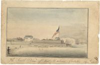
Work on paper in ink and watercolor dated 1796. Fort with flag raised in right side of image and houses in left. Ships are visible in background, and soldier is in left foreground. Sketch dated July 4, 1796.
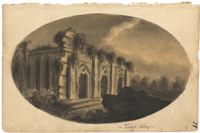
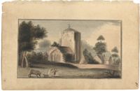
Work on paper in watercolor. Church and buildings with bull, dog, and running woman in foreground. Handwritten note identifies church as Beauchert Abbey.
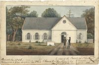
Work on paper in watercolor dated 1800. White church with three windows to left of door in center. Two men stand on road that leads to church door. Handwritten note identifies building as church in St. Andrews, built in 1706, with an organ destroyed by British soldiers.
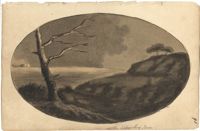
Work on paper in ink and wash. Black and sepia; bare tree in left foreground with branches growing toward right; hills to right; dark clouds and water in background.