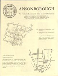
This four-page brochure includes background information on the Ansonborough Rehabilitation Project, photographs and information about Ansonborough homes, and a map of Ansonborough.
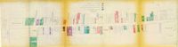
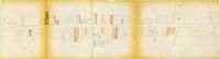
One of four maps of King Street building footprints, hand-colored to designate status. This map illustrates the historical significance of buildings on King Street from Calhoun Street to Columbus Street.
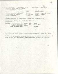
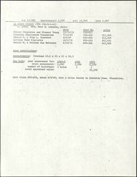
In this one-page typed document eight houses and gardens are added to the walking tour through the Ansonborough Neighborhood: 19 Wentworth Street, 57 Anson Street, 46 Society Street,43 Society Street, 63 Anson Street, 75 Anson Street, and 79 Anson Street. An approximate date of when the buildings on the property were built, as well as ownership information, is included.
One of four maps of King Street building footprints, hand-colored to designate status. This map illustrates proposed reuses of buildings on King Street from Calhoun Street to Queen Street.
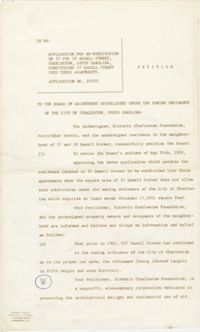
In this typed four-page document, N. L. Barnwell, attorney for Historic Charleston Foundation, presents a petition against allowing the subdivision of 37 Hasell Street into three separate apartments.
One of four maps of King Street building footprints, hand-colored to designate status. This map illustrates area conditions of buildings on King Street from Calhoun Street to Columbus Street.
A one-page typed document chronicling the history of 66 Anson Street, 40 Society Street, and 42 Society Street, from the fire of 1838 to launch of HCF Revolving Fund in 1958.