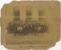
Black-and-white photograph, mounted on card, of the portrait of a group of men standing in front of a building. Writing under image reads, "House of Representatives."
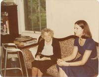
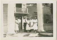
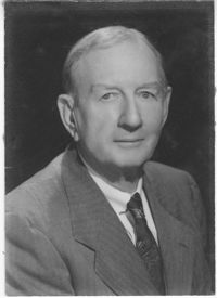
Black-and-white photograph of Willie McLeod, looking away from the camera. Writing on back of image reads, "October, 1985. Margaret Moore, Margaret Welsh, Anne Hay, Lyn, Garnes."
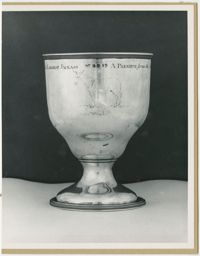
A black and white mounted photograph of one of three sides of a sliver chalice awarded as 'A premium from the Agricultural Society of So. [South] Carolina, to General [George] Washington for raising the largest jackass.' This side has an engraving of a donkey and the beginning and ending sentiments of the chalice.
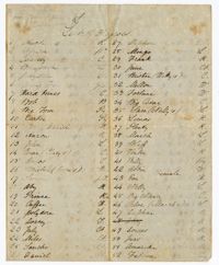
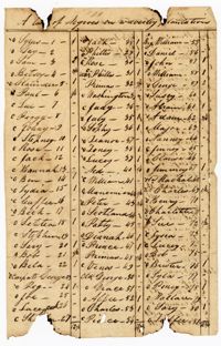
A list of 152 enslaved persons. Notations include the first names of each enslaved person, their role on the plantation and the name of their parent(s).
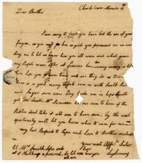
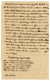
A letter from Lydia Simons to her brother John Ball discussing John Ball's inability to use his fingers, and the crops at "Limeric" (Limerick) Plantation.
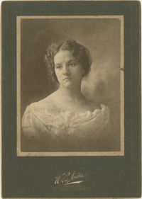
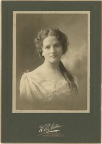
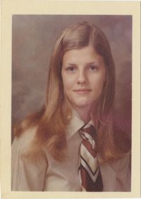
Color photograph of a portrait of a young woman. Writing on back of image reads, "Laura Fisher. 11th Grade High School. School Picture. 1972 Fall. North Augusta, S.C."
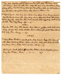
A list of 157 enslaved persons at Friendfield and the Point Plantations. The list is divided into adults and children, and includes notations such as "carpenter," "cripple," "old," "driver" and "nurse."
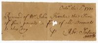
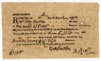
A receipt from Saxby stating that John Hentie paid one pound for two years "Quit-rent "due to the crown, and paid the Lord Carteret for three hundred acres of land.
Copy of a plat of 250 acres laid out to Abraham Michau on the north side of Santee River and “now belonging to John Pedro." Names associated with this plat are Abraham Michau, John Pedro, George Hunter and James Glen. Notable geographic locations include the Santee River, Prince Frederick Parish and Georgetown District.
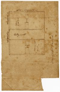
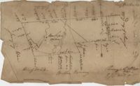
876 acre plot for Simpson, shows roads, houses, and rivers/creeks, no names on any of the details, includes surrounding tracts of lands and trees on the property boundaries. Names associated with this plat are Simpson, Keith, James Gray Wiase, and Charles Johnston.
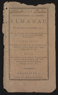
This is a Sandy Island plantation journal written inside of the South Carolina and Georgia Almanac for the year 1797. The plantation journal documents the planting of crops (rice, corn and potatoes), slave records (including runaway slaves), accounts, the weather, and business relations with Laurel Hill Plantation.
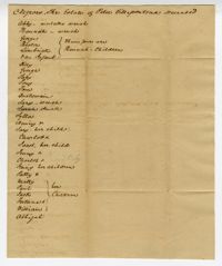
A document with the title "Negroes, The Estate of Peter Villepontoux Deceased" in which the writer lists the names of enslaved men, women and children. Makes notation "Abby-mulatto wench" as well as the relationships between slaves.
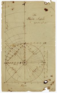
A diagram of the "Plain Scale." The horizontal axis is labeled "inclinations of meridians" and vertical axis is labeled hours. Various geometric shapes and lines such as chord, rhombus, tangents, secants, semi tangents, longitudes, and latitudes are drawn within the "plain."
Plat of Hopewell Plantation with surrounding lands owned by several people, shows the Edisto River and an unnamed settlement, labels the land in the center as uncleared land while swamps, roads, rivers and trees surround it. Acreage unclear. Names associated with this plat are Baring, Branford, Mellechamp, Colonel W. Hayne and Arthur Middleton. Notable geographic locations are St. Paul's Parish, Edisto River, and Willtown Road.
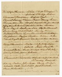
A list of lands and enslaved persons owned by John Ball which includes Back River Plantation, it's swamps, lands for cultivation, pine land, a carriage house, smoke house, overseer's house, store house, corn house, a cooper shop and twelve "negro" houses. The document also lists that there are four enslaved men above fifty years of age, eighteen enslaved men under fifty and above twelve, ten enslaved boys under the age of twelve, seven enslaved women above fifty years old, nineteen enslaved women under fifty and above twelve and twenty enslaved girls under twelve.
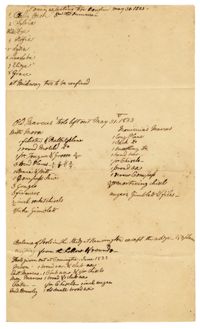
A list of enslaved women confined at Midway Plantation and tools left out by the enslaved person Marcus. The bottom of the document is a balance of tools at Kensington Plantation.
The Edisto Island Presbyterian Church Register is an unbound book recorded between 1837-1901. The register contains minutes from church sessions, baptism and marriage records, church memberships and church controversies with references to enslaved men and women by name and the accusations against them. Also included is the constitution of the Edisto Union Church, which was formed by Africans Americans, formerly enslaved, who took over the Edisto Island Presbyterian Church following the Civil War.
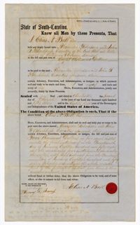
A bond from Elias Ball to executors of William Carson's estate Alexander Robertson and John Blacklock for $8,000. The document includes records of paid installments.
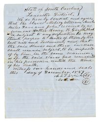
An agreement regarding six enslaved persons bequeathed to Henry Hilliard Gooch's children. The names of the enslaved persons are Melisy, William, Amelia, Miles, Dave and John.
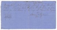
A receipt for thirteen bushels of rice from William Ball. The receipt includes a mark, most likely in place of a signature from an enslaved or freed person.
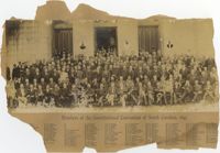
Black-and-white photograph, mounted on card, of a portrait of a large group of men, each one with a number written on or near them. Text under the image reads, "Members of the Constitutional Convention of South Carolina, 1895." The numbers near each man coordinate with a list of names below the title of the photograph.
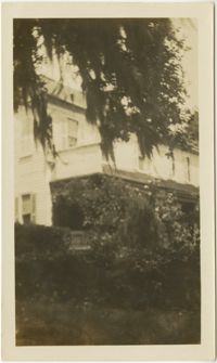
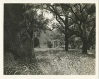
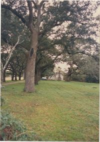
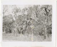
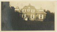
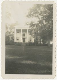
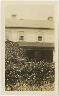
Black-and-white image depicting view of McLeod Plantation residence and part of lawn. Inscription on back of image reads, " Willie McLeod's home on James Island, Charleston SC, Aug. 1950."
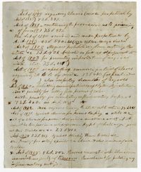
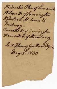
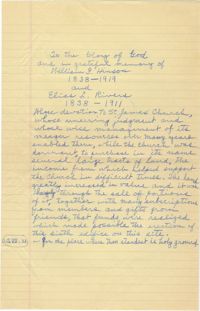
A handwritten memorial for William G. Hinson and Elias L. Rivers, both of whom were attendants of St. James' Church and helped to purchase several tracts of land in its name.