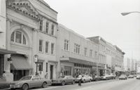
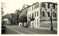
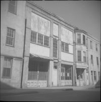
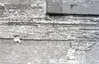
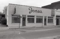
Black-and-white photograph of the west side of the 250 block of King Street, looking north, starting at 253 King Street, and showing 255 King Street, 257 King Street, 259 King Street, 265 King Street, and beyond.
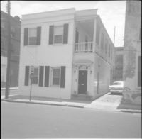
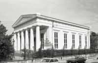
Society Street elevation of 272 Meeting Street, conjoined with 66½ Society Street, located at the northeast corner of Meeting Street and Society Street.
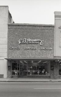
Three B&W photographs and one color photograph of buildings on the west side of King Street: Top left (319-325): 319 King Street (Bob Ellis Shoe Store), 321 King Street, 323 King Street (LeRoy's Jewelry Co.), and 325 King Street (Thom McAn); Top right: 315 King Street (Jean Meyers); Bottom left: 309-311 King Street (color photograph); Bottom right: 297 King Street (National Shirt Shop) (Arcade Theater sign on corner of building).
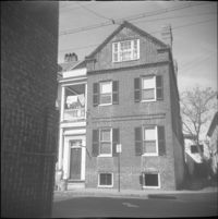
Two B&W photographs of buildings on the west side of King Street: Left (159-161): 159 King Street (Hildebrands) and 161 King Street; Right (201-203): 201 King Street (Castanes Grocery) and 203 King Street (later demolished for the construction of Victoria Center).
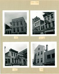
Four B&W photographs of buildings on the west side of King Street: Top left: 381 King Street (Felder's Rexall Drugs); Top right (367-369): 367 (Convertino's One Hour Cleaning) and 369 King Street (Lesser's Credit Jewelers); Bottom left (369-371): 369 King Street (Lesser's Credit Jewelers) and upper left portion of 371 King Street; Bottom right (341-343): 341 King Street (C.W. Kessler's) and 343 King Street (Askew's Clothiers).
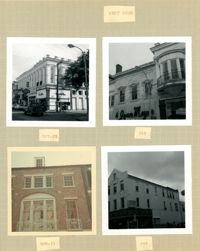
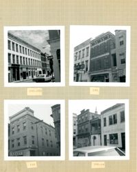
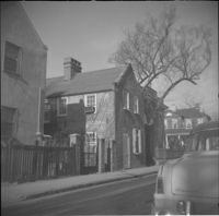
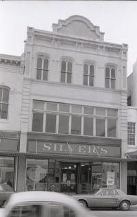
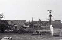
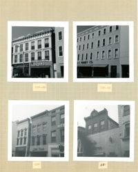
Four B&W photographs of buildings on the west side of King Street: Top left: 273 King Street (Mary Jane Shoe Store); Top right (263-267): 263 King Street (Legerton's), 265 King Street (Scottie Stores), and 267 King Street (Warner's); Bottom left (251-253): 251 King Street (Adams and Ortmann) and -253 King Street; Bottom right (243-245): 243 King Street (Siegling's) and 245 King Street (Silver 5 & 10 & 1.00 Store).
Four B&W photographs of buildings on the east side of King Street: Top left (188-200): 188 King Street (Installment Finance Co. Loans), 190 King Street, and 192-200 King Street (Hoffman House); Top right (188-190): Edge of 188 King Street (Installment Finance Co. Loans) and 190 King Street (Home Appliances and Service Co.); Bottom left: 188 King Street (Installment Finance Co.); Bottom right (184-186): 184 King Street (Dinty Moore's) and 186 King Street.
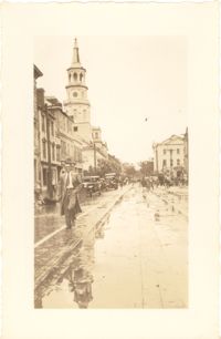
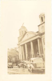
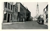
Photograph of Broad Street, looking west, showing the scene on the street after the tornadoes of September 29, 1938. South side of the 60 block of Broad Street in foreground; St. Michael's Church and the Charleston County Courthouse in the background. Onlookers and vehicles are on the street.
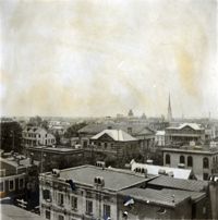
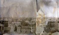
View of Charleston from rooftop at northeast corner of Wentworth and Meeting Streets, facing northwest. Buildings in image include Charleston Orphan House, Shirras Dispensary, St. Matthews Lutheran Church, and Trinity Methodist Church. Page 2, Photo 1 of collection. 3.5" x 3.5" B/W photograph.
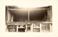
Photograph of the Sing Lee Laundry (133 King Street) after the tornadoes of September 29, 1938, showing the damage done to the building. Signs for the Robbins Bros. Circus (on Sept. 26) are posted in the windows.
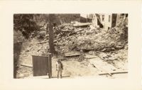
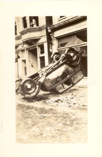
Photograph of the ruins of a building, after the September 29, 1938, tornadoes. Based on newspaper accounts, it is probably the site of 45 State Street. Infantry patrolman stands in foreground.
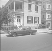
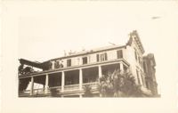
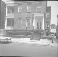
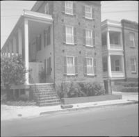
Looking west on Broad Street at 110 Broad Street (Bishop Northrop residence a/k/a William Harvey House a/k/a Ralph Izard House) and 114 Broad Street (Col. Thomas Pinckney House). Cars parked along the street.
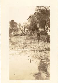
Photograph of Church Street, looking south from the corner of Broad Street at 49 Broad (right foreground), showing the scene on the street after the tornadoes of September 29, 1938. Fallen tree lies across the street; debris and water cover the street. Onlookers are on the street. 105 Church and 107 Church can also be seen.
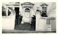
Photograph of Lamboll Street elevation of 19 King Street [Thomas Lamboll House] after the tornadoes of September 29, 1938, showing the damage done to the piazzas and roof. Men are standing on the roof.
Photograph of City Hall after the tornadoes of September 29, 1938, showing the damage done to the building. Men stand on the landing at the entry to the building.
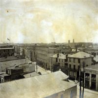
View of Charleston from rooftop at northeast corner of Wentworth and Meeting Streets, facing southwest. Church steeples in image include the Unitarian Church and St. John's Lutheran Church. Page 2, Photo 2 of collection. 3.5" x 3.5" B/W photograph.
This one-page typed document provides the age and ownership history of 49 Laurens Street, 13 Wentworth, 42 Laurens Street, 8 George Street, 27 Anson Street, and 7 George Street.
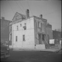
This one-page typed document, is a compilation of notes from an investigation into the ownership history of the property at 45 Hasell Street, tracing the property deed back to 1837.
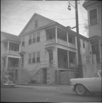
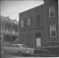
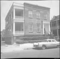
37 Wentworth Street. View of 33 Wentworth at far left, partial view of 35 Wentworth at immediate left, and a column of St. Johannes Lutheran Church at right.
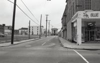
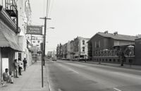
Black-and-white photograph of the view looking east on Market Street at the junction of King and Market Streets, from what was the location of Belk Department Store and parking lot (left) and 220 King Street (Blue Knight Gallery) (right) down to Market Hall (background). Meeting Street elevation of the Arnold-Hornik Building (112 North Market) also in view. Vacant lot is now the site of Charleston Place / Charleston Center.
Black-and-white photograph of the east side of Meeting Street looking south to from Market Street down to Cumberland Street. Shows 182 Meeting Street (First Citizens Bank), 172 Meeting Street, and other buildings since demolished.
Black-and-white photograph of the Meeting Street elevation (west elevation) of what would become the Indigo Inn. Signage atop protective construction walkway says "[illegible] Development by Limehouse Properties: Indigo Inn, 47 Luxurious Units Opening Nov. 1 to Accommodate the Most Discriminating." Building is located at the southeast corner of Meeting Street and Pinckney Street, with the current address 1 Maiden Lane.
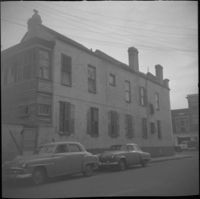
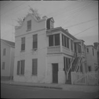
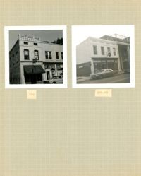
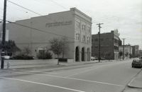
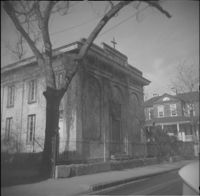
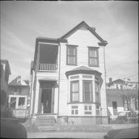
Black-and-white photograph of 252 King Street, north elevation on Hasell Street, showing the northeast corner of King and Hasell Streets. Portion of 249 King at right.
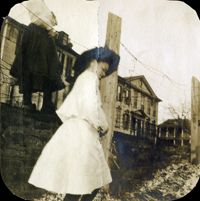
Photograph of wooden building demolished by the first tornado of September 29, 1938. The photograph is marked with a small green X to show the location of the body of a man killed by the tornado. Handwritten on back of photo: "1st tornado came in by Battery near Miller's junk yard - Laurence [Laurens?] Street. This shed is on top of small Negro house. The Negro was dead when found. Sept. 29, '38."
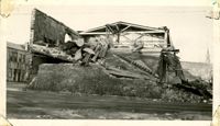
Photograph of the Viohl Hay & Grain warehouse demolished by the tornado of September 29, 1938. Located at the northwest corner of Vendue Range and Concord Street (address 14 Vendue Range). Portion of the building across the street can be seen at left. Steeple of St. Michael's Church in the distance at right. Handwritten on back of photo: "Taken in front of the Clyde Line Steam Ship Co. on Concord Street. Vohls Grain Place. Tornado - Sept. 29, 1938. In distance is St. Michael's Church steeple."
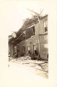
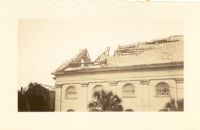
Photograph of the I.M. Pearlstine Building (203 East Bay Street), located on the southwest corner of East Bay Street and Street, after the tornado of September 29, 1938, showing the damage done to the building. Also shows 205 East Bay Street, located on the northwest corner of East Bay and Cumberland. "Bay City" heavy equipment vehicle (excavator?) parked in front of building. Pedestrian and a street worker walking on the sidewalk; repairman on the utility pole on the street corner.
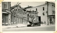
Photograph of the I.M. Pearlstine Building on Cumberland Street, located between East Bay and State Street, after the tornadoes of September 29, 1938, showing the damage done to the building. Portion of signage is visible at the right of the photograph, "I.M." and "Budwe[iser]"; signage for "Rex" is also on building (at left). Onlookers stand among the debris on the street.
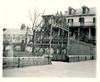
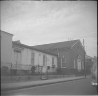
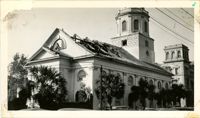
Photograph of First Scots Presbyterian Church [57 Meeting Street] after the tornadoes of September 29, 1938, showing the damage done to the building. The Nathaniel Russell House can be seen in the background. Cars are parked on the street in front of the church.
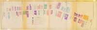
One of four maps of King Street building footprints, hand-colored to designate status. This map illustrates the historical significance of buildings on King Street from Calhoun Street to Queen Street.
Looking north on Church Street from Chalmers Street. Features buildings on the west side of the street: 127 Church, 129 Church, 131 Church, and the Dock Street Theater). Also in view are buildings on the east side of the street: 18 Chalmers Street, 132 Church Street, and St. Philip's Church). Cars are parked on the street.
Two young women and field of oyster shells at sea wall on South Battery. William Gibbes House and 68 South Battery are in background. Page 36, Photo 1 of collection. 3.5" x 3.5" B/W photograph, original in two pieces.
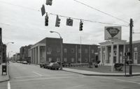
Black-and-white photograph of the view north on King Street showing the east side of King Street from 190 King Street (right) and 191 King Street (left). Kerrison's building in the background.
Black-and-white photograph of the view south on Meeting Street from 242 Meeting, showing Anderson Electric Co. (246 Meeting) at right and the Best Western King Charles Hotel (237 Meeting) at left.
View of Charleston from rooftop of Calhoun Mansion, facing north. Page 3, Photo 2 of collection. 5.5" x 3.75" B/W photograph, two images spliced together.
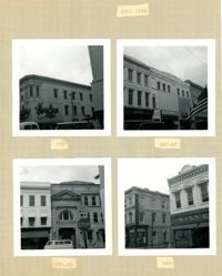
Four B&W photographs of buildings on the east side of King Street, including some that were demolished for the construction of Charleston Place: Top left (244-246): 244 Coastal Finance Loans and 246 King Street (The Linen Shop) demolished; Top right: 238-242 King Street (J.C. Penney Company) ? demolished; Bottom left (226-230): 226 King Street (Ritz [Hotel]), 228 King Street (Little Town), and 230 King Street demolished; Bottom right: 316 King Street (Rosalie Meyers) [labeled 318 on album page].
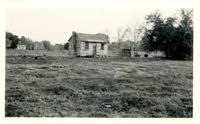
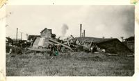
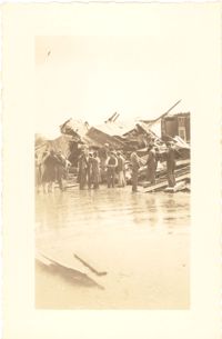
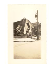
Photograph of the destruction of a house done by the tornadoes of September, 29, 1938. Based on newspaper accounts, the home was probably located in the Fiddlers' Green neighborhood near the Ashley River. Two men lean against the ruins while another man climbs a nearby telephone pole.
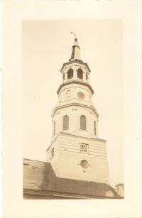
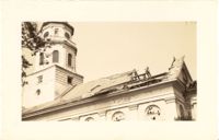
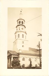
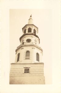
Photograph of St. Michael's Church after the first tornado of September 29, 1938, showing the damage done to the roof. Handwritten on back of photo: "Old historic St. Michael's Church, corner Broad Street and Meeting Street. Done by first tornado, Sept. 29, '38."
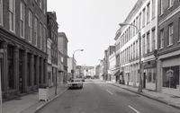
Black-and-white photograph of the west side of King Street below Market Street, starting from the southwest corner of King Street and Market Street. South Carolina Federal Savings & Loan (221 King Street) in foreground. Also shown are 219 King Street, 217 King Street, 215 King Street, and 213 King Street. (Currently the site of Majestic Square.)