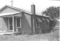
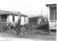
House (rear view) behind Joe Smith's Grocery, on site affected by the construction of Interstate 26 (I-26). Surveyor notations on back of photo: "Dkt.: 10.490. Property owner: Joseph F. Smith. Tract: 21. Station: 5819+00 Rt. Line "G." Date: March 22, 1962. In R/W - Bought." [See collection description for explanation of surveyor notations.]
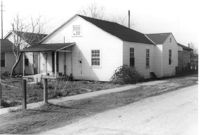
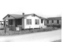
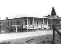
House on site affected by the construction of Interstate 26 (I-26). Surveyor notations on back of photo: "Dkt.: 10.490. Property owner: William N. Harrell. Tract: 22. Station: 5819+40 on CL Line "G." Date: March 22, 1962. In R/W - Bought." [See collection description for explanation of surveyor notations.]
House (rear view) on site affected by the construction of Interstate 26 (I-26). Surveyor notations on back of photo: "Dkt.: 10.490. Property owner: William N. Harrell. Tract: 22. Station: 5819+40 on CL Line "G." Date: March 22, 1962. In R/W - Bought." [See collection description for explanation of surveyor notations.]
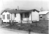
House on site affected by the construction of Interstate 26 (I-26). Surveyor notations on back of photo: "Dkt.: 10.490. Property owner: Myrtices S. Williams. Tract: 23. Station: 5820+00 Rt. Date: August 29, 1962. Bought." [See collection description for explanation of surveyor notations.]
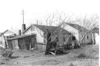
House (rear view) on site affected by the construction of Interstate 26 (I-26). Surveyor notations on back of photo: "Dkt.: 10.490. Property owner: Myrtices S. Williams. Tract: 23. Station: 5820+00 Rt. Date: August 29, 1962. Bought." [See collection description for explanation of surveyor notations.]
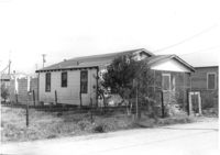
House on site affected by the construction of Interstate 26 (I-26). Surveyor notations on back of photo: "Dkt.: 10.490. Property owner: Margaret Ehrardt. Tract: 24. Station: 5820+55 Rt. Line "G." Date: March 22, 1962. In R/W - Bought." [See collection description for explanation of surveyor notations.]
House (side view) on site affected by the construction of Interstate 26 (I-26). Surveyor notations on back of photo: "Dkt.: 10.490. Property owner: Margaret Ehrardt. Tract: 24. Station: 5820+55 Rt. Line "G." Date: March 22, 1962. In R/W - Bought." [See collection description for explanation of surveyor notations.]
House on site affected by the construction of Interstate 26 (I-26). Surveyor notations on back of photo: "Dkt.: 10.490. Property owner: James and Joseph Davis. Tract: 25. Station: 5820+50 Lt. Line "G." Date: March 22, 1962. In R/W - Bought." [See collection description for explanation of surveyor notations.]
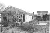
House, driveway, and shed on site affected by the construction of Interstate 26 (I-26). Surveyor notations on back of photo: "Dkt.: 10.490. Property owner: James and Joseph Davis. Tract: 25. Station: 5820+50 Lt. Line "G." Date: March 22, 1962. In R/W - Bought." [See collection description for explanation of surveyor notations.]
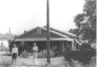
House on site affected by the construction of Interstate 26 (I-26). Surveyor notations on back of photo: "Dkt.: 10.490. Property owner: Ruth V. Cooper. Tract: 26. Station: 5820+50 on CL. Date: March 22, 1962. In R/W - Bought." [See collection description for explanation of surveyor notations.]
Right of way--South Carolina--Charleston County, Highway planning--South Carolina--Charleston County, Vernacular architecture--South Carolina--Charleston County, Lost architecture--South Carolina--Charleston County, Dwellings--South Carolina--Charleston County✖[remove]348