One of three scrapbooks compiled by William Henry Johnson containing, among other materials, photographs depicting scenes of the South Carolina Lowcountry, with descriptive notes. Volume 1 includes photographs depicting cemeteries, churches, plantations, historic buildings, ruins, landscapes, and the interiors of buildings. Subjects include locations in Berkeley County, St. Johns (Berkeley) Parish, Goose Creek, and along the Cooper River. Other sites and subjects include Belmont, Black Oak Church, Bluford, Casada, Cedar Grove, Cedar Spring, Comingtee, a Prioleau family burial ground, Crowfield, Dean Hall Plantation, Dockon Plantation, Eutaw, Eutaw Springs, Exeter, Fairspring, Fort Dorchester, Four Hole Swamp, Gippy, Gravel Hill, the gravestone of Susan Bee, Hanover Plantation, Indian Fields Campground, Ingleside, Indianfield, Liberty Hall Club, Lewisfield, Magnolia Cemetery, monument of Col. Hezekiah Maham, grave of Major Majoribanks, Medway Plantation, Mepkin, a milestone by the Cooper River, Moorfield, Mount Pleasant Plantation, Mulberry Castle, North Hampton, Numertia, The Oaks Plantation, Ophir, Otranto Hunting Club, Parnassus, Pimlico, Pinegrove, Pond Bluff, Pooshee Plantation, John Poppenheim's plantation, Quarter house, Red Bank Hunting Club, an Episcopal church in Pineville, Rice Hope Plantation, The Rocks, St. James Goose Creek church, St. Johns Berkeley rectory site, St. Johns AME Church, a St. Julien family house, a Santee Canal lock, "Sarrazin house," a shanty, Somerset Plantation, Somerton Plantation, "Francis Marion spring," Springfield, Stoney Landing, Strawberry Chapel, Ten Mile Hill, Thoroughgood, Wadboo Barony, Wadboo bridge, Walnut Grove, Walworth, Wampee, Wampoolah, Wappetaw, Washington Plantation, the Whaley place, White Hall, Wiskinboo, Woodlawn, and Yeamans Hall.
Page 252 of the City Engineer's Plat Book with two plats. Plat 1 shows lots on and near Lenwood Street, between South Bay Street and Boulevard Drive. Plat 2 shows lots located on and near the intersection of Huger Street and Rutledge Avenue.
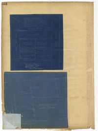
Page 250 of the City Engineer's Plat Book with one plat. The plat shows lots between Romney Street and Williman Street, and east of Meeting Street. The plat also shows Isabella Street.
Page 246 of the City Engineer's Plat Book with one plat. The plat shows lots located between Rutledge Avenue and the Ashley River. Groups of lots are labelled with red letters. The plat also shows Darlington Avenue, Ashley Avenue, Piedmont Avenue, Hester Street, Clemson Street, Maple Street, Peachtree Street, Poplar Street, Pendleton Street, and Sans Souci Street.
A report from the mayor, city council, and various governmental departments of Charleston, S.C. for the year 1920. The Year Book opens with an address from the mayor, John P. Grace, followed by reports from various departments.
The College of Charleston Magazine is a monthly publication released by the College of Charleston's Chrestomathic Society during the academic year. This volume is comprised of the bound together publications from the months of November 1920-April 1921.