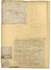
Page 146 of the City Engineer's Plat Book with three plats. Plat 1 shows lands located on and near the intersection of East Bay Street and Hasell Street. Plat 2 features a lot located on the north side of John Street, between Meeting Street and King Street. It also shows a lot labelled "So. Ca. RR. Co." Plat 4 shows a park and buildings located between King Street and Meeting Street, and between Calhoun Street and Hutson Street.
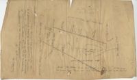
Plat of 101.5 acres on Ocketee [Oakatie] Creek. Plat shows the location of a marsh, road and surrounding lands. Names associated with this plat are N.H. Johnson, Ellis and Hogg. Notable geographic locations include the Savannah River, Oakatie Creek and Ellis Road.
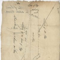
Plat of 89 acres in the Beaufort District. Plat shows the location of several ponds. Little other detail is included. Names associated with this plat are N.H. Johnson, R.J. Marker, Mary Kittles, John H. Raddell [?], and Brown. Notable geographic locations include the Savannah River, Beaufort District and Dry Gull Branch.
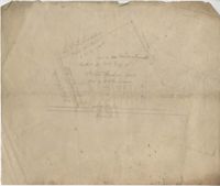
Plat of a tract of land. Very general with little information. Includes a street and placement of an Episcopal church. Names associated with this plat include D. La Roche, W.H. Gray, Steven Jenkins, and J.K. Goudin. Notable geographic locations include Wadmalaw.