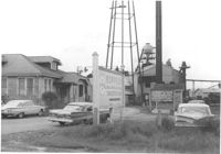
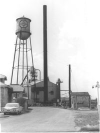
Koppers Company buildings and structures on site affected by the construction of Interstate 26 (I-26). Signage for Koppers Wood Preserving Division, Charleston Plant in foreground. Surveyor notations on back of photo: "Dkt.: 10.490. Property owner: Koppers Co. Tract: 137. Station: 5847+00 Rt. Date: August 29, 1962. In R/W - Bought." [See collection description for explanation of surveyor notations.]
Koppers Company building on site affected by the construction of Interstate 26 (I-26). Surveyor notations on back of photo: "Dkt.: 10.490. Property owner: Koppers Co. Tract: 137. Station: 5848+00 on CL. Date: August 29, 1962. In R/W - Bought." [See collection description for explanation of surveyor notations.]
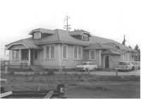
Koppers Company building no. 21 on site affected by the construction of Interstate 26 (I-26). Surveyor notations on back of photo: "Dkt.: 10.490. Property owner: Koppers Co. Tract: 137. Station: 5847+00 Rt. Date: August 29, 1962. In R/W - Bought." [See collection description for explanation of surveyor notations.]
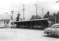
Koppers Company building and car port on site affected by the construction of Interstate 26 (I-26). Surveyor notations on back of photo: "Dkt.: 10.490. Property owner: Koppers Co. Tract: 137. Station: 5848+50 Rt. Date: August 29, 1962. To be moved by SCHD [SC Highway Department]." [See collection description for explanation of surveyor notations.]
Koppers Company buildings and structures on site affected by the construction of Interstate 26 (I-26). Surveyor notations on back of photo: "Dkt.: 10.490. Property owner: Koppers Co. Tract: 137. Station: 5847±. Date: August 29, 1962. Guys to be relocated." [See collection description for explanation of surveyor notations.]
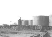
Koppers Company storage tanks on site affected by the construction of Interstate 26 (I-26). Surveyor notations on back of photo: "Dkt.: 10.490. Property owner: Koppers Co. Tract: 137. Station: 5845-5846 Rt. Date: August 29, 1962. For information." [See collection description for explanation of surveyor notations.]
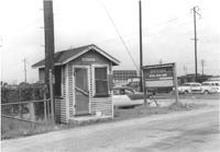
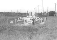
Koppers Company gas storage structure on site affected by the construction of Interstate 26 (I-26). Surveyor notations on back of photo: "Dkt.: 10.490. Property owner: Koppers Co. Tract: 137. Station: 5846+00 Lt. Date: August 29, 1962. To be moved." [See collection description for explanation of surveyor notations.]
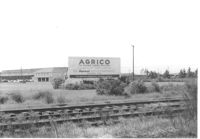
Agrico [fertilizer company] buildings on site affected by the construction of Interstate 26 (I-26). Railroad tracks in foreground. Surveyor notations on back of photo: "Dkt.: 10.490. Property owner: American Agr. Chemical Co. [American Agriculture Chemical Co.]. Tract: 138. Station: ? Date: August 29, 1962. Special damages ["spec. damages]." [See collection description for explanation of surveyor notations.]
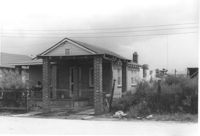
House on site affected by the construction of Interstate 26 (I-26). Surveyor notations on back of photo: "Dkt.: 10.490. Property owner: Jacob Bennekin. Tract: 138-A. Station: 5858+90 Lt. Date: August 29, 1962. In R/W - Bought." [See collection description for explanation of surveyor notations.]
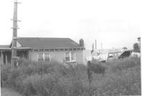
House (side view) and lot, on site affected by the construction of Interstate 26 (I-26). Surveyor notations on back of photo: "Dkt.: 10.490. Property owner: Jacob Bennekin. Tract: 138-A. Station: 5858+90 Lt. Date: August 29, 1962. In R/W - Bought." [See collection description for explanation of surveyor notations.]