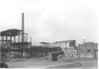
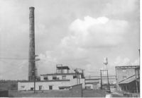
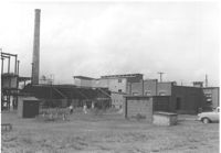
Virginia-Carolina Chemical Corp. structures on site affected by the construction of Interstate 26 (I-26). [VC Chemical Corp. was located on King Street Extn.] Surveyor notations on back of photo: "Dkt.: 10.490. Property owner: V.C. Chemical Co. Tract: 1. Station: 5800+00 Rt. Date: September 11, 1962. Second shot relating to picture #1 [photo 1017]." [See collection description for explanation of surveyor notations.]
Virginia-Carolina Chemical Corp. structures on site affected by the construction of Interstate 26 (I-26). [VC Chemical Corp. was located on King Street Extn.] Surveyor notations on back of photo: "Dkt.: 10.490. Property owner: V.C. Chemical Co. Tract: 1. Station: 5800+00 Rt. Date: September 11, 1962. For information only. Outside R/W. To be moved by VC." [See collection description for explanation of surveyor notations.]
Virginia-Carolina Chemical Corp. structures on site affected by the construction of Interstate 26 (I-26). [VC Chemical Corp. was located on King Street Extn.] Surveyor notations on back of photo: "Dkt.: 10.490. Property owner: V.C. Chemical Co. Tract: 1. Station: 5898+70 Rt. Date: September 11, 1962. Showing 2 small buildings taken in R/W." [See collection description for explanation of surveyor notations.]
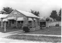
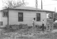
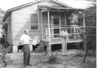
House and shed at end of driveway on site affected by the construction of Interstate 26 (I-26). Address: 1332 Rutledge Avenue. Surveyor notations on back of photo: "Dkt.: 10.490. Property owner: Cornelius B. Orvin. Tract: 169. Station: 100' Rt. Sta. 5883+25. Date: May 15, 1962. Owner to clear R/W." [See collection description for explanation of surveyor notations.]
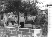
House (rear view) and backyard on site affected by the construction of Interstate 26 (I-26). Address: 1332 Rutledge Avenue. Surveyor notations on back of photo: "Dkt.: 10.490. Property owner: Cornelia B. Orvin. Tract: 169. Station: 130' Rt. Sta. 5883+00. Date: May 15, 1962. Proximity." [See collection description for explanation of surveyor notations.]
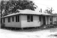
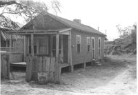
House (rear view) on site affected by the construction of Interstate 26 (I-26). Address: 2167 Heriot Street. Surveyor notations on back of photo: "Dkt.: 10.490. Property owner: Louise S. Carter. Tract: 147. Station: 85' Lt. Sta. 5879+50). Date: May 15, 1962. In R/W - Bought." [See collection description for explanation of surveyor notations.]
House (side view) on site affected by the construction of Interstate 26 (I-26). Surveyor notations on back of photo: "Dkt.: 10.490. Property owner: E.S. Lapine, et al. Tract: 60. Station: 5801+40 Rt. Line 'G'. Date: September 12, 1962. In R/W - Bought." [See collection description for explanation of surveyor notations.]
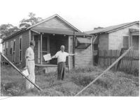
House (rear view) on site affected by the construction of Interstate 26 (I-26). Surveyor notations on back of photo: "Dkt.: 10.490. Property owner: F.F. Bellinger, et al. Tract: 48. Station: 5800+00 Rt. Line 'G'. Date: September 11, 1962. Proximity to rear." [See collection description for explanation of surveyor notations.]
House (rear view) on site affected by the construction of Interstate 26 (I-26). Surveyor notations on back of photo: "Dkt.: 10.490. Property owner: Thomasina Goss. Tract: 47. Station: 5799+90 Rt. Line 'G'. Date: September 11, 1962. Proximity." [See collection description for explanation of surveyor notations.]
House on site affected by the construction of Interstate 26 (I-26). Surveyor notations on back of photo: "Dkt.: 10.490. Property owner: F.F. Bellinger, et al. Tract: 48. Station: 5800+00 Rt. Line 'G'. Date: September 11, 1962. Proximity." [See collection description for explanation of surveyor notations.]