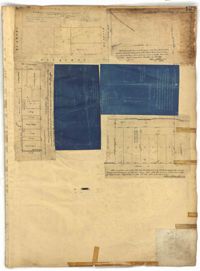
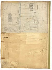
Page 136 of the City Engineer's Plat Book with seven plats. Plat 1 shows lots and structures located on and near the intersection of Liberty Street and St. Philips Street. Plat 2 shows lots located on Archdale Street, near Bennett's Mill Pond. Plat 3 shows lots and structures located on and near the intersection of Rutledge Street and Montague Street. Plat 4 shows lots and structures located on Archdale Street, including a building labelled "Hope Engine House." Plat 5 shows a lot located along Clifford Alley, near a lot labelled "Unitarian Church." Plat 6 shows lots located along King Street. Plat 7 shows lots located on and near Calhoun Street, located between Smith Street and Rutledge Street.
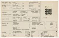
(Front) 5 x 8 index card with survey of the Huguenot Church at 136 Church Street. Includes one thumbnail image of dwelling. (Back) Brief notes about the property.
Page 137 of the City Engineer's Plat Book with six plats. Plat 1 shows lots located on and near Mazyck Street, between Short Street and King Street. Plat 2 shows lots located on and near the intersection of Pitt Street and Montague Street. Plat 3 features a lot located on the intersection of Archdale Street and Berresford Street. Plat 4 features a lot located at the intersection of Queen Street and Meeting Street. Plat 5 shows a lot located at the intersection of Queen Street and King Street. Plat 6 shows lots located on and near the intersection of Mazyck Street and Magazine Street, including one labelled "Roper Hospital Lot."
Page 138 of the City Engineer's Plat Book with three plats. Plat 1 features a lot located on Hasell Street, with a large building labelled "St. Mary's Church." Plat 2 shows lots and structures located between Rutledge Street and Trapmann Street, and between Queen Street and Broad Street. Plat 3 features a lot located on Radcliffe Street, between Rutledge Street and Smith Street.
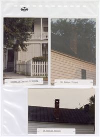
Three colored photographs of No. 16 Duncan Street and No. 138 Coming Street: Top left (north elevation of No. 138 Coming Street on the corner of Warren Street and Coming Street); Top right (west elevation roofline of No. 16 Duncan Street); Bottom (west elevation roofline of No. 16 Duncan Street). The photographs are placed in a clear plastic sheet with pockets for each photograph. The plastic sheet has a stamp that reads "The Holson Company." There are multiple holes ranging in size on the sheet surrounding the photographs. The photograph of No. 138 Coming Street shows the structure's two story piazza and fenced yard. The first story of the piazza is partially covered with shutters. There is a sidewalk leading to a door attached to the structure. The photographs of No. 16 Duncan Street show the structure's brick chimney on the west elevation roofline. The roof is a black tin pitched roof. The chimney projects from the slope of the pitched roof. The exterior of the structure consists of white horizontal paneling.
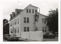
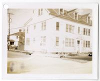
Black and white photograph of the front façade and east elevation of No. 138 Bull Street. The two-and-a-half-story structure has a sloped roof and three dormer windows on the half-story. The exterior has horizontal side paneling. The front door is centered on the front facade located on the north elevation of the structure. There is a thick wall projecting from the northwestern corner of the building. The photograph shows two cars parked in front of the north elevation. There is a white border around the photograph with a single hole punched through the top. There is a black mark above the hole punch.
Black and white photograph of the southwestern corner of No. 138 Bull Street. The photograph shows the north and east elevations of the two-and-a-half story structure. The sloped roof has three dormer windows. The exterior has horizontal side paneling. The front door is centered on the front facade located on the north elevation of the structure. There is a white border around the photograph with a hole punched in the top left corner.