Search
« Previous |
31 - 40 of 4,227
|
Next »
Search Results
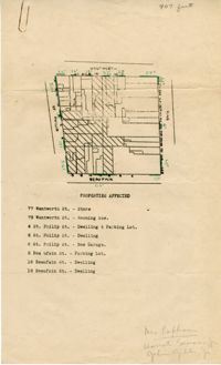
- Description:
- Map of area bounded by Beaufain, St. Philip, Wentworth, and King Street.
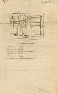
- Description:
- Map of area bounded by Wentworth, King, Liberty, and St. Philip Street.
- Description:
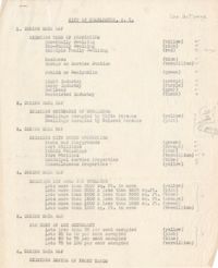
- Description of the layout and format of the map of Charleston for the Charleston Metropolitan Area Exhibit at the Gibbes Art Gallery rotunda.
- Description:
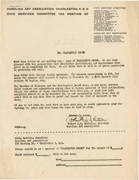
- Letter from Robert Whitelaw soliciting sponsorship for "Charleston Grows."
- Description:
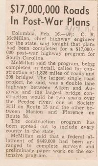
- Article entitled "$17,000,000 Roads in Post-War Plans" regarding the building of roads.
- Description:
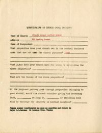
- Church owned property questionnaire filled out for Citadel Square Baptist Church located on 328 Meeting Street.
- Description:
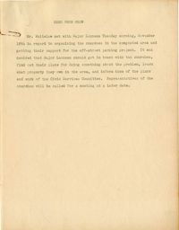
- Memorandum from Robert N.S. Whitelaw regarding a meeting he had with Major Lanneau about organizing the support of churches in congested areas.
- Description:
- Notes on "The Regional Planning of Banbury and District."
- Description:
- Notes from "Housing for the Machine Age" by Clarence Arthur Perry.
- Description:
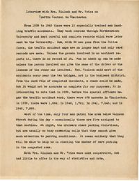
- Summary of an interview done with Mrs. Kinloch and Mr. Grice regarding parking and traffic conditions between 1939 and 1943.