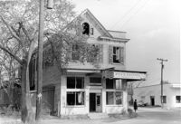
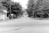
Firetag's Store (Mappus' Store, Six Mile Store) - View of NE (Front and Side) elevation. North Charleston, S.C.;6.5" x 10" B/W photo. Box 5, Folder 2-1-7. One copy.
Firetag's Store (Mappus' Store, Six Mile Store), Success Street (between Meeting Street Road and Rivers Avenue). View of West (Side) elevation. North Charleston, S.C.;6.5" x 10" B/W photo. Box 5, Folder 2-1-7. One copy.
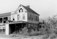
Firetag's Store (Mappus' Store, Six Mile Store), Success Street (between Meeting Street Road and Rivers Avenue). View of SW (Rear and Side) elevation. North Charleston, S.C.;6.5" x 10" B/W photo. Box 5, Folder 2-1-7. One copy.
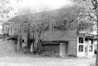
Firetag's Store (Mappus' Store, Six Mile Store), Success Street (between Meeting Street Road and Rivers Avenue). View of East (Side) elevation. North Charleston, S.C.;6.5" x 10" B/W photo. Box 5, Folder 2-1-7. One copy.
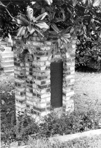
Quarter House Fort & Tavern Site, Success Street (between Meeting Street Road and Rivers Avenue). Detail View of Tavern Entrance Post and Historical Marker. Front and Side elevation. North Charleston, S.C.;10" x 6.5" B/W photo. Box 5, Folder 2-1-10. One copy.
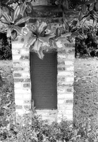
Quarter House Fort & Tavern Site, Success Street (between Meeting Street Road and Rivers Avenue). Detail View of Tavern Entrance Post and Historical Marker. Front elevation. North Charleston, S.C.;10" x 6.5" B/W photo. Box 5, Folder 2-1-10. One copy.
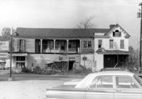
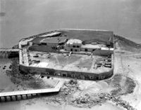
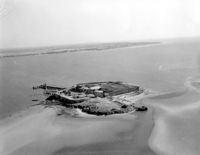
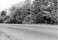
Quarter House Fort & Tavern Site, Success Street (between Meeting Street Road and Rivers Avenue). View of SE elevation. North Charleston, S.C.;6.5" x 10" B/W photo. Box 5, Folder 2-1-10. One copy.
Quarter House Fort & Tavern Site, Success Street (between Meeting Street Road and Rivers Avenue). View of SE elevation. North Charleston, S.C.;6.5" x 10" B/W photo. Box 5, Folder 2-1-10. One copy.