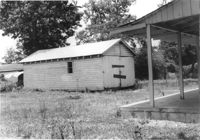
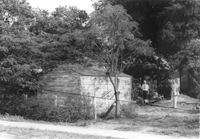
Structure (garage or shed) on site affected by the construction of Interstate 26 (I-26). Possibly on Rivers Avenue. Surveyor notations on back of photo: "Dkt.: 10.486. Property owner: Cleve G. Murray. Tract: 12. Station: 11+20 Lt. Date: May 30, 1961. In R/W - Bought." [See collection description for explanation of surveyor notations.]
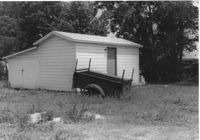
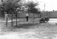
Structure (storage shed/garage) on site affected by the construction of Interstate 26 (I-26). Possibly on Rivers Avenue. Surveyor notations on back of photo: "Dkt.: 10.486. Property owner: Otis R. Burbage. Tract: 22 & 34. Station: 14+80 Rt. Date: May 30, 1961. In R/W to be moved." [See collection description for explanation of surveyor notations.]
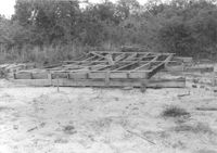
Pile of wood framing on lot, on site affected by the construction of Interstate 26 (I-26). Surveyor notations on back of photo: "Dkt.: 10.480. Property owner: Williams Furniture Co., et al. Tract: 103-B. Station: 5583+55 Rt. Date: May 2, 1961. In R/W - Bought." [See collection description for explanation of surveyor notations.]
Structures on site affected by the construction of Interstate 26 (I-26). Surveyor notations on back of photo: "Dkt.: 10.480. Property owner: Preston H. Mundy. Tract: 104. Station: 5574+35 Lt. (Line J). Date: May 2, 1961. In R/W - Bought." [See collection description for explanation of surveyor notations.]
Lot on site affected by the construction of Interstate 26 (I-26). Surveyor notations on back of photo: "Dkt.: 10.480. Property owner: O.H. Julian. Tract: 169. Station: 5680+80 Crosses CL. Date: May 30, 1961. In R/W - Bought." [See collection description for explanation of surveyor notations.]
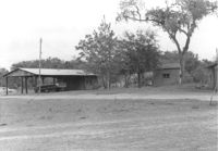
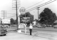
Roadside on site affected by the construction of Interstate 26 (I-26). Dorchester Road where Faith Street(?) intersects. Signage for Gulf gas station, Palmetto Welding & Iron Works, Jordan's Barber Shop, and Chas. Community Church in foreground. Surveyor notations on back of photo: "Dkt.: 10.480. Property owner: Tremarco, Inc. Tract: 173. Station: 129+30 Lt. (Route 642) [Dorchester Road]. Date: May 30, 1961. Move." [See collection description for explanation of surveyor notations.]
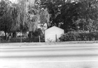
Property and structure (shed?) on Dorchester Road, on site affected by the construction of Interstate 26 (I-26). Surveyor notations on back of photo: "Dkt.: 10.480. Property owner: Frank R. Mangrum. Tract: 176. Station: 131+20 Rt. (Route 642) [Dorchester Road]. Date: May 30, 1961. In R/W - Bought." [See collection description for explanation of surveyor notations.]
Property and structure (shed?) on Dorchester Road, on site affected by the construction of Interstate 26 (I-26). Surveyor notations on back of photo: "Dkt.: 10.480. Property owner: James C. Thomas. Tract: 177. Station: 131+80 Rt. (Route 642) [Dorchester Road]. Date: May 30, 1961. In R/W - Bought." [See collection description for explanation of surveyor notations.]
Property and structure (shed?) on Dorchester Road, on site affected by the construction of Interstate 26 (I-26). Surveyor notations on back of photo: "Dkt.: 10.480. Property owner: Mrs. Dorothy V. Bartee. Tract: 178. Station: 132+42 Rt. (Route 642) [Dorchester Road]. Date: May 30, 1961. In R/W - Bought." [See collection description for explanation of surveyor notations.]
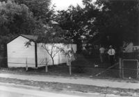
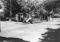
Yard and two small wooden structures on site affected by the construction of Interstate 26 (I-26). Surveyor notations on back of photo: "Dkt.: 10.480. Property owner: Hugh A. Wingo, et al. Tract: 205. Station: 5691+35 Lt. Date: May 31, 1961. In R/W - Bought." [See collection description for explanation of surveyor notations.]
Limit your search
SCDOT Photographs: Properties in the Right-of-Way✖[remove]12