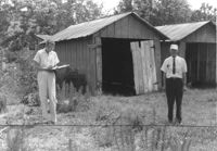
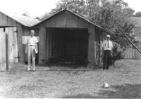
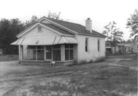
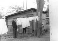
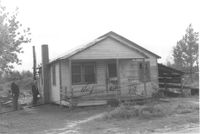
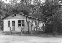
Storage shed on site affected by the construction of Interstate 26 (I-26). Possibly on Rivers Avenue. Surveyor notations on back of photo: "Dkt.: 10.486. Property owner: Ida K. Hill. Tract: 37. Station: 12+30 Lt. (Line D). Date: May 30, 1961. In R/W - Bought." [See collection description for explanation of surveyor notations.]
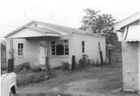
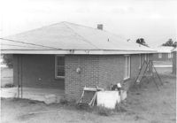
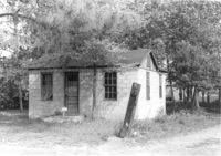
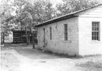
Storage shed on site affected by the construction of Interstate 26 (I-26). Possibly on Rivers Avenue. Surveyor notations on back of photo: "Dkt.: 10.486. Property owner: B.G. Hill. Tract: 38. Station: 12+75 Rt. (Line C). Date: May 30, 1961. In R/W - Bought." [See collection description for explanation of surveyor notations.]
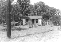
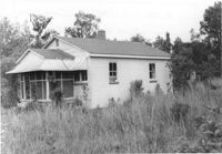
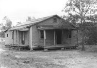
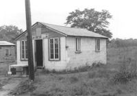
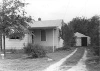
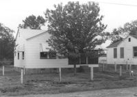
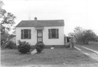
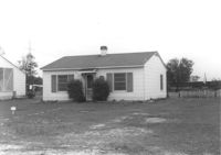
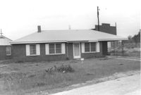
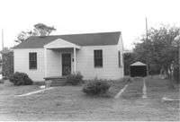
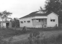
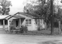
House on site affected by the construction of Interstate 26 (I-26). Possibly on Rivers Avenue. Surveyor notations on back of photo: "Dkt.: 10.486. Property owner: Williams Furniture Corp. Tract: 41. Station: 29+40 Lt. Date: May 30, 1961. In R/W - Bought." [See collection description for explanation of surveyor notations.]
House on site affected by the construction of Interstate 26 (I-26). Possibly on Rivers Avenue. Surveyor notations on back of photo: "Dkt.: 10.486. Property owner: Ernest E. & Nolie C. Grooms. Williams Furniture Corp. Tract: 41. Station: 29+40 Lt. Date: May 30, 1961. In R/W - Bought." [See collection description for explanation of surveyor notations.]
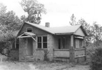
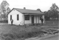
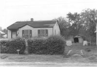
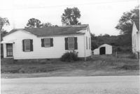
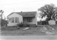
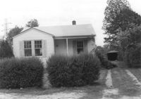
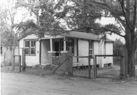
House on site affected by the construction of Interstate 26 (I-26). Surveyor notations on back of photo: "Dkt.: 10.480. Property owner: Julia M. Prichard. Tract: 12. Station: 5500+50 Rt. Date: May 1, 1961. In R/W - Bought." [See collection description for explanation of surveyor notations.]
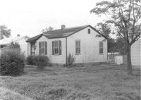
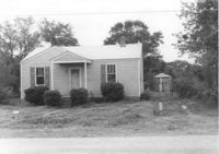
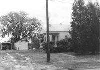
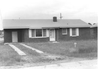
House on site affected by the construction of Interstate 26 (I-26). Surveyor notations on back of photo: "Dkt.: 10.480. Property owner: Freda Doscher. Tract: 14. Station: 5502+50 Lt. Date: May 1, 1961. In R/W - Bought." [See collection description for explanation of surveyor notations.]
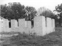
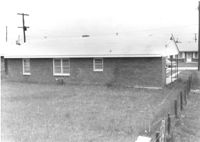
Block foundation of house on site affected by the construction of Interstate 26 (I-26). Surveyor notations on back of photo: "Dkt.: 10.480. Property owner: Louis Garfield. Tract: 22. Station: 5504+05 Lt. Date: May 1, 1961. In R/W - Bought." [See collection description for explanation of surveyor notations.]
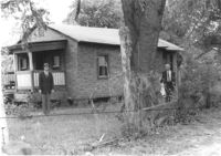
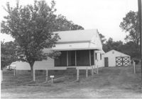
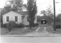
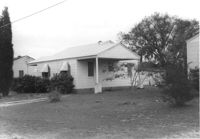
House on site affected by the construction of Interstate 26 (I-26). Surveyor notations on back of photo: "Dkt.: 10.480. Property owner: Joe Stephens, Est. Tract: 29. Station: 5506+00 Lt. Date: May 1, 1961. In R/W - Bought." [See collection description for explanation of surveyor notations.]
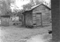
Outbuildings on site affected by the construction of Interstate 26 (I-26). Surveyor notations on back of photo: "Dkt.: 10.480. Property owner: Joe Stephens, Est. Tract: 29. Station: 5505+50 Lt. Date: May 1, 1961. In R/W - Bought." [See collection description for explanation of surveyor notations.]
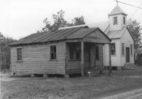
House on site affected by the construction of Interstate 26 (I-26). Neighboring church in background. Surveyor notations on back of photo: "Dkt.: 10.480. Property owner: Joseph Perry. Tract: 35. Station: 5507+40 Lt. Date: May 1, 1961. In R/W - Bought." [See collection description for explanation of surveyor notations.]
House on site affected by the construction of Interstate 26 (I-26). Surveyor notations on back of photo: "Dkt.: 10.480. Property owner: Andrew Smalls, Est. Tract: 42-A. Station: 5511+00 Lt. Date: May 1, 1961. In R/W - Bought." [See collection description for explanation of surveyor notations.]
House on site affected by the construction of Interstate 26 (I-26). Surveyor notations on back of photo: "Dkt.: 10.480. Property owner: Simon Simmons. Tract: 49. Station: 5514+80 Lt. Date: May 1, 1961. In R/W - Bought." [See collection description for explanation of surveyor notations.]
Dwelling on site affected by the construction of Interstate 26 (I-26). Surveyor notations on back of photo: "Dkt.: 10.480. Property owner: Simon Simmons. Tract: 49. Station: 5513+80 Lt. Date: May 1, 1961. In R/W - Bought." [See collection description for explanation of surveyor notations.]
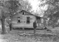
House on site affected by the construction of Interstate 26 (I-26). Neighboring (rear) houses and structures in background. Surveyor notations on back of photo: "Dkt.: 10.480. Property owner: Rochell Dinkins, et al. Tract: 59. Station: 5516+80 Lt. Date: May 1, 1961. In R/W - Bought." [See collection description for explanation of surveyor notations.]
House on site affected by the construction of Interstate 26 (I-26). Surveyor notations on back of photo: "Dkt.: 10.480. Property owner: Charles Small, et al. Tract 70. Station: 5517+80 Rt. Date: May 1, 1961. In R/W - Bought." [See collection description for explanation of surveyor notations.]
Small cinder block building, presumably formerly a market (Pepsi signage over door), on site affected by the construction of Interstate 26 (I-26). Surveyor notations on back of photo: "Dkt.: 10.480. Property owner: J.C. Griffin, et al. Tract: 76. Station: 5520+30 Lt. Date: May 1, 1961. In R/W - Bought." [See collection description for explanation of surveyor notations.]
House on site affected by the construction of Interstate 26 (I-26). Surveyor notations on back of photo: "Dkt.: 10.480. Property owner: Mary Broomfield. Tract: 95. Station: 5522+70 Rt. Date: May 1, 1961. In R/W - Bought." [See collection description for explanation of surveyor notations.]
House on site affected by the construction of Interstate 26 (I-26). Driveway leads to garage/shed. Surveyor notations on back of photo: "Dkt.: 10.480. Property owner: James W. Sadler. Tract: 123. Station: 5647+60 Lt. Date: May 1, 1961. In R/W - Bought." [See collection description for explanation of surveyor notations.]
House on site affected by the construction of Interstate 26 (I-26). Driveway leads to garage/shed. Surveyor notations on back of photo: "Dkt.: 10.480. Property owner: Marie J. Pounds. Tract: 124. Station: 5648+00 Rt. Date: May 1, 1961. In R/W - Bought." [See collection description for explanation of surveyor notations.]
House (corner view) on site affected by the construction of Interstate 26 (I-26). Surveyor notations on back of photo: "Dkt.: 10.480. Property owner: Marie J. Pounds. Tract: 124. Station: 5648+00 Rt. Date: May 1, 1961. In R/W - Bought." [See collection description for explanation of surveyor notations.]
House on site affected by the construction of Interstate 26 (I-26). Driveway leads to garage/shed. Surveyor notations on back of photo: "Dkt.: 10.480. Property owner: O.C. House, et al. Tract: 129. Station: 5651+25 Rt. Date: May 1, 1961. In R/W - Bought." [See collection description for explanation of surveyor notations.]
House on site affected by the construction of Interstate 26 (I-26). Surveyor notations on back of photo: "Dkt.: 10.480. Property owner: O.C. House, et al. Tract: 129. Station: 5651+25 Rt. Date: May 1, 1961. In R/W - Bought." [See collection description for explanation of surveyor notations.]
House on site affected by the construction of Interstate 26 (I-26). Driveway leads to garage/shed. Surveyor notations on back of photo: "Dkt.: 10.480. Property owner: Evan L. Stigall. Tract: 130. Station: 5651+50 Rt. Date: May 1, 1961. In R/W - Bought." [See collection description for explanation of surveyor notations.]
House on site affected by the construction of Interstate 26 (I-26). Building address number 191. Driveway leads to garage/shed. Surveyor notations on back of photo: "Dkt.: 10.480. Property owner: John S. Singleton. Tract: 132. Station: 5652+80 Rt. Date: May 1, 1961. In R/W - Bought." [See collection description for explanation of surveyor notations.]
House on site affected by the construction of Interstate 26 (I-26). Driveway leads to garage/shed. Surveyor notations on back of photo: "Dkt.: 10.480. Property owner: L.K. Goodale. Tract: 133. Station: 5653+50 Rt. Date: May 1, 1961. In R/W - Bought." [See collection description for explanation of surveyor notations.]
House on site affected by the construction of Interstate 26 (I-26). Driveway leads to garage/shed. Surveyor notations on back of photo: "Dkt.: 10.480. Property owner: Shade R. Rogers. Tract: 138. Station: 5656+40 Rt. Date: May 1, 1961. In R/W - Bought." [See collection description for explanation of surveyor notations.]
House on site affected by the construction of Interstate 26 (I-26). Driveway leads to shed. Surveyor notations on back of photo: "Dkt.: 10.480. Property owner: V.J. Bouranick. Tract: 139. Station: 5657+00 Rt. Date: May 1, 1961. In R/W - Bought." [See collection description for explanation of surveyor notations.]
House and outbuilding on site affected by the construction of Interstate 26 (I-26). Surveyor notations on back of photo: "Dkt.: 10.480. Property owner: G.B. Lewis. Tract: 140. Station: 5657+60 Rt. Date: May 1, 1961. In R/W - Bought." [See collection description for explanation of surveyor notations.]
House on site affected by the construction of Interstate 26 (I-26). Surveyor notations on back of photo: "Dkt.: 10.480. Property owner: G.B. Lewis. Tract: 140. Station: 5657+60 Rt. Date: May 1, 1961. In R/W - Bought." [See collection description for explanation of surveyor notations.]
House on site affected by the construction of Interstate 26 (I-26). Surveyor notations on back of photo: "Dkt.: 10.480. Property owner: S.G. Carroll, Sr. Tract: 142. Station: 5658+80 Rt. Date: May 1, 1961. In R/W - Bought." [See collection description for explanation of surveyor notations.]
House on site affected by the construction of Interstate 26 (I-26). Driveway leads to garage/shed. Surveyor notations on back of photo: "Dkt.: 10.480. Property owner: Thomas McGough, et al. Tract: 147. Station: 5662+00 Rt. Date: May 1, 1961. In R/W - Bought." [See collection description for explanation of surveyor notations.]
House on site affected by the construction of Interstate 26 (I-26). Surveyor notations on back of photo: "Dkt.: 10.480. Property owner: Paul W. Wall. Tract: 158. Station: 5670+20 Rt. Date: May 1, 1961. In R/W - Bought." [See collection description for explanation of surveyor notations.]
House (rear view) on site affected by the construction of Interstate 26 (I-26). Surveyor notations on back of photo: "Dkt.: 10.480. Property owner: Paul W. Wall. Tract: 158. Station: 5670+20 Rt. Date: May 1, 1961. In R/W - Bought." [See collection description for explanation of surveyor notations.]
House on site affected by the construction of Interstate 26 (I-26). Surveyor notations on back of photo: "Dkt.: 10.480. Property owner: Burl T. Wortham, et al. Tract: 161. Station: 5672+00 Rt. Date: May 1, 1961. In R/W - Bought." [See collection description for explanation of surveyor notations.]
House (rear view) on site affected by the construction of Interstate 26 (I-26). Surveyor notations on back of photo: "Dkt.: 10.480. Property owner: Burl T. Wortham, et al. Tract: 161. Station: 5672+00 Rt. Date: May 1, 1961. In R/W - Bought." [See collection description for explanation of surveyor notations.]
House on site affected by the construction of Interstate 26 (I-26). Driveway leads to garage/shed. Surveyor notations on back of photo: "Dkt.: 10.480. Property owner: Lewis S. Snipes. Tract: 193. Station: 5687+50 Lt. Date: May 2, 1961. In R/W - Bought." [See collection description for explanation of surveyor notations.]
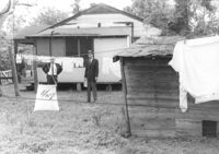
Laundry hanging on clothesline in front of shed, on site affected by the construction of Interstate 26 (I-26). Surveyor notations on back of photo: "Dkt.: 10.480. Property owner: Ruth I. Kirby. Tract: 236. Station: 5699+25 Lt. Date: May 2, 1961. In R/W - Bought." [See collection description for explanation of surveyor notations.]
Rear of house and shed, with laundry hanging on clothesline, on site affected by the construction of Interstate 26 (I-26). Surveyor notations on back of photo: "Dkt.: 10.480. Property owner: Ruth I. Kirby. Tract: 236. Station: 5699+30 Lt. Date: May 2, 1961. Shed bought -- proximity to house." [See collection description for explanation of surveyor notations.]
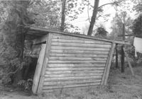
Shed on site affected by the construction of Interstate 26 (I-26). Surveyor notations on back of photo: "Dkt.: 10.480. Property owner: Ruth I. Kirby. Tract: 236. Station: 5699+30 Lt. Date: May 2, 1961. In R/W - Bought." [See collection description for explanation of surveyor notations.]
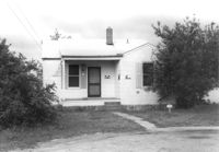
House on site affected by the construction of Interstate 26 (I-26). Building address number 187. "River View." Surveyor notations on back of photo: "Dkt.: 10.480. Property owner: Mary E. Martin. Tract: 261. Station: 5712+75 CL. Date: May 2, 1961. In R/W - Bought." [See collection description for explanation of surveyor notations.]
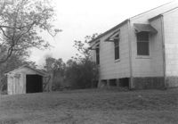
Corner view of house and garage/shed, on site affected by the construction of Interstate 26 (I-26). Surveyor notations on back of photo: "Dkt.: 10.480. Property owner: Mary E. Martin. Tract: 261. Station: 5712+75 CL. Date: May 2, 1961. In R/W - Bought." [See collection description for explanation of surveyor notations.]
House and garage/shed, on site affected by the construction of Interstate 26 (I-26). Surveyor notations on back of photo: "Dkt.: 10.480. Property owner: Frank Jenkins, et al. Tract: 6. Station: 5499+40 Rt. Date: May 2, 1961. In R/W - Bought." [See collection description for explanation of surveyor notations.]
House on site affected by the construction of Interstate 26 (I-26). Surveyor notations on back of photo: "Dkt.: 10.480. Property owner: Leroy Hilton, et al. Tract: 8. Station: 5499+80 Rt. Date: May 2, 1961. In R/W - Bought." [See collection description for explanation of surveyor notations.]
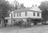
Building that appears to be a second-story residence with a ground-story grocery store, on site affected by the construction of Interstate 26 (I-26). Front facade has stepped parapet. Surveyor notations on back of photo: "Dkt.: 10.480. Property owner: Ruth Bell Young. Tract: 10. Station: 5501+25 Lt. Date: May 2, 1961. Proximity." [See collection description for explanation of surveyor notations.]
House on site affected by the construction of Interstate 26 (I-26). Surveyor notations on back of photo: "Dkt.: 10.480. Property owner: Oree McFadden. Tract: 11. Station: 5502+10 Lt. Date: May 2, 1961. In R/W - Bought." [See collection description for explanation of surveyor notations.]
House on site affected by the construction of Interstate 26 (I-26). Surveyor notations on back of photo: "Dkt.: 10.480. Property owner: Robert Watson. Tract: 13. Station: 5502+35 Lt. Date: May 2, 1961. In R/W - Bought." [See collection description for explanation of surveyor notations.]
House on site affected by the construction of Interstate 26 (I-26). Surveyor notations on back of photo: "Dkt.: 10.480. Property owner: Rebecca R. Wiggins. Tract: 16. Station: 5503+30 Rt. Date: May 2, 1961. In R/W - Bought." [See collection description for explanation of surveyor notations.]
House on site affected by the construction of Interstate 26 (I-26). Surveyor notations on back of photo: "Dkt.: 10.480. Property owner: Central McMillan. Tract: 17. Station: 5503+70 Rt. Date: May 2, 1961. In R/W - Bought." [See collection description for explanation of surveyor notations.]
House (side view) on site affected by the construction of Interstate 26 (I-26). Outbuilding in background. Surveyor notations on back of photo: "Dkt.: 10.480. Property owner: Rebecca R. Wiggins. Tract: 16. Station: 5502+80 Rt. Date: May 2, 1961. In R/W - Bought." [See collection description for explanation of surveyor notations.]
Grocery with signage for Dr. Pepper, Coca-Cola, Royal Crown Cola, Tru-Ade, Pepsi, on site affected by the construction of Interstate 26 (I-26). Neighboring house in background. Surveyor notations on back of photo: "Dkt.: 10.480. Property owner: John Chaplin. Tract: 18. Station: 5503+90 Rt. Date: May 2, 1961. In R/W - Bought." [See collection description for explanation of surveyor notations.]