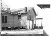
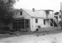
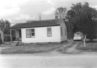
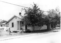
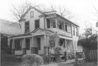
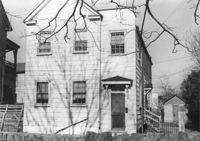
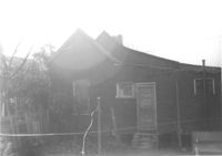
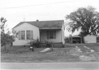
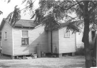
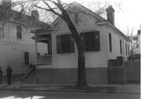
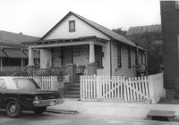
House (rear view) on site affected by the construction of Interstate 26 (I-26). [Building address number 2204.] Surveyor notations on back of photo: "Dkt.: 10.490. Property owner: Joseph B. Cusack, Jr. Tract: 27. Station: 5820+50 Lt. Date: March 22, 1962. In R/W - Bought." [See collection description for explanation of surveyor notations.]
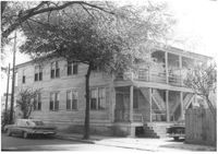
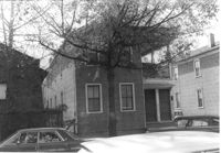
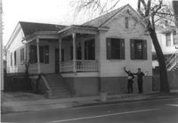
House on site affected by the construction of Interstate 26 (I-26). (See I-26 Photo 1138, rear view.) Surveyor notations on back of photo: "Dkt.: 10.490. Property owner: Nathaniel Phoenix. Tract: 46. Station: 5799+65 Rt. Line 'G'. Date: September 11, 1962. Proximity." [See collection description for explanation of surveyor notations.]
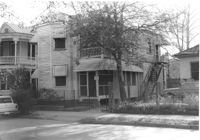
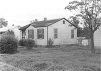
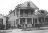
House on site affected by the construction of Interstate 26 (I-26). Surveyor notations on back of photo: "Dkt.: 10.490. Property owner: Rev. Andrew Johnson, et al. Tract: 30. Station: 5794+45 on CL Line 'A'. Date: September 11, 1962. In R/W - Bought." [See collection description for explanation of surveyor notations.]
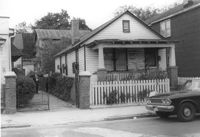
House (rear view) on site affected by the construction of Interstate 26 (I-26). Surveyor notations on back of photo: "Dkt.: 10.490. Property owner: Anna Broderick. Tract: 31. Station: 5794+75 on CL Line 'A'. Date: September 11, 1962. In R/W - Bought." [See collection description for explanation of surveyor notations.]
House on site affected by the construction of Interstate 26 (I-26). Surveyor notations on back of photo: "Dkt.: 10.490. Property owner: Anna Broderick. Tract: 31. Station: 5794+75 on CL Line 'A'. Date: September 11, 1962. In R/W - Bought." [See collection description for explanation of surveyor notations.]
House on site affected by the construction of Interstate 26 (I-26). Surveyor notations on back of photo: "Dkt.: 10.490. Property owner: Sylvia Yaschik. Tract: 32. Station: 5795+05 on CL Line 'A'. Date: September 11, 1962. In R/W - Bought." [See collection description for explanation of surveyor notations.]
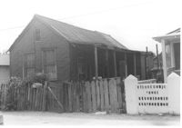
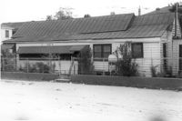
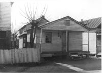
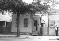
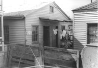
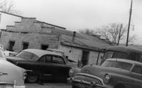
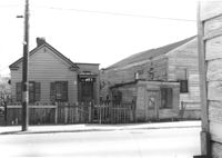
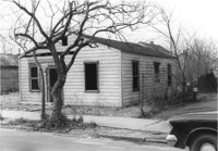
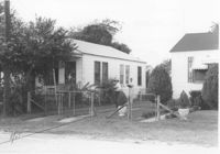
House in dilapidated condition on site affected by the construction of Interstate 26 (I-26). Outbuilding, possible once a market, in background. Has signs for Royal Crown Cola and Pepsi-Cola on front. Surveyor notations on back of photo: "Dkt.: 10.480. Property owner: J.L. Spencer, et al. Tract: 50. Station: 5515+30 Lt. Date: May 2, 1961. In R/W - Bought." [See collection description for explanation of surveyor notations.]
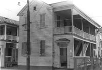
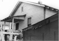
House (rear) on site affected by the construction of Interstate 26 (I-26). Address: 691 King Street. Surveyor notations on back of photo: "Dkt.: 10.517. Property owner: Henry Deas Jr., et al. Tract: 133. Station: 18+60 Rt. (Line "1"). Date: November 4, 1965. Rear view of subject residence. Not in R/W. Range poles on new R/W." [See collection description for explanation of surveyor notations.]
House (corner view, rear) on site affected by the construction of Interstate 26 (I-26). Address: 693 King Street. Surveyor notations on back of photo: "Dkt.: 10.517. Property owner: Rose Sokol. Tract: 132. Station: 19+85 Lt. and Rt. (Line "1"). Date: November 4, 1965. Rear view of residence. Complete lot and building in R/W." [See collection description for explanation of surveyor notations.]
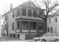
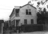
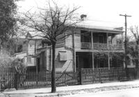
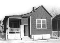
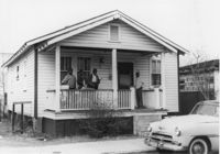
House on site affected by the construction of Interstate 26 (I-26). Address: 310 St. Philip Street. Surveyor notations on back of photo: "Dkt.: 10.517. Property owner: Benjamin W. Steed. Tract: 131. Station: 20+65 Lt. and Rt. (Line "1"). Date: November 4, 1965. Front view of subject residence and lot, all in R/W." [See collection description for explanation of surveyor notations.]
House on site affected by the construction of Interstate 26 (I-26). Address: 289 St. Philip Street. Surveyor notations on back of photo: "Dkt.: 10.517. Property owner: John Henry Mehrtens. Tract: 111. Station: 24+25 Rt. Southbound Lane Route 17. Date: March 5, 1963. In R/W - Bought." [See collection description for explanation of surveyor notations.]
House (rear view) on site affected by the construction of Interstate 26 (I-26). Address: 3 D Street. Surveyor notations on back of photo: "Dkt.: 10.517. Property owner: Hattie Bell Collier. Tract: 19. Station: 5946+20 Lt. - Line 1. Date: February 21, 1963. In R/W - Bought." [See collection description for explanation of surveyor notations.]
House on site affected by the construction of the Crosstown. Address: 112 Bogard Street. Surveyor notations on back of photo: "Dkt.: 10.524. Property owner: Susan D. Butler, Est. Tract: 65. Station: 76+00 CL Rt. Date: Oct. 14, 1964. In R/W - Bought." [See collection description for explanation of surveyor notations.]
House on site affected by the construction of the Crosstown. Address: 116 Bogard Street. Surveyor notations on back of photo: "Dkt.: 10.524. Property owner: Arletha Powers. Tract: 63. Station: 75+40 CL. Date: Oct. 14, 1964. In R/W - Bought." [See collection description for explanation of surveyor notations.]
House on site affected by the construction of the Crosstown. Address: 116 Bogard Street. Surveyor notations on back of photo: "Dkt.: 10.524. Property owner: Arletha Powers. Tract: 63. Station: 75+40 CL. Date: Oct. 14, 1964. In R/W - Bought." [See collection description for explanation of surveyor notations.]
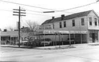
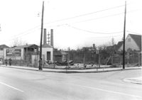
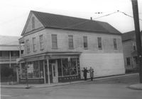
Corner of Meeting Street and Cooper Street. Charleston Auto Sales (510 Meeting Street) and Infinger's Shoe Store (508 Meeting Street), on site affected by the construction of the Crosstown. Surveyor notations on back of photo: "Dkt.: 10.518. Property owner: Robert L. Knoth. Tract: 14. Station: 5962+85 CL of Line 3 of the S.B. lane of Route 17. Date: Mar. 6, 1963. In R/W - Bought. [See collection description for explanation of surveyor notations.]
House (rear corner view) on site affected by the construction of the Crosstown. Address: 110 Bogard Street. Surveyor notations on back of photo: "Dkt.: 10.524. Property owner: Thomassina Elizabeth McCray. Tract: 72. Station: 76+60 Rt. Date: Oct. 14, 1964. In R/W - Bought." [See collection description for explanation of surveyor notations.]
House on site affected by the construction of the Crosstown. Address: 71 Kracke Street. Surveyor notations on back of photo: "Dkt.: 10.524. Property owner: William Henry Godfrey. Tract: 66. Station: 76+10 Lt. Date: Oct. 14, 1964. Portion in R/W to be removed." [See collection description for explanation of surveyor notations.]
House (rear view) and lot on site affected by the construction of the Crosstown. Address: 18-20 Wescott Street. Surveyor notations on back of photo: "Dkt.: 10.524. Property owner: Ralph E. Thornley, et al. Tract: 11. Station: 62+10 Lt. Date: Oct. 13, 1964." [See collection description for explanation of surveyor notations.]
Side view of house on site affected by the construction of the Crosstown. Address: 119 Bogard Street. Surveyor notations on back of photo: "Dkt.: 10.524. Property owner: Rebecca S. Cooper. Tract: 55. Station: 73+90 Rt. Date: Oct. 14, 1964. In R/W - Bought." [See collection description for explanation of surveyor notations.]
House on site affected by the construction of the Crosstown. Address: 110 Bogard Street. Surveyor notations on back of photo: "Dkt.: 10.524. Property owner: Thomassina Elizabeth McCray. Tract: 72. Station: 76+60 Rt. Date: Oct. 14, 1964. In R/W - Bought." [See collection description for explanation of surveyor notations.]
House on site affected by the construction of the Crosstown. Address: 190 Spring Street. Surveyor notations on back of photo: "Dkt.: 10.524. Property owner: E.H. Heidman, Est. Tract: 18. Station: 24± Lt. (Spring Street). Date: Oct. 13, 1964. Portion in R/W to be removed." [See collection description for explanation of surveyor notations.]
House on site affected by the construction of Interstate 26 (I-26). Address: 4 Carters Court. Surveyor notations on back of photo: "Dkt.: 10.490. Property owner: Louise S. Carter. Tract: 149. Station: 35' Lt. Sta. 5881+00. Date: May 15, 1962. In R/W - Bought." [See collection description for explanation of surveyor notations.]
House on site affected by the construction of Interstate 26 (I-26). Address: Carters Court. Surveyor notations on back of photo: "Dkt.: 10.490. Property owner: Louise S. Carter. Tract: 151. Station: 30' Lt. Sta. 5880+10. Date: May 15, 1962. In R/W - Bought." [See collection description for explanation of surveyor notations.]
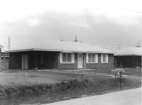
House on site affected by the construction of Interstate 26 (I-26). Building address number 183. Garage/shed at end of driveway. Surveyor notations on back of photo: "Dkt.: 10.480. Property owner: D.M. Swails, et al. Tract: 128. Station: 5650+40 Rt. Date: May 2, 1961. In R/W - Bought." [See collection description for explanation of surveyor notations.]
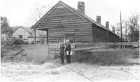
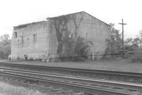
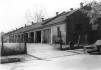
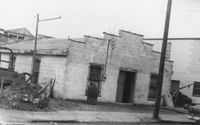
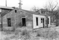
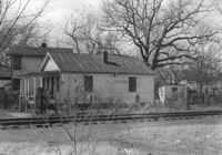
Building by railroad tracks, on site affected by the construction of Interstate 26 (I-26). Surveyor notations on back of photo: "Dkt.: 10.480. Property owner: Raymond O. Dion. Tract: 107. Station: 5630± to 5636±. Date: May 2, 1961. To be demolished." [See collection description for explanation of surveyor notations.]
House on site affected by the construction of Interstate 26 (I-26). Surveyor notations on back of photo: "Dkt.: 10.480. Property owner: Preston H. Mundy. Tract: 104. Station: 5574+70 Lt. (Line J). Date: May 2, 1961. In R/W - Bought." [See collection description for explanation of surveyor notations.]
House on site affected by the construction of Interstate 26 (I-26). Address: 2135 Montford Avenue. Surveyor notations on back of photo: "Dkt.: 10.490. Property owner: Paul E. West. Tract: 182. Station: 60'Rt. Sta. 5885+50. Date: May 15, 1962. In R/W - Bought. Storage house to be retained by owner." [See collection description for explanation of surveyor notations.]
House on street corner (rear corner view), on site affected by the construction of Interstate 26 (I-26). Address: 1346 Rutledge Avenue. Surveyor notations on back of photo: "Dkt.: 10.490. Property owner: Louise S. Carter. Tract: 153. Station: 5879+60 Rt. Date: May 15, 1962. In R/W - Bought." [See collection description for explanation of surveyor notations.]
House (rear view) on site affected by the construction of Interstate 26 (I-26). Address: 19 Indian Street. Surveyor notations on back of photo: "Dkt.: 10.503. Property owner: Gibbs Mitchell, Est. Tract: 75. Station: 5913+45 Rt. Date: Feb. 20, 1963. In R/W - Bought." [See collection description for explanation of surveyor notations.]
House (rear view) on site affected by the construction of Interstate 26 (I-26). Address: 4 Carters Court. Surveyor notations on back of photo: "Dkt.: 10.490. Property owner: Louise S. Carter. Tract: 149. Station: 35' Lt. Sta. 5881+00. Date: May 15, 1962. In R/W - Bought." [See collection description for explanation of surveyor notations.]
House (rear view) on site affected by the construction of Interstate 26 (I-26). Address: 406 Boyer Street. Surveyor notations on back of photo: "Dkt.: 10.503. Property owner: Dora P. Wright. Tract: 79. Station: 5914+00 Lt. Date: Feb. 20, 1963. In R/W - Bought." [See collection description for explanation of surveyor notations.]
House on site affected by the construction of the Crosstown. Address: 163A Line Street [163 Line Street]. Surveyor notations on back of photo: "Dkt.: 10.524. Property owner: Ethelyn M. Parker. Tract: 95. Station: 82+50 Rt. Date: Dec. 1, 1964. In R/W - Bought." [See collection description for explanation of surveyor notations.]
House on site affected by the construction of the Crosstown. Address: 269 Ashley Avenue. Surveyor notations on back of photo: "Dkt.: 10.524. Property owner: Paul Graham. Tract: 82. Station: 79+20 Lt. Date: Oct. 14, 1964. In R/W - Bought." [See collection description for explanation of surveyor notations.]
House on site affected by the construction of Interstate 26 (I-26). Surveyor notations on back of photo: "Dkt.: 10.490. Property owner: Minnie R. Sherman. Tract: 93. Station: 5826+55 Lt. Date: March 22, 1962. In R/W - Bought." [See collection description for explanation of surveyor notations.]
House on site affected by the construction of Interstate 26 (I-26). Surveyor notations on back of photo: "Dkt.: 10.490. Property owner: Minnie R. Sherman. Tract:96. Station: 5826+50 Rt. Date: March 22, 1962. In R/W - Bought." [See collection description for explanation of surveyor notations.]
Storage structure for lumber and other structure (for lumber processing?) on site affected by the construction of Interstate 26 (I-26). Address: Heriot Street. Presumably part of lumber yard. Surveyor notations on back of photo: "Dkt.: 10.490. Property owner: G.S. Carter & Son., Inc. Tract: 143. Station: 5878±. Date: August 29, 1962. To be cut off at R/W." [See collection description for explanation of surveyor notations.]
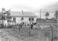
Backyard lot on site affected by the construction of Interstate 26 (I-26). House (corner view, rear) in background. Surveyor notations on back of photo: "Dkt.: 10.480. Property owner: Jennie B. Henson, et al. Tract: 73. Station: 5517+20 Rt. Date: May 2, 1961. Proximity." [See collection description for explanation of surveyor notations.]
Shed on site affected by the construction of Interstate 26 (I-26). Pepsi-Cola, Camel [cigarettes] signs on front. Surveyor notations on back of photo: "Dkt.: 10.480. Property owner: Central McMillan, et al. Tract: 38. Station: 5507+90 Rt. Date: May 2, 1961. In R/W - Bought." [See collection description for explanation of surveyor notations.]
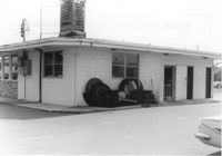
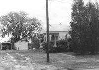
Rear (corner view) of building (a pizza restaurant), on site affected by the construction of Interstate 26 (I-26). Surveyor notations on back of photo: "Dkt.: 10.480. Property owner: G.S. Carter, Sr. Tract: 162. Station: 5679+50 Rt. Date: May 30, 1961. In R/W - Bought." [See collection description for explanation of surveyor notations.]
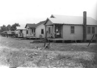
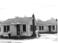
Three houses (rear view) on site affected by the construction of Interstate 26 (I-26). Surveyor notations on back of photo: "Dkt.: 10.480. Property owner: G.S. Carter, Sr. Tract: 162. Station: 5677+55 to 5678+75 Rt. & Lt. CL. Date: May 30, 1961. In R/W - Bought." [See collection description for explanation of surveyor notations.]
House on site affected by the construction of Interstate 26 (I-26). Building address number 31. Surveyor notations on back of photo: "Dkt.: 10.480. Property owner: John A. & Mrs. Sarah H. Meyer. Tract: 293. Station: 5747+85 Lt. Date: May 30, 1961. Proximity." [See collection description for explanation of surveyor notations.]
House (corner view, rear) on site affected by the construction of Interstate 26 (I-26). 7 Wood Street. Surveyor notations on back of photo: "Dkt.: 10.503. Property owner: Janie Washington. Tract: 34. Station: 5901+00 Lt. Date: Feb. 19, 1963. In R/W - Bought." [See collection description for explanation of surveyor notations.]
House on site affected by the construction of Interstate 26 (I-26). Building address number 213. Surveyor notations on back of photo: "Dkt.: 10.480. Property owner: J. Lester Goff. Tract: 143. Station: 5659+70 Rt. Date: May 2, 1961. In R/W - Bought." [See collection description for explanation of surveyor notations.]
House on site affected by the construction of Interstate 26 (I-26). Garage/shed at end of driveway. Surveyor notations on back of photo: "Dkt.: 10.480. Property owner: C.W. Floyd. Tract: 136. Station: 5655+30 Rt. Date: May 2, 1961. In R/W - Bought." [See collection description for explanation of surveyor notations.]
House on site affected by the construction of Interstate 26 (I-26). Building address number 25. Surveyor notations on back of photo: "Dkt.: 10.480. Property owner: Lynn C. Davis, et al. Tract: 155. Station: 5668+00 Rt. Date: In R/W - Bought." [See collection description for explanation of surveyor notations.]
House (freedman's cottage?) (rear view) on site affected by the construction of Interstate 26 (I-26). Address: 21 Addison Street. Surveyor notations on back of photo: "Dkt.: 10.503. Property owner: Andrew R. Bland. Tract: 97. Station: 5919+90 Rt. Date: Feb. 20, 1963. In R/W - Bought." [See collection description for explanation of surveyor notations.]
Houses on site affected by the construction of Interstate 26 (I-26). Address: 2157 Heriot Street. Surveyor notations on back of photo: "Dkt.: 10.490. Property owner: Thos. W. Towns [Thomas W. Towns]. Tract: 147-C. Station: 215' Lt. Sta. 5879 and fronting on Heriot Street. Date: May 15, 1962. Men on R/W 'bought.'" [See collection description for explanation of surveyor notations.]
House (side view) on site affected by the construction of Interstate 26 (I-26). Address: 2163 Heriot Street. Surveyor notations on back of photo: "Dkt.: 10.490. Property owner: Thos. W. Towns [Thomas W. Towns]. Tract: 147-A. Station: 135' Lt. Sta. 5880+10. Date: May 15, 1962. Proximity." [See collection description for explanation of surveyor notations.]
House on site affected by the construction of the Crosstown. Address: 117 Sheppard Street. Surveyor notations on back of photo: "Dkt.: 10.524. Property owner: Julia Sharpe, et al., Est. Tract: 140. Station: 17+85 Rt. N.B. lane. Date: Dec. 2, 1964. Condemned." [See collection description for explanation of surveyor notations.]
House on Sheppard Street on site affected by the widening of U.S. Route 17. Address 131 Sheppard Street. Surveyor notations on back of photo: "Dkt.: 10.524. Property owner: William Delestine, et al. Tract: 127. Station: 90+20 CL. Date: Dec. 2, 1964. In R/W - Bought." [See collection description for explanation of surveyor notations.]
House on site affected by the construction of the Crosstown. Address: 127 Sheppard Street. Surveyor notations on back of photo: "Dkt.: 10.524. Property owner: Essie W. Jenkins. Tract: 129. Station: 91+50 Rt. Date: Dec. 2, 1964. In R/W - Bought." [See collection description for explanation of surveyor notations.]
City Garage, on site affected by the construction of the Crosstown. Address: 134 Line Street. Surveyor notations on back of photo: "Dkt.: 10.524. Property owner: City of Charleston. Tract: 128. Station: 90+50 CL Rt. Date: Dec. 2, 1964. Partially in R/W." [See collection description for explanation of surveyor notations.]
City Garage, on site affected by the construction of the Crosstown. Address: 134 Line Street. Surveyor notations on back of photo: "Dkt.: 10.524. Property owner: City of Charleston. Tract: 128. Station: 90+50 CL Rt. Date: Dec. 2, 1964. Partially in R/W." [See collection description for explanation of surveyor notations.]
Looking down driveway between City Garage and building with gas pump, on site affected by the construction of the Crosstown. Address: 134 Line Street. Surveyor notations on back of photo: "Dkt.: 10.524. Property owner: City of Charleston. Tract: 128. Station: 91+00 CL Rt. Date: Dec. 2, 1964. Panoramic view." [See collection description for explanation of surveyor notations.]
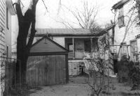
Storage shed or garage and backyard in rear of house on site affected by the construction of the Crosstown. Address: 160½ Line Street [160 Line Street]. Surveyor notations on back of photo: "Dkt.: 10.524. Property owner: John Meyer, Est. Tract: 101. Station: 83+65 Lt. Date: Dec. 1, 1964. In R/W - Bought." [See collection description for explanation of surveyor notations.]
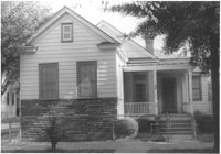
Freedman's cottage on site affected by the construction of the Crosstown. Address: 74½ Cooper Street [74 Cooper Street]. Surveyor notations on back of photo: "Dkt.: 10.518. Property owner: R.F. Momier. Tract: 23. Station: 40+45 Rt. N.B. lane Route 17. Date: Mar. 6, 1963. In R/W - Bought. [See collection description for explanation of surveyor notations.]
House on site affected by the construction of the Crosstown. Address: 100 Sheppard Street. Surveyor notations on back of photo: "Dkt.: 10.518. Property owner: M.J. Christine Butt, Est. Tract: 19. Station: 29+40 to 29+75 Lt. Sheppard Street. Date: Mar. 6, 1963. In R/W - Bought. [See collection description for explanation of surveyor notations.]
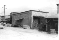
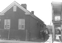
One-story building (rear view) and back lot on site affected by the construction of Interstate 26 (I-26). Address: 75 Cooper Street. Rear facade has stepped parapet. Several cars in back lot. Surveyor notations on back of photo: "Dkt.: 10.517. Property owner: S.E. Jenkins. Tract: 71. Station: 5959+75 CL - Line 4. Date: March 5, 1963. In R/W - Bought." [See collection description for explanation of surveyor notations.]
One-story building on site affected by the construction of Interstate 26 (I-26). Address: 75 Cooper Street. Front facade has stepped parapet. Sign for chain saws over doorway. Surveyor notations on back of photo: "Dkt.: 10.517. Property owner: S.E. Jenkins. Tract: 71. Station: 5959+75 CL - Line 4. Date: March 5, 1963. In R/W - Bought." [See collection description for explanation of surveyor notations.]
Storage structure for lumber and other structure (lumber processing?) on site affected by the construction of Interstate 26 (I-26). Address: Heriot Street. Presumably part of lumber yard. Surveyor notations on back of photo: "Dkt.: 10.490. Property owner: G.S. Carter & Son., Inc. Tract: 143. Station: 5878±. Date: August 29, 1962. To be cut off at R/W." [See collection description for explanation of surveyor notations.]
Storage structure for lumber on site affected by the construction of Interstate 26 (I-26). Address: Heriot Street. Presumably part of lumber yard. Surveyor notations on back of photo: "Dkt.: 10.490. Property owner: G.S. Carter & Son., Inc. Tract: 143. Station: 5878±. Date: August 29, 1962. To be cut off at R/W." [See collection description for explanation of surveyor notations.]
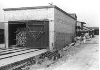
Storage structures for lumber on site affected by the construction of Interstate 26 (I-26). Address: Heriot Street. Presumably part of lumber yard. Surveyor notations on back of photo: "Dkt.: 10.490. Property owner: G.S. Carter & Son., Inc. Tract: 143. Station: 5878±. Date: August 29, 1962. To be cut off at R/W." [See collection description for explanation of surveyor notations.]
Storage structures for lumber on site affected by the construction of Interstate 26 (I-26). Address: Heriot Street. Presumably part of lumber yard. Surveyor notations on back of photo: "Dkt.: 10.490. Property owner: G.S. Carter & Son., Inc. Tract: 143. Station: 5878±. Date: August 29, 1962. In R/W - Bought." [See collection description for explanation of surveyor notations.]
Building, on site affected by the widening of Route 171 (Folly Road). Dave Richardson and Son General Contractor. Front facade has stepped parapet. Surveyor notations on back of photo: "Dkt.: 10.494. Property owner: Dave Richardson, et al. Tract: 93. Station: 314+40 Lt. Date: Mar. 21, 1962. To be cut off at R/W by SCHD [SC Highway Department?]. [See collection description for explanation of surveyor notations.]
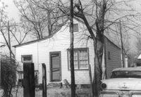
House (side view) on site affected by the construction of the Crosstown. On Cooper Street; address unknown. Surveyor notations on back of photo: "Dkt.: 10.518. Property owner: Louise McLead Drayton. Tract: 30-B. Station: 14+60 Lt. (Cooper Street). 41+70 Rt. (U.S. Rt. 17). Date: Apr. 20, 1965. Partially in R/W." [See collection description for explanation of surveyor notations.]
House on site affected by the construction of the Crosstown. Address: 98 Hanover Street. (Number on front door: 110.) Surveyor notations on back of photo: "Dkt.: 10.518. Property owner: Rosalie Pezant, et al. Tract: 48. Station: 45+20 CL N.B. lane Route 17. Date: Mar. 6, 1963. In R/W - Bought." [See collection description for explanation of surveyor notations.]
House on site affected by the construction of the Crosstown. Address: 63 Lee Street. Building Address: number 3. Surveyor notations on back of photo: "Dkt.: 10.518. Property owner: Peter Bennett, Est. Tract: 38. Station: 43+65 Rt. S.B. lane Route 17. Date: Mar. 6, 1963. In R/W - Bought. [See collection description for explanation of surveyor notations.]
Freedman's cottage on site affected by the construction of the Crosstown. Address: 173 Nassau Street. Surveyor notations on back of photo: "Dkt.: 10.518. Property owner: Isiah Bryant, et al. Tract: 25. Station: 41+00 Lt. N.B. lane Route 17. Date: Mar. 6, 1963. In R/W - Bought. [See collection description for explanation of surveyor notations.]
House (rear view) on site affected by the construction of the Crosstown. Address: 119 America Street. Surveyor notations on back of photo: "Dkt.: 10.518. Property owner: J.A. Barrineau. Tract; 59. Station: 49+55 Rt. N.B. lane Route 17. Date: Mar. 7, 1963. In R/W - Bought." [See collection description for explanation of surveyor notations.]
House on site affected by the construction of the Crosstown. Address: 119 America Street. Surveyor notations on back of photo: "Dkt.: 10.518. Property owner: J.A. Barrineau. Tract; 59. Station: 49+55 Rt. N.B. lane Route 17. Date: Mar. 7, 1963. In R/W - Bought." [See collection description for explanation of surveyor notations.]
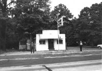
Sewer pump house on corner lot, on site affected by the construction of the Crosstown. Address: corner of Aiken Street and Lee Street (SE corner). View of street corner. Surveyor notations on back of photo: "Dkt.: 10.518. Property owner: City of Charleston. Tract: 56. Station: 48+00 Lt. N.B. lane Route 17. Date: Mar. 7, 1963. Sewage pumping station." [See collection description for explanation of surveyor notations.]
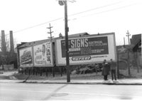
Billboards on lot, on site affected by the construction of the Crosstown. Address: corner of Lee Street and America Street (SW corner). Surveyor notations on back of photo: "Dkt.: 10.518. Property owner: Turner Advertising Co. Tract: 57. Station: 49+30 Rt. S.B. lane Route 17. Date: Mar. 7, 1963. Signs." [See collection description for explanation of surveyor notations.]
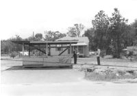
Lot with what appears to be a roadside stand; house in background, on site affected by the construction of Interstate 26 (I-26). Surveyor notations on back of photo: "Dkt.: 10.480. Property owner: Marshall A. Radford, et al. Tract: 101. Station: 60+20 Lt. (Goodrich Road). Date: May 2, 1961. In R/W - Bought." [See collection description for explanation of surveyor notations.]
House (freedman's cottage) on site affected by the construction of Interstate 26 (I-26). Address: 24 Riker Street. Surveyor notations on back of photo: "Dkt.: 10.503. Property owner: Ethel Middleton. Tract: 65. Station: 5910+55 Rt. Date: Feb. 20, 1963. In R/W - Bought." [See collection description for explanation of surveyor notations.]
House (freedman's cottage) on site affected by the construction of Interstate 26 (I-26). Address: 24 Riker Street. Surveyor notations on back of photo: "Dkt.: 10.503. Property owner: Ethel Middleton. Tract: 65. Station: 5910+55 Rt. Date: Feb. 20, 1963. In R/W - Bought." [See collection description for explanation of surveyor notations.]
House (rear view) on site by the construction of Interstate 26 (I-26). Address: 1211 King Street (rear). Surveyor notations on back of photo: "Dkt.: 10.503. Property owner: Albert M. Jones, et al. Tract: 17. Station: 5894+75 Lt. Date: Feb. 19, 1963. In R/W - Bought." [See collection description for explanation of surveyor notations.]
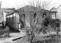
House on site affected by the construction of Interstate 26 (I-26). Driveway leads to garage/shed. Surveyor notations on back of photo: "Dkt.: 10.480. Property owner: Shade R. Rogers. Tract: 138. Station: 5656+40 Rt. Date: May 1, 1961. In R/W - Bought." [See collection description for explanation of surveyor notations.]
House on site affected by the construction of Interstate 26 (I-26). Driveway leads to shed. Surveyor notations on back of photo: "Dkt.: 10.480. Property owner: V.J. Bouranick. Tract: 139. Station: 5657+00 Rt. Date: May 1, 1961. In R/W - Bought." [See collection description for explanation of surveyor notations.]
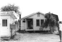
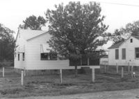
House (corner view) on site affected by the construction of Interstate 26 (I-26). Surveyor notations on back of photo: "Dkt.: 10.480. Property owner: Marie J. Pounds. Tract: 124. Station: 5648+00 Rt. Date: May 1, 1961. In R/W - Bought." [See collection description for explanation of surveyor notations.]
House and outbuilding on site affected by the construction of Interstate 26 (I-26). Surveyor notations on back of photo: "Dkt.: 10.480. Property owner: G.B. Lewis. Tract: 140. Station: 5657+60 Rt. Date: May 1, 1961. In R/W - Bought." [See collection description for explanation of surveyor notations.]
House on site affected by the construction of Interstate 26 (I-26). Surveyor notations on back of photo: "Dkt.: 10.480. Property owner: O.C. House, et al. Tract: 129. Station: 5651+25 Rt. Date: May 1, 1961. In R/W - Bought." [See collection description for explanation of surveyor notations.]
House (freedman's cottage) (rear view) on site affected by the construction of Interstate 26 (I-26). Surveyor notations on back of photo: "Dkt.: 10.490. Property owner: Janie Simmons. Tract: 41. Station: 5798+30 on CL Line 'G'. Date: September 12, 1962. In R/W - Bought." [See collection description for explanation of surveyor notations.]
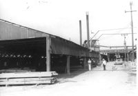
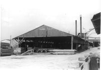
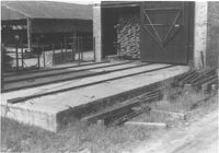
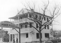
Cole Lumber Company, presumably main office building, on site affected by the construction of Interstate 26 (I-26). Sign arches over the entrance: C. Ed Cole Lumber Mills. Address from 1961 City Directory: 293 Huger Street. Address from 1951 Sanborn Map: 17 Huger Street. Surveyor notations on back of photo: "Dkt.: 10.517. Property owner: Charles E. Cole Lumber Co. Tract 1. Station: 5937+70 Lt. Date: February 21, 1963." [See collection description for explanation of surveyor notations.]
House (rear view) on site affected by the construction of Interstate 26 (I-26). Address: 48 Sheppard Street. Surveyor notations on back of photo: "Dkt.: 10.517. Property owner: Michael Criley. Tract: 74. Station: 5959+75 CL - Line 3. Date: March 5, 1963. In R/W - Bought." [See collection description for explanation of surveyor notations.]
House (rear view) on site affected by the construction of Interstate 26 (I-26). [Building address number 1989.] Surveyor notations on back of photo: "Dkt.: 10.490. Property owner: John Hamilton. Tract: 33. Station: 5795+35 on CL Line 'A'. Date: September 11, 1962. In R/W - Bought." [See collection description for explanation of surveyor notations.]
House on site affected by the construction of Interstate 26 (I-26). Address: 46 Sheppard Street. Surveyor notations on back of photo: "Dkt.: 10.517. Property owner: Mary Wolfe Hennersby. Tract: 73. Station: 5960+15 CL - Line 3. Date: March 5, 1963. In R/W - Bought." [See collection description for explanation of surveyor notations.]
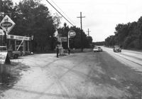
Gulf gas station and County Store on site affected by the widening of U.S. Route 17. Presumably located in Mount Pleasant or vicinity. Surveyor notations on back of photo: "Dkt.: 10.597. Property owner: Mrs. Catherine Owens, et al. Tract: 9. Station: 254+00 Rt. looking north. Date: Sept. 17, 1968." [See collection description for explanation of surveyor notations.]
Building on site affected by the widening of U.S. Route 17. Appears to have previously been a bar; Budweiser sign posted in front of building. Presumably located in Mount Pleasant or vicinity. Surveyor notations on back of photo: "Dkt.: 10.597. Property owner: Leon Burns, et al. Tract: 5. Station: 265± Lt. Date: Sept. 17, 1968." [See collection description for explanation of surveyor notations.]
House (corner view) on site affected by the construction of the Crosstown. Address: 205 Spring Street. First story was a store front; has signage indicating its move to 216 Spring Street. View of street corner (corner of Spring Street and Courtenay Street). Surveyor notations on back of photo: "Dkt.: 10.524. Property owner: Katie Anna Meier, Est. Tract: 168. Station: 21+20 Rt. Spring Street. Date: Dec. 2, 1964." [See collection description for explanation of surveyor notations.]
House on site affected by the construction of the Crosstown. Address: 71 Kracke Street. Surveyor notations on back of photo: "Dkt.: 10.524. Property owner: William Henry Godfrey. Tract: 66. Station: 76+10 Lt. Date: Oct. 14, 1964. Portion in R/W to be removed." [See collection description for explanation of surveyor notations.]
Houses on site affected by the widening of U.S. Route 17. Presumably located in Mount Pleasant or vicinity. Surveyor notations on back of photo: "Dkt.: 10.439. Property owner: Doretha B. Chavis. Tract: 15. Station: 225+00 Lt. Date: Jul. 22, 1965. Proximity." [See collection description for explanation of surveyor notations.]
House on site affected by the construction of the Crosstown. Address: 287 Coming Street. Surveyor notations on back of photo: "Dkt.: 10.524. Property owner: John T. Bowden. Tract: 152. Station: 21+50 Lt. S.B. lane. Date: Dec. 2, 1964. In R/W - Bought." [See collection description for explanation of surveyor notations.]
House on site affected by the construction of the Crosstown. Address: 287 Coming Street. Surveyor notations on back of photo: "Dkt.: 10.524. Property owner: John T. Bowden. Tract: 152. Station: 21+50 Lt. S.B. lane. Date: Dec. 2, 1964. In R/W - Bought." [See collection description for explanation of surveyor notations.]
House on site affected by the construction of the Crosstown. Address: 147 President Street. Surveyor notations on back of photo: "Dkt.: 10.524. Property owner: Frank Chinners. Tract: 31. Station: 67+60 Rt. Date: Oct. 13, 1964. Partially In R/W - Bought." [See collection description for explanation of surveyor notations.]
House on site affected by the construction of the Crosstown. Address: 127 Bogard Street. Surveyor notations on back of photo: "Dkt.: 10.524. Property owner: Lucille Frasier. Tract: 46. Station: 72+40 Lt. Date: Oct. 14, 1964. Portion In R/W - Bought." [See collection description for explanation of surveyor notations.]
House on site affected by the construction of the Crosstown. Address: 127 Bogard Street. Surveyor notations on back of photo: "Dkt.: 10.524. Property owner: Lucille Frasier. Tract: 46. Station: 72+40 Lt. Date: Oct. 14, 1964. Portion In R/W - Bought." [See collection description for explanation of surveyor notations.]
View from street of houses on site affected by the construction of Interstate 26 (I-26). Addresses: 2126 Montford Avenue and its neighbor at 2124 Montford Avenue. Surveyor notations on back of photo: "Dkt.: 10.490. Property owner: Emory Hendrix, et al. Tract: 175. Station: 5884+80 Lt. Date: August 29, 1962. In R/W - Bought." [See collection description for explanation of surveyor notations.]
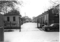
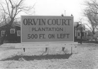
Sign for Orvin Court (Plantation) on lot, dwellings in background, on site affected by the construction of Interstate 26 (I-26). Address: 1204 King Street. Surveyor notations on back of photo: "Dkt.: 10.503. Property owner: Francis Hartnett. Tract: 24. Station: 5896+50 Lt. Date: Feb. 19, 1963. In R/W - Bought." [See collection description for explanation of surveyor notations.]
House (side view) on site affected by the construction of Interstate 26 (I-26). Address: 26 Sans Souci Street. Railroad tracks in foreground. Surveyor notations on back of photo: "Dkt.: 10.503. Property owner: Annie E. Koger. Tract: 26. Station: 5898+85 Rt. Date: Feb. 19, 1963. In R/W - Bought." [See collection description for explanation of surveyor notations.]