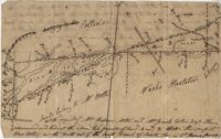
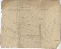
Two parcels of land (A & B) on the south side of the south branch of the Santee River in St. James Parish, Charleston District. Names associated with this plat include Rebecca Motte and Jonah Collin. Notable geographic locations include Washo Plantation, St. James Parish, Santee and Charleston District.
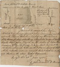
Plat of 640 acres of land belonging to Thomas Roberts situated in Berkeley County on the Cooper River bounding to the North and NE on land lad out to Nicholas Aremile to the south and SW on lands of Robert Miles and all other sides on vacant land. Names associated with this plat are John Berry, Ephraim Mitchell, Thomas Roberts, Nicholas Roberts, Nicholas Aremile, Robert Miles, William Gilbert, Barfield Homan and John Diamond. Notable geographic locations include the St. John's Parish, Cooper River, Berkeley County and Charleston District.
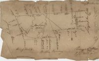
876 acre plot for Simpson, shows roads, houses, and rivers/creeks, no names on any of the details, includes surrounding tracts of lands and trees on the property boundaries. Names associated with this plat are Simpson, Keith, James Gray Wiase, and Charles Johnston.
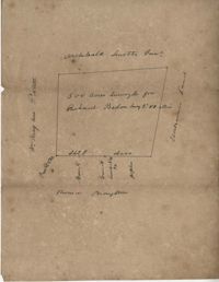
500 acres of land surveyed for Richard Bedon. Details are minor and include trees and surrounding lands. Names associated with this plat are Broughton, Archibald Smith, May Postell and Richard Bedon. Notable geographic locations include Dorchester and St. George's Parish.
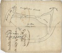
Plat of land with rice fields and highlands noted along with the neighboring properties. Very little other detail or explanation given. Names associated with this plat include Carson, Isaac Waight, and Ann Stanyarn.
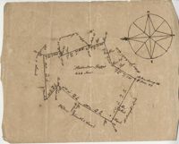
Plan of 500 acres of land along Turtle Island. Notable geographic locations include St. Peters Parish, Turtle Island, Wrights River, Dawfuskie [Daufuskie] Sound, Black Oyster Point, and New River.
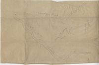
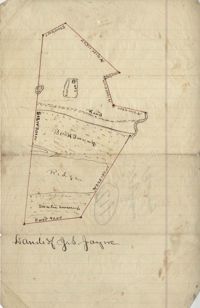
Unnamed plot of land that is divided into four parts, Santee swamp, ridge, Buck Swamp, and the section that includes a road and the house, no measurements or surrounding details. Names associated with this plat are G.S. Jayne.