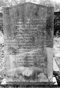
Colonel William Washington Cemetery. Tombstone of Colonel William Washington (1810) and Jane Riley Elliott - View of Rear. Ravenel, S.C.;10" x 6.5" B/W photo. Box 16, Folder 2-11-11. Two copies.
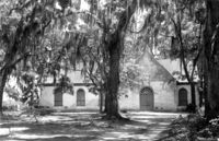
Edisto Island Presbyterian Church, S.C. Hwy. 174. View of NE (Front and Side) elevation. Edisto Island, S.C.;8" x 10" B/W photo. Box 10, Folder 2-3-7. One copy.
Edisto Island Baptist Church, S.C. Hwy. 174. View of NW (Rear and Side) elevation. Edisto Island, S.C.;8" x 10" B/W photo. Box 10, Folder 2-3-6. One copy.
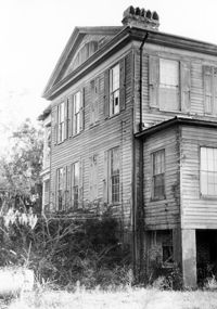
Peter's Point Plantation, off S.C. Hwy 174 on County Road 764 (Peters Point Road). View of North (Side and Front) elevation. Edisto Island, S.C.;6.5" x 10" B/W photo. Box 11, Folder 2-3-17. Two copies.
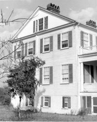
Peter's Point Plantation, off S.C. Hwy 174 on County Road 764 (Peters Point Road). View of West (Side and Rear) elevation. Edisto Island, S.C.;10" x 6.5" B/W photo. Box 11, Folder 2-3-17. One copy.
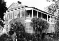
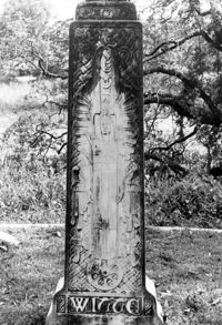
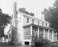
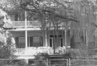
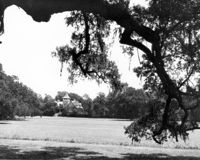
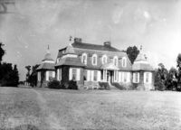
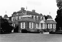
Windsor Plantation (Little Edisto Plantation, Ashwood Plantation), S.C. Hwy. 174. View of NE (Front and Side) elevation. Edisto Island, S.C.;6.5" x 10" B/W photo. Box 11, Folder 2-3-18. One copy.
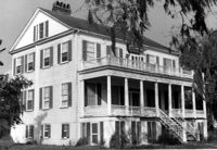
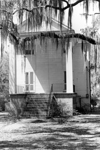
Windsor Plantation (Little Edisto Plantation, Ashwood Plantation), S.C. Hwy. 174. View of NE (Side and Front) elevation. Edisto Island, S.C.;10" x 8" B/W photo. Box 11, Folder 2-3-18. One copy.
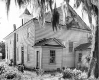
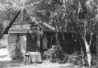
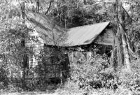
William Robertson House - Slave Cabin (Wampee Plantation Summer House). View of NW (Front and Side) elevation. Pinopolis, S.C.;6.5" x 9.5" B/W photo. Box 4, Folder 1-10-1 (III). Two copies.
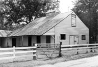
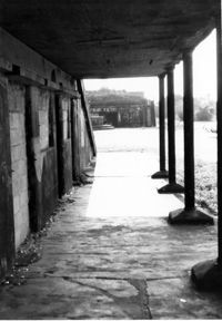
Boone Hall Plantation, Oak Avenue. Stable - View of SW (Front and Side) elevation. Mount Pleasant, S.C.;6.5" x 10" B/W photo. Box 10, Folder 2-2-5. One copy.
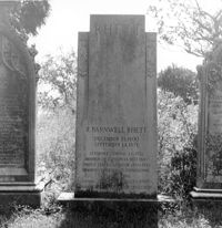
Magnolia Cemetery, Huguenin Avenue and Algonquin Road. Tombstone of R. Barnwell Rhett. View of ESE elevation. Charleston, S.C.;8" x 8" B/W photo. Box 5, Folder 2-1-3. One copy.
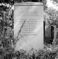
Magnolia Cemetery, Huguenin Avenue and Algonquin Road. Hunley Monument. View of North elevation. Charleston, S.C.;8" x 8" B/W photo. Box 5, Folder 2-1-3. One copy.
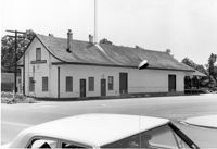
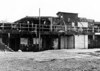
Moncks Corner Railroad Station. View of West (Front) elevation - taken from the SE. Moncks Corner, SC.;6.5" x 9.5" B/W photo. Box 2, Folder 1-8-15. Three copies.
Oak Grove Plantation, Leadenwah Drive. View of NE (Side and Front) elevation. Wadmalaw Island, S.C.;8" x 10" B/W photo. Box 17, Folder 2-14-3. One copy.
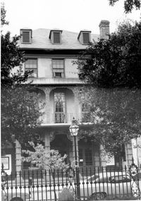
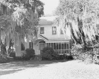
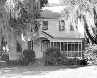
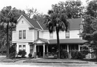
Rockville Historic District - Morse-Fripp House (Stanley F. Morse House, Charles E. Fripp House), Sea Island Yacht Club Road. View of South (Front) elevation. Wadmalaw Island, S.C.;8" x 10" B/W photo. Box 17, Folder 2-14-11. One copy.
Rockville Historic District - Morse-Fripp House (Stanley F. Morse House, Charles E. Fripp House), Sea Island Yacht Club Road. View of South (Front) elevation. Wadmalaw Island, S.C.;8" x 10" B/W photo. Box 17, Folder 2-14-11. One copy.
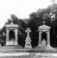
Rockville Historic District - Rockville Presbyterian Church, 2479 Sea Island Yacht Club Road. View of NW (Rear and Side) elevation. Wadmalaw Island, S.C.;6.5" x 10" B/W photo. Box 17, Folder 2-14-10. Two copies.
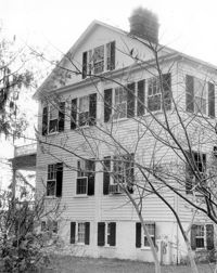
Rockville Historic District - Mary A. Whaley House, Maybank Highway. View of North (Front) elevation. Wadmalaw Island, S.C.;6.5" x 10" (and 8" x 10") B/W photo. Box 17, Folder 2-14-12. Two copies.
Rockville Historic District - Rockville Presbyterian Church, 2479 Sea Island Yacht Club Road. View of South (Front) elevation. Wadmalaw Island, S.C.;10" x 6.5" B/W photo. Box 17, Folder 2-14-10. One copy.
Edisto Island Baptist Church, S.C. Hwy. 174. View of NE (Front and Side) elevation. Edisto Island, S.C.;8" x 10" B/W photo. Box 10, Folder 2-3-6. One copy.
William Cain House - Lodge. View of NW (Side and Front) elevation. Pinopolis Historic District North. Pinopolis, S.C.;6.5" x 9.5" B/W photo. Box 4, Folder 1-10-1 (III). Two copies.
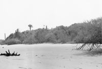
Folly Island Staging Area (Battery Green, U.S. Coast Guard Loran Station, Folly North Site), Address restricted. View facing WSW. Folly Beach, S.C.;8" x 10" B/W photo. Box 17, Folder 2-16-1. One copy.
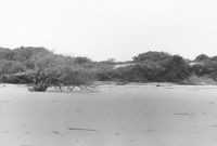
Folly Island Staging Area (Battery Green, U.S. Coast Guard Loran Station, Folly North Site), Address restricted. View facing NW. Folly Beach, S.C.;8" x 10" B/W photo. Box 17, Folder 2-16-1. One copy.
Stony Landing Plantation, East of U.S. Hwy. 52 and Riverwood Drive, along the Cooper River. View of Front elevation. Moncks Corner, SC.;6.5" x 9.5" B/W photo. Box 2, Folder 1-8-5. One copy.
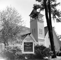
Mount Pleasant Presbyterian Church (Trinity Methodist Church, Hibben Methodist Church, Mount Pleasant Seventh Day Adventist Church), corner of Hibben and Bennet Streets. View of East (Front) elevation. Mount Pleasant, S.C.;10" x 6.5" B/W photo. Box 13, Folder 2-8-2. One copy.
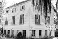
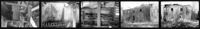
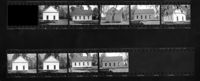
Comingtee Rice Barn (Mill), Located along the Western branch of the Cooper River. Contact Sheet 9 - Multiple Views. Berkeley County, S.C.;7.5" x 1" B/W photo. Box 20, Folder: Miscellaneous Photos: Scanned Contact Sheets. One copy.
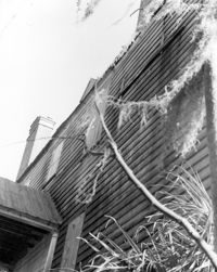
Arnoldus Vander Horst House (Kiawah House), Mansion Court. Detail View of clapboard, South (Front) elevation. Kiawah Island, S.C.;10" x 8" B/W photo. Box 12, Folder 2-6-1. One copy.
Arnoldus Vander Horst House (Kiawah House), Mansion Court. View of NW (Side and Rear) elevation. Kiawah Island, S.C.;10" x 6.5" B/W photo. Box 12, Folder 2-6-1. One copy.
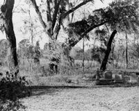
Ashley Hall Plantation, address restricted. Indian Mound - View of Side elevation. Charleston, S.C.;8" x 10" B/W photo. Box 13, Folder 2-9-1. One copy.
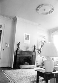
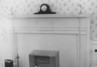
Old Rectory (Gourdin House). Interior View - Detail of Mantle on East Side. ENE elevation. Pineville Historic District. St. Stephen, SC.;6.5" x 9.5" B/W photo. Box 3, Folder 1-9-1 (I). One copy.
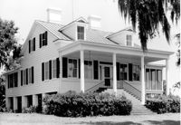
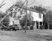
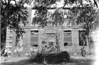
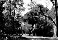
Ashley Hall Plantation, address restricted. Main House (Stephen Bull House) - View of West (Front and Side) elevation. Charleston, S.C.;8" x 10" B/W photo. Box 13, Folder 2-9-1. One copy.
Lawson's Pond Plantation, Lawson Pond Lane. Interior View - Detail of door frame in East Front Room. West elevation. Cross, SC.;6.5" x 9.5" B/W photo. Box 2, Folder 1-4-3. One copy.
Library Society Building. Interior View - Detail of Mantel on East Side. WNW elevation. Pineville Historic District. St. Stephen, SC.;6.5" x 9.5" B/W photo. Box 3, Folder 1-9-1 (I). One copy.
Old Rectory (Gourdin House). Interior View - Detail of Newel Post. WSW elevation. Pineville Historic District. St. Stephen, SC.;6.5" x 9.5" B/W photo. Box 3, Folder 1-9-1 (I). One copy.
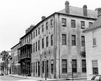
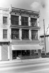
Cast Iron District, 207-235 Meeting Street - Detail of 235. View of NW (Front) elevation, looking North. Charleston, S.C.;10" x 6.5" B/W photo. Box 9, Folder 2-1-159. Three copies.
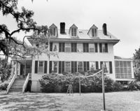
Boone Hall Plantation, Oak Avenue. Main House - View of North (Front) elevation. Mount Pleasant, S.C.;6.5" x 10" B/W photo. Box 10, Folder 2-2-5. One copy.
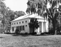
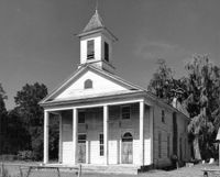
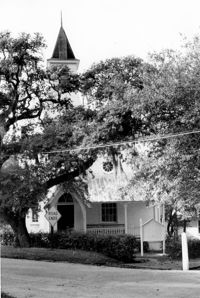
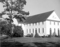
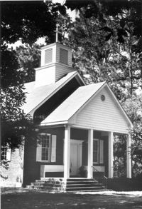
Johns Island Presbyterian Church, 2550 Bohicket Road. Church - View of Front and Side elevation. Johns Island, S.C.;8" x 10" B/W photo. Box 12, Folder 2-5-4. One copy.
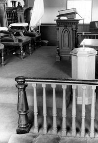
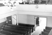
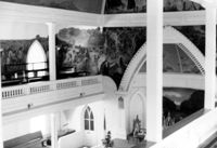
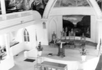
Central Baptist Church, 26 Radcliffe Street. Interior View - Upper Balcony and Chancel. SE (Front and Side) elevation. NOTE: Original print is out of focus. Charleston, S.C.;6.5" x 10" B/W photo. Box 9, Folder 2-1-156. One copy.
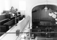
Central Baptist Church, 26 Radcliffe Street. Interior View - Altar and Pulpit. SE (Front and Side) elevation. NOTE: Original print is out of focus. Charleston, S.C.;6.5" x 10" B/W photo. Box 9, Folder 2-1-156. One copy.
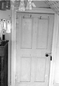
Seaside Plantation (Locksley Hall), off of Cypress Bottom Road. Interior View - 3rd Floor, West Bedroom. Detail of door, West elevation. Edisto Island, S.C.;5" x 7" B/W photo. Box 11, Folder 2-3-12. One copy.
St. Andrews Episcopal Church (Old St. Andrews Parish Church), 2604 Ashley River Road. View of South (Side) elevation. Charleston, S.C.;2" x 3" B/W photo. Box 14, Folder 2-9-7. One copy.
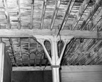
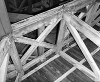
S.C. Railroad Car Shop (AAA Downtown Storage), 44 Line Street. Interior View - Detail of Support Beam. Charleston, S.C.;8" x 10" B/W photo. Box 18, Folder: Charleston: 44 Line Street, South Carolina Car Shop. One copy.
S.C. Railroad Car Shop (AAA Downtown Storage), 44 Line Street. Interior View - Unidentified Detail. Charleston, S.C.;8" x 10" B/W photo. Box 18, Folder: Charleston: 44 Line Street, South Carolina Car Shop. One copy.
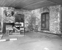
S.C. Railroad Car Shop (AAA Downtown Storage), 44 Line Street. Interior View - Unidentified Room. Charleston, S.C.;8" x 10" B/W photo. Box 18, Folder: Charleston: 44 Line Street, South Carolina Car Shop. One copy.
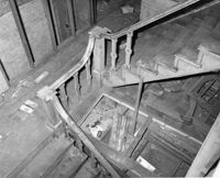
S.C. Railroad Car Shop (AAA Downtown Storage), 44 Line Street. Interior View - Detail of Staircase. Charleston, S.C.;8" x 10" B/W photo. Box 18, Folder: Charleston: 44 Line Street, South Carolina Car Shop. One copy.
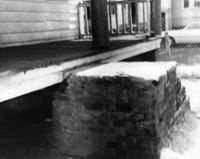
Fairlawn Plantation (Hugh Rose Plantation), Off of Guerins Bridge Road, adjacent to the Francis Marion National Forest. Detail View of Steam Engine for Rice Mill.;6.5" x 10" B/W photo. Box 19, Folder: Charleston County: Christ Church: Fairlawn Plantation. One copy.
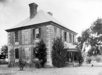
Brick House (Paul Hamilton House), Brick House Road (off of S.C. Hwy. 174). View of South (Front) elevation. Edisto Island, S.C.;6.5" x 10" B/W photo. Box 11, Folder 2-3-22. Two copies.
Marshlands Plantation, Fort Sumter Drive. Main House - View of SE (Front and Side) elevation. James Island, S.C.;8" x 10" B/W photo. Box 11, Folder 2-4-3. One copy.
Brick House (Paul Hamilton House), Brick House Road (off of S.C. Hwy. 174). View of SW (Side and Front) elevation. Edisto Island, S.C.;3" x 4" B/W photo. Box 11, Folder 2-3-22. One copy.
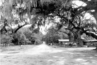
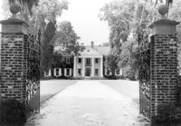
Magnolia Gardens, 3550 Ashley River Road. Main House and Grounds - View of South elevation. Charleston, S.C.;8" x 10" B/W photo. Box 13, Folder 2-9-6. Two copies.
Martha M. Porcher House, ca. 1901 - Pivotal to Historic District. View of Side and Front elevations. Pinopolis Historic District South. Pinopolis, S.C.;5" x 7" B/W photo. Box 3, Folder 1-10-1 (II). One copy.
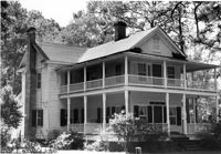
Louis H. Harvey House, ca. 1909 - Pivotal to Historic District. View of Front and Side elevations. Pinopolis Historic District South. Pinopolis, S.C.;5" x 7" B/W photo. Box 3, Folder 1-10-1 (II). One copy.
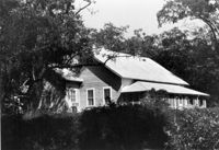
Unidentified House, ca. Early 20th century - Contributory to Historic District. Front and Side elevation. Pinopolis, S.C.;5" x 7" B/W photo. Box 3, Folder 1-10-1 (II). One copy.
W.K. Fishburne House, ca. 1911 - Pivotal to Historic District. View of Front and Side elevations. Pinopolis, S.C.;5" x 7" B/W photo. Box 3, Folder 1-10-1 (II). Three copies.
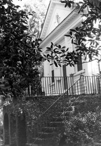
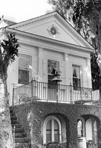
Trinity Episcopal Church, ca. 1844 - Contributory to Historic District. View of Front elevation. Pinopolis, S.C.;5" x 7" B/W photo. Box 3, Folder 1-10-1 (II). One copy.
Unidentified House, ca. 1980 - Non-contributory to Historic District. Front and Side elevations. Pinopolis, S.C.;5" x 7" B/W photo. Box 3, Folder 1-10-1 (II). One copy.
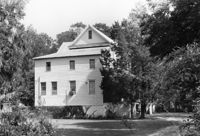
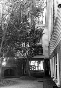
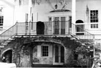
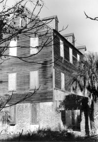
William Robertson House, ca. 1844 - Pivotal to Historic District. View of Front elevation. Pinopolis, S.C.;5" x 7" B/W photo. Box 3, Folder 1-10-1 (II). One copy.
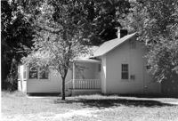
Unidentified House, ca. 1920 - Contributory to Historic District. Front elevation. Pinopolis Historic District South. Pinopolis, S.C.;5" x 7" B/W photo. Box 3, Folder 1-10-1 (II). One copy.
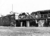
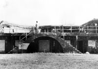
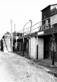
Battery Thomson, 2013 I'on Avenue. View of Armaments Section, North (Front) elevation. Sullivans Island, S.C.;6.5" x 10" B/W photo. Box 16, Folder 2-13-7. One copy.
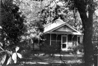
Eugenia I. Graham House (ca. 1904), Oak Street. View of Front elevation. McClellanville Historic District. McClellanville, S.C.;6.5" x 10" B/W photo. Box 14, Folder 2-10-5. One copy.
Battery Thomson, 2013 I'on Avenue. View of Gun Platform, North (Front) elevation. Sullivans Island, S.C.;6.5" x 10" B/W photo. Box 16, Folder 2-13-7. One copy.
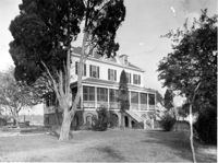
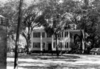
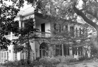
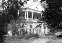
Lowndes Grove Plantation, 260 St. Margaret Street. Main House - View of NW (Front and Side) elevation. Charleston, S.C.;6.5" x 10" B/W photo. Box 8, Folder 2-1-148. One copy.
Lowndes Grove Plantation, 260 St. Margaret Street. Main House - View of NE (Front and Side) elevation. Charleston, S.C.;6.5" x 10" B/W photo. Box 8, Folder 2-1-148. One copy.
Lowndes Grove Plantation, 260 St. Margaret Street. Kitchen House - View of North (Front) elevation. Charleston, S.C.;10" x 6.5" B/W photo. Box 8, Folder 2-1-148. One copy.
John T. Hills House (ca. 1919). View of Front elevation. McClellanville Historic District. McClellanville, S.C.;6.5" x 10" B/W photo. Box 14, Folder 2-10-5. One copy.
Baker House (ca. 1913). View of Front elevation. McClellanville Historic District. McClellanville, S.C.;6.5" x 10" B/W photo. Box 14, Folder 2-10-5. One copy.
Battery Gadsden (Charleston County Public Library, Edgar Allen Poe Branch), 1921 I'on Avenue. View of East and Middle Wings, South (Rear) elevation. Sullivans Island, S.C.;6.5" x 10" B/W photo. Box 16, Folder 2-13-6. One copy.
Battery Gadsden (Charleston County Public Library, Edgar Allen Poe Branch), 1921 I'on Avenue. View of East Wing, South (Rear) elevation. Sullivans Island, S.C.;6.5" x 10" B/W photo. Box 16, Folder 2-13-6. One copy.
Battery Thomson, 2013 I'on Avenue. View of Observation Post, North (Front) elevation. Sullivans Island, S.C.;6.5" x 10" B/W photo. Box 16, Folder 2-13-7. One copy.
Battery Thomson, 2013 I'on Avenue. View of North (Front) elevation, looking West. Sullivans Island, S.C.;10" x 6.5" B/W photo. Box 16, Folder 2-13-7. One copy.
Battery Thomson, 2013 I'on Avenue. View of North (Front) elevation, looking East. Sullivans Island, S.C.;10" x 6.5" B/W photo. Box 16, Folder 2-13-7. One copy.