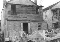
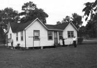
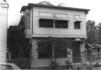
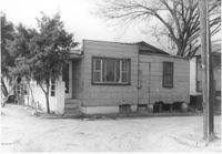
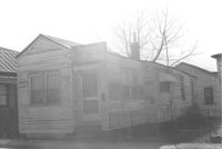
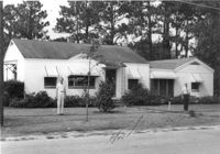
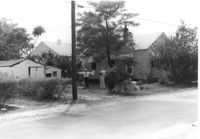
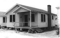
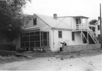
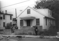
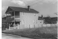
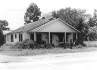
House (rear view) on site affected by the construction of Interstate 26 (I-26). Address: 5 Brigade Street. Surveyor notations on back of photo: "Dkt.: 10.503. Property owner: Maybelle Taylor. Tract: 46. Station: 5905+00 Lt. Date: Feb. 19, 1963. In R/W - Bought." [See collection description for explanation of surveyor notations.]
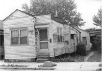
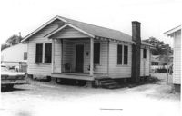
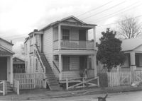
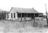
House (rear view) on site affected by the construction of Interstate 26 (I-26). Address: 1085 Meeting Street. Surveyor notations on back of photo: "Dkt.: 10.503. Property owner: Gussie Feldman. Tract: 41. Station: 5903+50 Lt. Date: Feb. 19, 1963. In R/W - Bought." [See collection description for explanation of surveyor notations.]
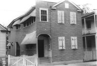
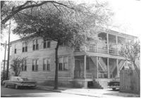
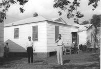
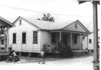
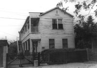
House on site affected by the construction of Interstate 26 (I-26). Address: 1085 Meeting Street. Surveyor notations on back of photo: "Dkt.: 10.503. Property owner: Gussie Feldman. Tract: 41. Station: 5903+50 Lt. (In Brigade Street R/W.) Date: Feb. 19, 1963. In R/W - Bought." [See collection description for explanation of surveyor notations.]
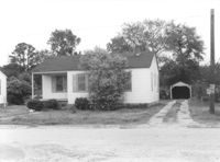
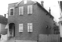
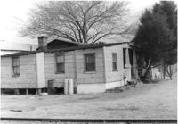
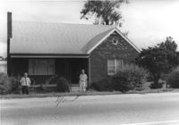
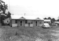
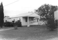
House on site affected by the widening of U.S. Route 17. Presumably located in Mount Pleasant or vicinity. Surveyor notations on back of photo: "Dkt.: 10.597. Property owner: F. Gregorie, Estate. Tract: 93. Station: 460± Rt. Date: Sept. 17, 1968." [See collection description for explanation of surveyor notations.]
House on site affected by the widening of U.S. Route 17. Presumably located in Mount Pleasant or vicinity. Surveyor notations on back of photo: "Dkt.: 10.597. Property owner: F. Gregorie, Estate. Tract: 93. Station: 460± Rt. Date: Sept. 17, 1968." [See collection description for explanation of surveyor notations.]
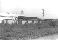
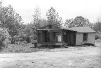
House-like structure in dilapidated condition (side view) on site affected by the construction of Interstate 26 (I-26). Dirt lot in foreground. Address: 739 Meeting Street. Surveyor notations on back of photo: "Dkt.: 10.503. Property owner: Eula Chitwood. Tract: 61. Station: 5909+30 Rt. Date: Feb. 20, 1963. In R/W - Bought." [See collection description for explanation of surveyor notations.]
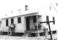
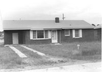
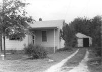
House on site affected by the construction of Interstate 26 (I-26). Building address number 197. Garage/shed at end of driveway. Surveyor notations on back of photo: "Dkt.: 10.480. Property owner: Geo. Smith, et al. Tract: 135. Station: 5654+50 Rt. Date: May 2, 1961. In R/W - Bought." [See collection description for explanation of surveyor notations.]
House on site affected by the construction of Interstate 26 (I-26). Building address number 189. Garage/shed at end of driveway. Surveyor notations on back of photo: "Dkt.: 10.480. Property owner: Elmer C. Waite. Tract: 131. Station: 5652+30 Rt. Date: May 2, 1961. In R/W - Bought." [See collection description for explanation of surveyor notations.]
House-like structure on site affected by the construction of Interstate 26 (I-26). Address: 739 Meeting Street. Surveyor notations on back of photo: "Dkt.: 10.503. Property owner: George E. Williams. Tract: 60. Station: 5909+30 Rt. Date: Feb. 20, 1963. In R/W - Bought." [See collection description for explanation of surveyor notations.]
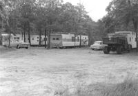
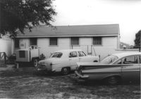
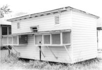
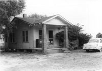
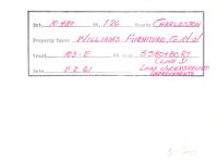
Trailers (trailer park?) on site affected by the construction of Interstate 26 (I-26). Surveyor notations on back of photo: "Dkt.: 10.480. Property owner: Williams Furniture Co., et al. Tract: 103-E. Station: 5580+80 Rt. (Line J). Date: May 2, 1961. Loss underground improvements." [See collection description for explanation of surveyor notations.]
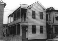
House (freedman's cottage) on site affected by the construction of Interstate 26 (I-26). Address: 23 Riker Street. Surveyor notations on back of photo: "Dkt.: 10.503. Property owner: Lucille Williams. Tract: 68. Station: 5911+40 Rt. Date: May 30, 1963. In R/W - Bought." [See collection description for explanation of surveyor notations.]
House (corner view) on site affected by the construction of Interstate 26 (I-26). Garage/shed at end of driveway. Surveyor notations on back of photo: "Dkt.: 10.480. Property owner: R.R. Barwick. Tract: 137. Station: 5655+80 Rt. Date: May 2, 1961. In R/W - Bought." [See collection description for explanation of surveyor notations.]
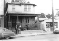
House on site affected by the construction of Interstate 26 (I-26). Address: 11 Brigade Street. Surveyor notations on back of photo: "Dkt.: 10.503. Property owner: Ada Williams. Tract: 42. Station: 5905+20 Rt. Date: Feb. 19, 1963. In R/W - Bought." [See collection description for explanation of surveyor notations.]
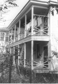
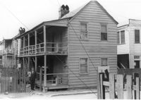
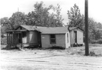
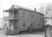
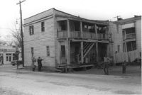
Row of houses on site affected by the construction of Interstate 26 (I-26). Address: 20-32 Brigade Street. Surveyor notations on back of photo: "Dkt.: 10.503. Property owner: Gussie Feldman. Tract: 41. Station: 5904+30 Rt. In R/W - Bought." [See collection description for explanation of surveyor notations.]
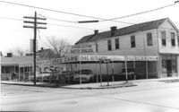
Building (corner view, front) on site affected by the construction of the Crosstown. Address: 120 Drake Street (based on buildings across the street). Sign in front: Harrisson & Co. Fishing Tacking Hardware. Elevated roadway (presumably the off-ramp of the Grace Memorial Bridge) in background. Surveyor notations on back of photo: "Dkt.: 10.518. Property owner: Frank J. Kelly. Tract: 78. Station: 55+60 Rt. N.B. lane Route 17. Date: Mar. 7, 1963." [See collection description for explanation of surveyor notations.]
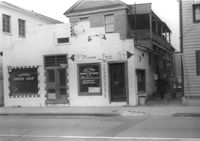
Building, on site affected by the construction of the Crosstown. Address: 209 Spring Street. Friendly Barber Shop and Spot Light Radio TV Service. Front facade has stepped parapet. Surveyor notations on back of photo: "Dkt.: 10.524. Property owner: Maybell Fields. Tract: 166. Station: 20+00 Rt. Spring Street. Date: Dec. 2, 1964." [See collection description for explanation of surveyor notations.]
Building, on site affected by the construction of the Crosstown. Address: 207 Spring Street. Sew-U-Save Shop. Surveyor notations on back of photo: "Dkt.: 10.524. Property owner: Olympia Papaeilidow. Tract: 167. Station: 20+35 Rt. Spring Street. Date: Dec. 2, 1964." [See collection description for explanation of surveyor notations.]
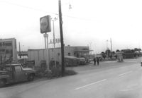
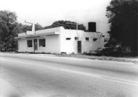
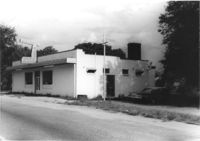
Shell gas station (rear view) on site affected by the construction of the Crosstown. Address: 233 Spring Street. Surveyor notations on back of photo: "Dkt.: 10.524. Property owner: Shell Oil Co. Tract: 155. Station: 9+00 Rt. Spring Street. Date: Dec. 2, 1965." [See collection description for explanation of surveyor notations.]
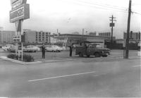
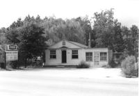
Hardee's, on site affected by the construction of the Crosstown. Address: 223 Spring Street. Surveyor notations on back of photo: "Dkt.: 10.524. Property owner: Sarah Chinnis Sanders. Tract: 157. Station: 14+60 Rt. Spring Street. Date: Dec. 2, 1964." [See collection description for explanation of surveyor notations.]
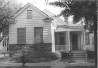
House on site affected by the construction of the Crosstown. Address: 114 Bogard Street. Surveyor notations on back of photo: "Dkt.: 10.524. Property owner: Francis Jenkins, et al. Tract: 64. Station: 75+70 CL Rt. Date: Oct. 14, 1964. In R/W - Bought." [See collection description for explanation of surveyor notations.]
House on site affected by the construction of the Crosstown. Address: 112 Bogard Street. Surveyor notations on back of photo: "Dkt.: 10.524. Property owner: Susan D. Butler, Est. Tract: 65. Station: 76+00 CL Rt. Date: Oct. 14, 1964. In R/W - Bought." [See collection description for explanation of surveyor notations.]
House on site affected by the construction of the Crosstown. Address: 116 Bogard Street. Surveyor notations on back of photo: "Dkt.: 10.524. Property owner: Arletha Powers. Tract: 63. Station: 75+40 CL. Date: Oct. 14, 1964. In R/W - Bought." [See collection description for explanation of surveyor notations.]
House on site affected by the construction of the Crosstown. Address: 116 Bogard Street. Surveyor notations on back of photo: "Dkt.: 10.524. Property owner: Arletha Powers. Tract: 63. Station: 75+40 CL. Date: Oct. 14, 1964. In R/W - Bought." [See collection description for explanation of surveyor notations.]
House in dilapidated condition on site affected by the construction of Interstate 26 (I-26). Outbuilding, possible once a market, in background. Has signs for Royal Crown Cola and Pepsi-Cola on front. Surveyor notations on back of photo: "Dkt.: 10.480. Property owner: J.L. Spencer, et al. Tract: 50. Station: 5515+30 Lt. Date: May 2, 1961. In R/W - Bought." [See collection description for explanation of surveyor notations.]
House (rear) on site affected by the construction of Interstate 26 (I-26). Address: 691 King Street. Surveyor notations on back of photo: "Dkt.: 10.517. Property owner: Henry Deas Jr., et al. Tract: 133. Station: 18+60 Rt. (Line "1"). Date: November 4, 1965. Rear view of subject residence. Not in R/W. Range poles on new R/W." [See collection description for explanation of surveyor notations.]
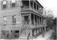
House (corner view, rear) on site affected by the construction of Interstate 26 (I-26). Address: 693 King Street. Surveyor notations on back of photo: "Dkt.: 10.517. Property owner: Rose Sokol. Tract: 132. Station: 19+85 Lt. and Rt. (Line "1"). Date: November 4, 1965. Rear view of residence. Complete lot and building in R/W." [See collection description for explanation of surveyor notations.]
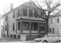
House on site affected by the construction of Interstate 26 (I-26). Address: 310 St. Philip Street. Surveyor notations on back of photo: "Dkt.: 10.517. Property owner: Benjamin W. Steed. Tract: 131. Station: 20+65 Lt. and Rt. (Line "1"). Date: November 4, 1965. Front view of subject residence and lot, all in R/W." [See collection description for explanation of surveyor notations.]
House on site affected by the construction of Interstate 26 (I-26). Address: 289 St. Philip Street. Surveyor notations on back of photo: "Dkt.: 10.517. Property owner: John Henry Mehrtens. Tract: 111. Station: 24+25 Rt. Southbound Lane Route 17. Date: March 5, 1963. In R/W - Bought." [See collection description for explanation of surveyor notations.]
House (rear view) on site affected by the construction of Interstate 26 (I-26). Address: 3 D Street. Surveyor notations on back of photo: "Dkt.: 10.517. Property owner: Hattie Bell Collier. Tract: 19. Station: 5946+20 Lt. - Line 1. Date: February 21, 1963. In R/W - Bought." [See collection description for explanation of surveyor notations.]
House on site affected by the construction of Interstate 26 (I-26). Address: 11 C Street. Surveyor notations on back of photo: "Dkt.: 10.517. Property owner: Irene D. Meyers. Tract: 22. Station: 5944+30 Lt. - Line 6. Date: February 21, 1963. In R/W - Bought." [See collection description for explanation of surveyor notations.]
House on site affected by the construction of Interstate 26 (I-26). Address: 3 D Street. Surveyor notations on back of photo: "Dkt.: 10.517. Property owner: Hattie Bell Collier. Tract: 19. Station: 5946+20 Lt. - Line 1. Date: February 21, 1963. In R/W - Bought." [See collection description for explanation of surveyor notations.]
House on site affected by the construction of Interstate 26 (I-26). Address: 7 C Street. Surveyor notations on back of photo: "Dkt.: 10.517. Property owner: Ida Sokol. Tract: 24. Station: 5945+00 Lt. - Line 6. Date: February 21, 1963. In R/W - Bought." [See collection description for explanation of surveyor notations.]
Building -- Simmons Garage -- on site affected by the construction of the Crosstown. Address: 76 Cooper Street or 78 Cooper Street. Front facade has stepped parapet. Surveyor notations on back of photo: "Dkt.: 10.518. Property owner: Helen Phillips Brown. Tract: 10. Station: 39+30 Rt. North Bound Survey of Route 17. Date: Mar. 6, 1963. In R/W - Bought. [See collection description for explanation of surveyor notations.]
Rear view of building -- Simmons Garage -- on site affected by the construction of the Crosstown. Address: 76 Cooper Street or 78 Cooper Street. Surveyor notations on back of photo: "Dkt.: 10.518. Property owner: Helen Phillips Brown. Tract: 10. Station: 39+30 Rt. North Bound Route 17 Lane. Date: Mar. 6, 1963. In R/W - Bought. [See collection description for explanation of surveyor notations.]
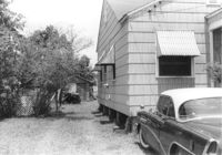
Building (rear view) on site affected by the construction of Interstate 26 (I-26). [Possibly previously a corner store with residence on second floor.] Surveyor notations on back of photo: "Dkt.: 10.490. Property owner: Robert Martin. Tract: 38. Station: 5957+45 on CL Line 'G'. Date: September 11, 1962. In R/W - Bought." [See collection description for explanation of surveyor notations.]
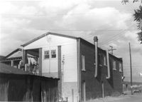
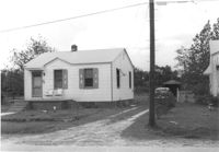
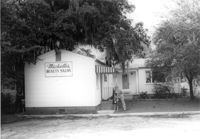
Michelle's Beauty Salon, on site affected by the widening of State Road 13 (Remount Road). Surveyor notations on back of photo: "Dkt.: 10.562. Property owner: Jerry Gray. Tract: 120. Date: Jul. 19, 1967." [See collection description for explanation of surveyor notations.]
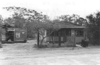
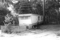
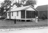
Mobile home on site affected by the widening of State Road 13 (Remount Road). Surveyor notations on back of photo: "Dkt.: 10.562. Property owner: Alline S. Crum. Tract: 139. Date: Jul. 19, 1967." [See collection description for explanation of surveyor notations.]
View of a row of utility poles on site affected by the construction of Interstate 26 (I-26). Charleston Plywood & Lumber Co. buildings in background. Surveyor notations on back of photo: "Dkt.: 10.490. Property owner: S.C. Electric & Gas Co. Tract: 134. Station: 5835+00 - 5835+50 Lt. Date: August 29, 1962. Camera on CL. Meters approximately 15 feet inside R/W." [See collection description for explanation of surveyor notations.]
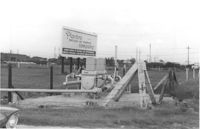
Industrial equipment on site affected by the construction of Interstate 26 (I-26). Billboard for Planters Fertilizer and Phosphate Company in background. Surveyor notations on back of photo: "Dkt.: 10.490. Property owner: Planters Fertilizer Co. Tract: 136. Station: 5843+40 Lt. Date: August 29, 1962. Moving items." [See collection description for explanation of surveyor notations.]
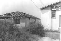
Unfinished cinder block structure next door to National Welders Supply Co., on site affected by the construction of Interstate 26 (I-26). Surveyor notations on back of photo: "Dkt.: 10.490. Property owner: Estell Stephney. Tract: 117. Station: 5830+05 Lt. Date: August 29, 1962. Rear of building to be removed by SCHD [SC Highway Department]." [See collection description for explanation of surveyor notations.]
Unfinished cinder block structure next door to National Welders Supply Co., on site affected by the construction of Interstate 26 (I-26). Surveyor notations on back of photo: "Dkt.: 10.490. Property owner: Estell Stephney. Tract: 117. Station: 5830+05 Lt. Date: August 29, 1962." [See collection description for explanation of surveyor notations.]
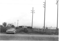
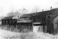
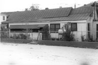
Dwellings on site affected by the construction of Interstate 26 (I-26). See previous seven photographs. Lane's Dry Cleaners and Laundry at left of photo. Surveyor notations on back of photo: "Dkt.: 10.471. Property owner: Palmetto Flower Corp. Tract: 143. Station: 5480+00 Lt. Date: Aug. 23, 1960. Panoramic view. In R/W - Bought." [See collection description for explanation of surveyor notations.]
House-like structure (rear view) and neighboring structures on site affected by the construction of Interstate 26 (I-26). Address: 739 Meeting Street. Surveyor notations on back of photo: "Dkt.: 10.503. Property owner: George E. Williams. Tract: 60. Station: 5909+30 Rt. Date: Feb. 20, 1963. In R/W - Bought." [See collection description for explanation of surveyor notations.]
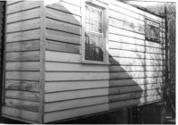
Exterior wall of freedman's cottage on site affected by the construction of Interstate 26 (I-26). Address: 23 Riker Street. Surveyor notations on back of photo: "Dkt.: 10.503. Property owner: Lucille Williams. Tract: 68. Station: 5911+35 Rt. Date: Feb. 20, 1963. In R/W - Bought." [See collection description for explanation of surveyor notations.]
House (freedman's cottage) on site affected by the construction of Interstate 26 (I-26). Address: 23 Riker Street. Surveyor notations on back of photo: "Dkt.: 10.503. Property owner: Lucille Williams. Tract: 68. Station: 5911+35 Rt. Date: Feb. 20, 1963. In R/W - Bought." [See collection description for explanation of surveyor notations.]
House (freedman's cottage) on site affected by the construction of Interstate 26 (I-26). Address: 23 Riker Street. Surveyor notations on back of photo: "Dkt.: 10.503. Property owner: Lucille Williams. Tract: 68. Station: 5911+40 Rt. Date: May 30, 1963. In R/W - Bought." [See collection description for explanation of surveyor notations.]
Dwelling on site affected by the construction of Interstate 26 (I-26). Surveyor notations on back of photo: "Dkt.: 10.471. Property owner: Palmetto Flower Corp. Tract: 143. Station: 5480+20 Lt. Date: Aug. 23, 1960. Building No. 3. In R/W - Bought." [See collection description for explanation of surveyor notations.]
House on site affected by the construction of Interstate 26 (I-26). Surveyor notations on back of photo: "Dkt.: 10.471. Property owner: Mildred G. Bowers. Tract: 141. Station: 3+00 Lt. (Remount Road). Date: Aug. 23, 1960. Proximity." [See collection description for explanation of surveyor notations.]
House on site affected by the construction of Interstate 26 (I-26). Surveyor notations on back of photo: "Dkt.: 10.471. Property owner: Donald C. Drennen. Tract: 106. Station: 5380+00 Lt. Date: Aug. 23, 1960. Proximity." [See collection description for explanation of surveyor notations.]
House on site affected by the construction of Interstate 26 (I-26). Surveyor notations on back of photo: "Dkt.: 10.471. Property owner: C.D. Jones. Tract: 101. Station: 5377± Rt. Date: Aug. 23, 1960. Proximity." [See collection description for explanation of surveyor notations.]
Building, on site affected by the construction of the Crosstown. Address: 209 Spring Street. Friendly Barber Shop and Spot Light Radio TV Service. Front facade has stepped parapet. Neighboring buildings on either side seen; Address 207 Spring Street and 211 Spring Street. Surveyor notations on back of photo: "Dkt.: 10.524. Property owner: Maybell Fields. Tract: 166. Station: 20+00 Rt. Spring Street. Date: Dec. 2, 1964." [See collection description for explanation of surveyor notations.]
Corner of house, with view of shed at rear of property, on site affected by the construction of Interstate 26 (I-26). Possibly on Rivers Avenue. Surveyor notations on back of photo: "Dkt.: 10.486. Property owner: Mrs. Ida K. Hill. Tract: 16. Station: 12+00 Rt. (Main Line). Date: May 30, 1961. In R/W - Bought." [See collection description for explanation of surveyor notations.]
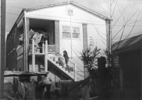
Side view of house (duplex) on site affected by the construction of Interstate 26 (I-26). Building address numbers 1809A and 1809B. Possibly on Rivers Avenue. Surveyor notations on back of photo: "Dkt.: 10.486. Property owner: Joseph S. & Vivian G. Walsh. Tract: 14. Station: 12+00 (Line D). Date: May 30, 1961. In R/W - Bought." [See collection description for explanation of surveyor notations.]
Side view of The Fork (restaurant) and lot on site affected by the construction of the Crosstown. Address: 223 Spring Street. Signs for the Castle Pinckney Motel and The Fork Restaurant at right. Presumably on Spring Street. Surveyor notations on back of photo: "Dkt.: 10.524. Property owner: The Fork Co. Inc. Tract: 156. Station: 13±00 Rt. Spring Street. Date: Dec. 2, 1964." [See collection description for explanation of surveyor notations.]
House (duplex) on site affected by the construction of Interstate 26 (I-26). Building address numbers 1809A and 1809B. Possibly on Rivers Avenue. Surveyor notations on back of photo: "Dkt.: 10.486. Property owner: Joseph S. & Vivian G. Walsh. Tract: 14. Station: 12+00 (Line D). Date: May 30, 1961. In R/W - Bought." [See collection description for explanation of surveyor notations.]
House (rear view) on site affected by the construction of Interstate 26 (I-26). Building address number 1812. Possibly on Rivers Avenue. Surveyor notations on back of photo: "Dkt.: 10.486. Property owner: J.A. Livingston. Tract: 15. Station: 11+80 Lt. Date: May 30, 1961. In R/W - Bought." [See collection description for explanation of surveyor notations.]
House on site affected by the construction of Interstate 26 (I-26). Building address number 1806. Possibly on Rivers Avenue. Surveyor notations on back of photo: "Dkt.: 10.486. Property owner: Cleve G. Murray. Tract: 12. Station: 10+90 Lt. Date: May 30, 1961. In R/W - Bought." [See collection description for explanation of surveyor notations.]
Side view of The Fork (restaurant) and lot on site affected by the construction of the Crosstown. Address: 223 Spring Street. Surveyor notations on back of photo: "Dkt.: 10.524. Property owner: The Fork Co. Inc. Tract: 156. Station: 13±00 Rt. Spring Street. Date: Dec. 2, 1964." [See collection description for explanation of surveyor notations.]
Billboard for BlueCross BlueShield on site affected by construction of the Crosstown. Billboard for Charleston Inn and 233 Spring Street (Shell gas station) in background. Presumably on Spring Street. Surveyor notations on back of photo: "Dkt.: 10.524. Property owner: Turner Advertising Co. Tract: 155. Station: 11±00 Rt. Spring Street. Date: Dec. 2, 1964." [See collection description for explanation of surveyor notations.]
House on site affected by the construction of Interstate 26 (I-26). Address: 691 King Street. Surveyor notations on back of photo: "Dkt.: 10.517. Property owner: Henry Deas Jr., et al. Tract: 133. Station: 18+60 Rt. (Line "1"). Date: November 4, 1965. Front view of subject residence showing portion in R/W. Range poles on new R/W." [See collection description for explanation of surveyor notations.]
House and shed at end of driveway on site affected by the construction of Interstate 26 (I-26). Address: 2133 Courtland Avenue. Surveyor notations on back of photo: "Dkt.: 10.490. Property owner: J.H. Black, et al. Tract: 165. Station: 5883±10 Lt. Date: August 29, 1962. In R/W - Bought." [See collection description for explanation of surveyor notations.]
View from street of house and sheds on site affected by the construction of Interstate 26 (I-26). Address: 1334 Rutledge Avenue. Surveyor notations on back of photo: "Dkt.: 10.490. Property owner: Heyward Barnes. Tract: 168. Station: 125' Rt. Sta. 5882+70. Date: May 15, 1962. Proximity." [See collection description for explanation of surveyor notations.]
Structure (possibly a bird coop) on site affected by the construction of Interstate 26 (I-26).Address: 1338 Rutledge Avenue. Surveyor notations on back of photo: "Dkt.: 10.490. Property owner: Louise S. Carter. Tract: 157. Station: 5880+90 Lt. Date: May 15, 1962. In R/W - Bought." [See collection description for explanation of surveyor notations.]
House (corner view, rear) on site affected by the construction of Interstate 26 (I-26). Address: 2127 Courtland Avenue. Surveyor notations on back of photo: "Dkt.: 10.490. Property owner: Geo. L. Johnson [George L. Johnson]. Tract: 162. Station: 5883±70 Lt. Date: August 29, 1962. Proximity." [See collection description for explanation of surveyor notations.]
House (rear view) on site affected by the construction of Interstate 26 (I-26). Address: Carters Court. Surveyor notations on back of photo: "Dkt.: 10.490. Property owner: Louise S. Carter. Tract: 151. Station: 30' Lt. Sta. 5880+10. Date: May 15, 1962. In R/W - Bought." [See collection description for explanation of surveyor notations.]
House on site affected by the construction of Interstate 26 (I-26). Address: 2 Carters Court. Surveyor notations on back of photo: "Dkt.: 10.490. Property owner: Louise S. Carter. Tract: 150. Station: 25' Lt. Sta. 5880+55. Date: May 15, 1962. In R/W - Bought." [See collection description for explanation of surveyor notations.]
House on site affected by the construction of Interstate 26 (I-26). Address: 4 Carters Court. Surveyor notations on back of photo: "Dkt.: 10.490. Property owner: Louise S. Carter. Tract: 149. Station: 35' Lt. Sta. 5881+00. Date: May 15, 1962. In R/W - Bought." [See collection description for explanation of surveyor notations.]
House on site affected by the construction of Interstate 26 (I-26). Address: Carters Court. Surveyor notations on back of photo: "Dkt.: 10.490. Property owner: Louise S. Carter. Tract: 151. Station: 30' Lt. Sta. 5880+10. Date: May 15, 1962. In R/W - Bought." [See collection description for explanation of surveyor notations.]
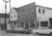
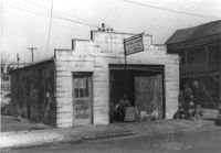
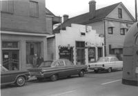
Corner of Meeting Street and Cooper Street. Charleston Auto Sales (510 Meeting Street) and Infinger's Shoe Store (508 Meeting Street), on site affected by the construction of the Crosstown. Surveyor notations on back of photo: "Dkt.: 10.518. Property owner: Robert L. Knoth. Tract: 14. Station: 5962+85 CL of Line 3 of the S.B. lane of Route 17. Date: Mar. 6, 1963. In R/W - Bought. [See collection description for explanation of surveyor notations.]
House (rear corner view) on site affected by the construction of the Crosstown. Address: 110 Bogard Street. Surveyor notations on back of photo: "Dkt.: 10.524. Property owner: Thomassina Elizabeth McCray. Tract: 72. Station: 76+60 Rt. Date: Oct. 14, 1964. In R/W - Bought." [See collection description for explanation of surveyor notations.]
House on site affected by the construction of the Crosstown. Address: 71 Kracke Street. Surveyor notations on back of photo: "Dkt.: 10.524. Property owner: William Henry Godfrey. Tract: 66. Station: 76+10 Lt. Date: Oct. 14, 1964. Portion in R/W to be removed." [See collection description for explanation of surveyor notations.]
House (rear view) and lot on site affected by the construction of the Crosstown. Address: 18-20 Wescott Street. Surveyor notations on back of photo: "Dkt.: 10.524. Property owner: Ralph E. Thornley, et al. Tract: 11. Station: 62+10 Lt. Date: Oct. 13, 1964." [See collection description for explanation of surveyor notations.]
Side view of house on site affected by the construction of the Crosstown. Address: 119 Bogard Street. Surveyor notations on back of photo: "Dkt.: 10.524. Property owner: Rebecca S. Cooper. Tract: 55. Station: 73+90 Rt. Date: Oct. 14, 1964. In R/W - Bought." [See collection description for explanation of surveyor notations.]
House on site affected by the construction of the Crosstown. Address: 110 Bogard Street. Surveyor notations on back of photo: "Dkt.: 10.524. Property owner: Thomassina Elizabeth McCray. Tract: 72. Station: 76+60 Rt. Date: Oct. 14, 1964. In R/W - Bought." [See collection description for explanation of surveyor notations.]
House on site affected by the construction of the Crosstown. Address: 190 Spring Street. Surveyor notations on back of photo: "Dkt.: 10.524. Property owner: E.H. Heidman, Est. Tract: 18. Station: 24± Lt. (Spring Street). Date: Oct. 13, 1964. Portion in R/W to be removed." [See collection description for explanation of surveyor notations.]
House on site affected by the construction of the Crosstown. Address: 190 Spring Street. Surveyor notations on back of photo: "Dkt.: 10.524. Property owner: E.H. Heidman, Est. Tract: 18. Station: 24± Lt. (Spring Street). Date: Oct. 13, 1964. Portion in R/W to be removed." [See collection description for explanation of surveyor notations.]
House on site affected by the construction of the Crosstown. Address: 22 Wescott Street. Surveyor notations on back of photo: "Dkt.: 10.524. Property owner: Ida J. Gantt. Tract: 10. Station: 61+20 Lt. Date: Oct. 13, 1964." [See collection description for explanation of surveyor notations.]
House on site affected by the construction of Interstate 26 (I-26). Building address number 183. Garage/shed at end of driveway. Surveyor notations on back of photo: "Dkt.: 10.480. Property owner: D.M. Swails, et al. Tract: 128. Station: 5650+40 Rt. Date: May 2, 1961. In R/W - Bought." [See collection description for explanation of surveyor notations.]
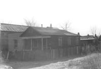
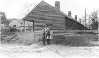
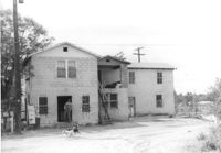
Building by railroad tracks, on site affected by the construction of Interstate 26 (I-26). Surveyor notations on back of photo: "Dkt.: 10.480. Property owner: Raymond O. Dion. Tract: 107. Station: 5630± to 5636±. Date: May 2, 1961. To be demolished." [See collection description for explanation of surveyor notations.]
House on site affected by the construction of Interstate 26 (I-26). Surveyor notations on back of photo: "Dkt.: 10.480. Property owner: Preston H. Mundy. Tract: 104. Station: 5574+70 Lt. (Line J). Date: May 2, 1961. In R/W - Bought." [See collection description for explanation of surveyor notations.]
House on site affected by the construction of Interstate 26 (I-26). Possibly on Rivers Avenue. Surveyor notations on back of photo: "Dkt.: 10.486. Property owner: John W. Faulkner. Tract: 3. Station: 6+40 Lt. Date: May 30, 1961. Proximity." [See collection description for explanation of surveyor notations.]
House on site affected by the construction of Interstate 26 (I-26). Surveyor notations on back of photo: "Dkt.: 10.480. Property owner: Paul W. Wall. Tract: 158. Station: 5670+20 Rt. Date: May 1, 1961. In R/W - Bought." [See collection description for explanation of surveyor notations.]
House on site affected by the construction of Interstate 26 (I-26). Surveyor notations on back of photo: "Dkt.: 10.480. Property owner: G.B. Lewis. Tract: 140. Station: 5657+60 Rt. Date: May 1, 1961. In R/W - Bought." [See collection description for explanation of surveyor notations.]
Owen's Dry Cleaners, on site affected by the construction of Interstate 26 (I-26). Building address number 2160. Surveyor notations on back of photo: "Dkt.: 10.471. Property owner: Willa W.S. Owens. Tract: 136. Station: 5477+80 Lt. Date: Aug. 23, 1960. In R/W - Bought." [See collection description for explanation of surveyor notations.]
House or apartment building on site affected by the construction of Interstate 26 (I-26). Pepsi-Cola sign and mailbox with address number 164 next to building. Surveyor notations on back of photo: "Dkt.: 10.480. Property owner: Central McMillan, et al. Tract: 38. Station: 5508+40 Rt. Date: May 2, 1961. In R/W - Bought." [See collection description for explanation of surveyor notations.]
House in dilapidated condition and adjacent structure on site affected by the construction of Interstate 26 (I-26). Building address number 316. Surveyor notations on back of photo: "Dkt.: 10.480. Property owner: Fred McMillian, et al. Tract: 41. Station: 5509+50 Lt. Date: May 2, 1961. In R/W - Bought." [See collection description for explanation of surveyor notations.]
House in dilapidated condition and adjacent structure on site affected by the construction of Interstate 26 (I-26). Building address number 316. Surveyor notations on back of photo: "Dkt.: 10.480. Property owner: Fred McMillian, et al. Tract: 41. Station: 5509+50 Lt. Date: May 2, 1961. In R/W - Bought." [See collection description for explanation of surveyor notations.]
House on site affected by the construction of Interstate 26 (I-26). Driveway leads to garage/shed. Surveyor notations on back of photo: "Dkt.: 10.480. Property owner: James W. Sadler. Tract: 123. Station: 5647+60 Lt. Date: May 1, 1961. In R/W - Bought." [See collection description for explanation of surveyor notations.]
House on site affected by the construction of Interstate 26 (I-26). Address: 10 Lenox Street. Surveyor notations on back of photo: "Dkt.: 10.503. Property owner: Benjamin Thompson. Tract: 37. Station: 5901+50 Lt. Date: Feb. 19, 1963. In R/W - Bought." [See collection description for explanation of surveyor notations.]
House on site affected by the construction of Interstate 26 (I-26). Address: 5 Lenox Street. Surveyor notations on back of photo: "Dkt.: 10.503. Property owner: Estelle Thompson. Tract: 40. Station: 5902+60 Lt. Date: Feb. 19, 1963. In R/W - Bought." [See collection description for explanation of surveyor notations.]
House on site affected by the construction of Interstate 26 (I-26). Address: 14 Lenox street. Surveyor notations on back of photo: "Dkt.: 10.503. Property owner: Harry Thompson. Tract: 38. Station: 5901+50 Rt. Date: Feb. 19, 1963. In R/W - Bought." [See collection description for explanation of surveyor notations.]
House on site affected by the construction of Interstate 26 (I-26). Address: 16 Lenox Street. Surveyor notations on back of photo: "Dkt.: 10.503. Property owner: Harry Thompson. Tract: 38. Station: 5901+50 Rt. Date: Feb. 19, 1963. In R/W - Bought." [See collection description for explanation of surveyor notations.]
House (rear and side view) on site affected by the construction of the Crosstown. Address: 215 Spring Street. Corner of Spring Street and Vaughan Street. Paint and hardware store across the street. Surveyor notations on back of photo: "Dkt.: 10.524. Property owner: Ruby E. Jacobs. Tract: 163. Station: 18+85 Rt. Spring Street. Date: Dec. 2, 1964. Partially In R/W - Bought." [See collection description for explanation of surveyor notations.]
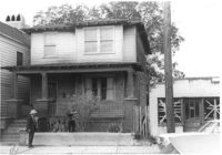
House on site affected by the construction of Interstate 26 (I-26). Building address number 1800. Possibly on Rivers Avenue. Surveyor notations on back of photo: "Dkt.: 10.486. Property owner: G.P. Parris, Est. Tract: 6. Station: 9+50 Lt. Date: May 30, 1961. In R/W - Bought." [See collection description for explanation of surveyor notations.]
Dwelling on site affected by the construction of Interstate 26 (I-26). Appears to be apartments. Surveyor notations on back of photo: "Dkt.: 10.471. Property owner: Palmetto Flower Corp. Tract: 143. Station: 5480+20 Lt. Date: Aug. 23, 1960. Building No. 5. In R/W - Bought." [See collection description for explanation of surveyor notations.]
House (rear view) on site affected by the construction of Interstate 26 (I-26). Possibly on Rivers Avenue. Surveyor notations on back of photo: "Dkt.: 10.486. Property owner: James M. Miller. Tract: 8. Station: 10+45 CL (Line D). Date: May 30, 1961. In R/W - Bought." [See collection description for explanation of surveyor notations.]
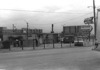
Portaro's Pizza Spaghetti Restaurant on site affected by the construction of Interstate 26 (I-26). Surveyor notations on back of photo: "Dkt.: 10.471. Property owner: Marko Moskas, et al. Tract: 144. Station: 5478+15 Lt. Date: Aug. 23, 1960. In R/W - Bought." [See collection description for explanation of surveyor notations.]
Portaro's Pizza Spaghetti Restaurant on site affected by the construction of Interstate 26 (I-26). Surveyor notations on back of photo: "Dkt.: 10.471. Property owner: Marko Moskas, et al. Tract: 144. Station: 5478+15 Lt. Date: Aug. 23, 1960. In R/W - Bought." [See collection description for explanation of surveyor notations.]
House on site affected by the construction of Interstate 26 (I-26). Surveyor notations on back of photo: "Dkt.: 10.471. Property owner: Palmetto Flower Corp. Tract: 143. Station: 5479+35 Lt. Date: Aug. 23, 1960. Building No. 1. In R/W - Bought." [See collection description for explanation of surveyor notations.]
Example of information written on back of photograph: Docket Number, Route, County, Property Owner, Tract, Station, Date, and added note pertaining to right-of-way.
Limit your search
SCDOT Photographs: Properties in the Right-of-Way✖[remove]2,276