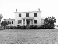
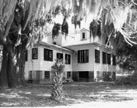
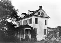
Middleton's Plantation (Chisolm's Plantation; The Launch), S.C. Hwy. 174. View of South (Front) elevation. Edisto Island, S.C.;8" x 10" B/W photo. Box 11, Folder 2-3-9. Two copies.
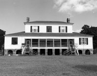
Middleton's Plantation (Chisolm's Plantation; The Launch), S.C. Hwy. 174. View of North (Rear) elevation. Edisto Island, S.C.;8" x 10" B/W photo. Box 11, Folder 2-3-9. One copy.
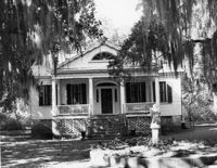
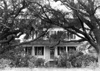
Old House Plantation, Clark Road. Main House - View of North (Front) elevation. Edisto Island, S.C.;8" x 10" B/W photo. Box 11, Folder 2-3-10. One copy.
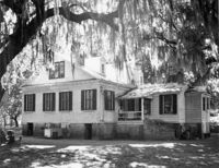
Old House Plantation, Clark Road. Main House - View of SE (Side and Rear) elevation. Edisto Island, S.C.;8" x 10" B/W photo. Box 11, Folder 2-3-10. One copy.
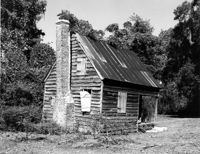
Old House Plantation, Clark Road. Slave Cabin - View of North (Side and Front) elevation. Edisto Island, S.C.;8" x 10" B/W photo. Box 11, Folder 2-3-10. One copy.
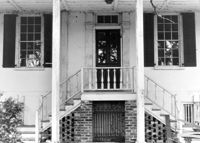
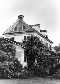
Seaside Plantation (Locksley Hall), off of Cypress Bottom Road. View of South (Front) elevation. Edisto Island, S.C.;8" x 10" B/W photo. Box 11, Folder 2-3-12. One copy.
Seaside Plantation (Locksley Hall), off of Cypress Bottom Road. Detail View of South (Front) elevation. Edisto Island, S.C.;8" x 10" B/W photo. Box 11, Folder 2-3-12. One copy.
Seaside Plantation (Locksley Hall), off of Cypress Bottom Road. View of SE (Front and Side) elevation. Edisto Island, S.C.;8" x 10" B/W photo. Box 11, Folder 2-3-12. One copy.
Seaside Plantation (Locksley Hall), off of Cypress Bottom Road. View of SW (Front and Side) elevation. Edisto Island, S.C.;10" x 8" B/W photo. Box 11, Folder 2-3-12. One copy.