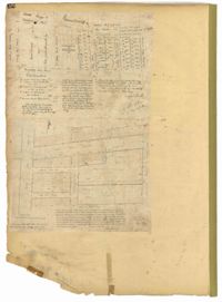
Page 12 of the City Engineer's Plat Book with two plats. Plat 1 shows plots near Coming Street, St. Phillip Street, King Street, Meeting Street, and Vanderhorst Street. Plat 2 Shows lots on Queen Street near the intersections with East Bay Street and Prioleau Street, has the label "Charleston Harbour Cooper River" on the right-hand margin.
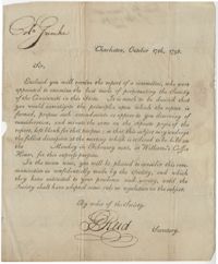
A short letter from George Reid, Secretary of the Society of the Cincinnati, to John F. Grimke regarding starting a society chapter in South Carolina. Reid notes that a meeting will be held at "William's Coffee House" to discuss the matter further.
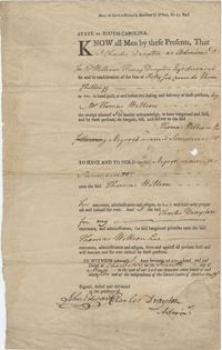
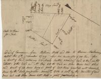
Copy of tract of land containing 200 acres, butting and bounding south and west by William Elliott, and on the east by Clay, and to the north by John Rivers. Names associated with this plat include William Webb, Thomas Mellichamp, Butler, William Elliott, William Clay, Shem, John Rivers, John S. Cripps, Samuel Jones, the Lords Proprietors, and Daniel Gibson.
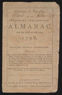
This is a Sandy Island plantation journal written inside of a South Carolina and Georgia almanac for the year 1798. The plantation journal documents the planting of crops (rice, corn and potatoes), runaway slaves (including women and children), business relations with Laurel Hill Plantation, the hiring of Mrs. Taylor's bricklayers, illness, the weather, calculations, and the receipt of cypress planks from Plowden Weston.
A short letter to Judge John F. Grimke from a "N. Marshal" asking for more information about a particular "daily" [newspaper?] mentioned in a court case.