Search
« Previous |
91 - 100 of 103
|
Next »
Search Results
Date:
1945
Description:
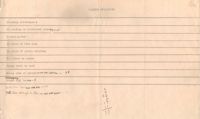
A parking violations tally sheet (presumably of area shown on attached map) with the corresponding map of the Charleston peninsula; survey area marked.
Date:
1945
Description:
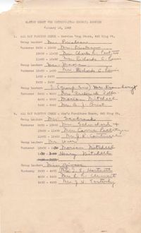
Master sheet for the Metropolitan Council parking survey, listing parking check location, group leaders, shifts and workers (Jan. 16,1945).
Date:
1945
Description:
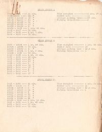
Metropolitan Council traffic survey report for parking spaces 1-13 and a bus stop; location not indicated.
Date:
1944-09
Description:
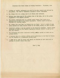
Summary of an interview done with James Altman by June S. Wing regarding parking and parking practices (Sept., 1944).
Description:
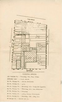
Map of area bounded by Calhoun Street, King Street, George Street, and St. Philip Street.
Description:
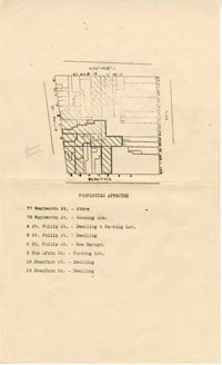
Map of area bounded by Wentworth Street, St. Philip Street, Beaufain Street, and King Street.
Description:
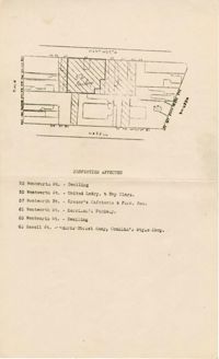
Map of area bounded by Wentworth Street, Meeting Street, Hasell Street, and King Street.
Description:
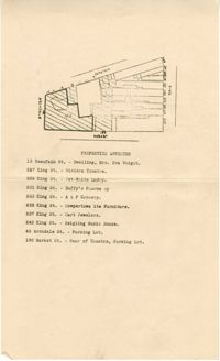
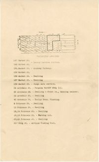
Map of area bounded by Archdale Street, Beaufain Street, King Street, and Market Street.
Description:
Map of area bounded by Market Street, King Street, Princess Street, and Archdale Street.
Date:
1944-10-01
Description:
News and Courier article (Oct. 1, 1944), "Metropolitan Council Formed, Parking Poll to Start Oct. 16."