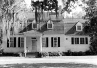
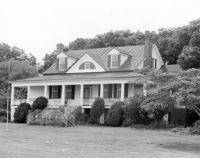
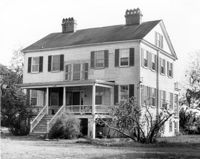
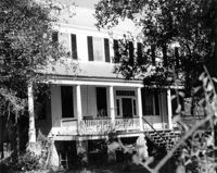
Oakland Plantation (Youghall Plantation), 1164 Porcher Bluff Road. Main House - View of North (Front) elevation. Mount Pleasant, S.C.;6.5" x 10" B/W photo. Box 10, Folder 2-2-10. One copy.
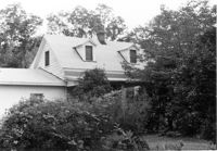
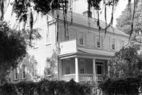
Oakland Plantation (Youghall Plantation), 1164 Porcher Bluff Road. Main House - View of South (Rear) elevation. Mount Pleasant, S.C.;6.5" x 10" B/W photo. Box 10, Folder 2-2-10. One copy.
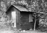
William Robertson House - Office (Wampee Plantation Summer House). View of SW (Front and Side) elevation. Pinopolis, S.C.;9.5" x 6.5" B/W photo. Box 4, Folder 1-10-1 (III). Two copies.
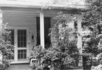
Dr. Morton Waring House - Lodge. Detail View of Front Porch, East (Front) elevation. Pinopolis Historic District South. Pinopolis, S.C.;6.5" x 9.5" B/W photo. Box 4, Folder 1-10-1 (III). Two copies.
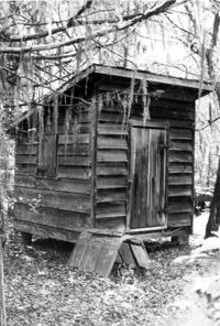
Dr. Morton Waring House - Outbuilding. View of NE (Side and Front) elevation. Pinopolis Historic District South. Pinopolis, S.C.;6.5" x 9.5" B/W photo. Box 4, Folder 1-10-1 (III). Two copies.
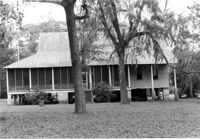
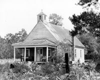
Dean Hall Plantation - Overseers House. View of East (Front) elevation. Oakley, SC. NOTE: Property relocated to Moncks Corner, S.C.;8" x 10" B/W photo. Box 2, Folder 1-8-9. One copy.
Dr. Morton Waring House - Office. View of SE (Front and Side) elevation. Pinopolis Historic District South. Pinopolis, S.C.;6.5" x 9.5" B/W photo. Box 4, Folder 1-10-1 (III). Two copies.
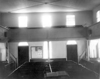
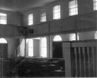
Johns Island Presbyterian Church, 2550 Bohicket Road. Church - Interior View. Pews and Entrance Doors, Rear elevation. Johns Island, S.C.;8" x 10" B/W photo. Box 12, Folder 2-5-4. Two copies.
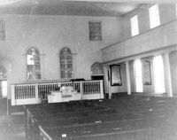
Johns Island Presbyterian Church, 2550 Bohicket Road. Church - Interior View. Sanctuary, Front elevation. Johns Island, S.C.;6.5" x 10" B/W photo. Box 12, Folder 2-5-4. One copy.
Dr. Morton Waring House - Lodge. View of NW (Side and Rear) elevation. Pinopolis Historic District South. Pinopolis, S.C.;6.5" x 9.5" B/W photo. Box 4, Folder 1-10-1 (III). Two copies.
Captain Peter Lewis House, 206 Live Oak Drive. View of West (Side) elevation. Mount Pleasant, S.C.;6.5" x 10" B/W photo. Box 13, Folder 2-8-12. Two copies.
Secessionville Manor (Secessionville Plantation), Battallion Drive. View of NE (Side and Waterfront) elevation. Charleston, S.C.;6.5" x 10" B/W photo. Box 12, Folder 2-4-6. One copy.
Dr. Morton Waring House - Lodge. View of East (Front) elevation. Pinopolis Historic District South. Pinopolis, S.C.;6.5" x 9.5" B/W photo. Box 4, Folder 1-10-1 (III). Two copies.
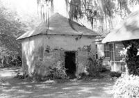
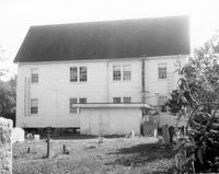
Oakland Plantation (Youghall Plantation), 1164 Porcher Bluff Road. Smoke House - View of NE (Front and Side) elevation. Mount Pleasant, S.C.;6.5" x 10" B/W photo. Box 10, Folder 2-2-10. One copy.
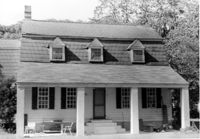
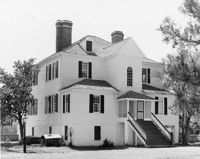
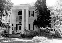
Isaac Porcher House - Main House. View of North (Front) elevation. Pinopolis Historic District North. Pinopolis, S.C.;6.5" x 9.5" B/W photo. Box 4, Folder 1-10-1 (III). Two copies.
Dean Hall Plantation - Overseers House. View of North (Side) elevation. Oakley, SC. NOTE: Property relocated to Moncks Corner, S.C.;8" x 10" B/W photo. Box 2, Folder 1-8-9. One copy.
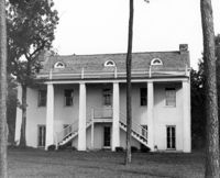
Windsor Plantation (Little Edisto Plantation, Ashwood Plantation), S.C. Hwy. 174. View of SE (Rear and Side) elevation. Edisto Island, S.C.;8" x 10" B/W photo. Box 11, Folder 2-3-18. One copy.
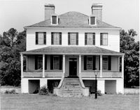
McLeod Plantation, 325 Country Club Drive. Main House - View of NE (Rear and Side) elevation. Charleston, S.C.;6.5" x 10" B/W photo. Box 12, Folder 2-4-5. One copy.
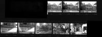
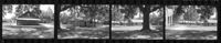
Old Carroll House (Carroll Place), Junction of Quaker and Wire Roads. Contact Sheet 13 - Multiple Views. St. George, S.C.;10" x 4" B/W photo. Box 20, Folder: Miscellaneous Photos: Scanned Contact Sheets. One copy.
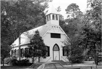
Church of the Redeemer (Pineville Chapel), Matilda Circle. View of SE (Side and Rear) elevation. Pineville Historic District. Pineville, SC.;6.5" x 9.5" B/W photo. Box 3, Folder 1-9-1 (I). One copy.
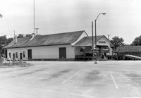
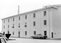
Moncks Corner Railroad Station. View of West (Front) elevation - taken from the NE. Moncks Corner, SC.;6.5" x 9.5" B/W photo. Box 2, Folder 1-8-15. Three copies.
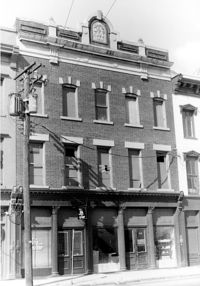
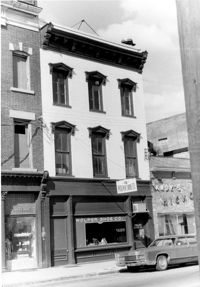
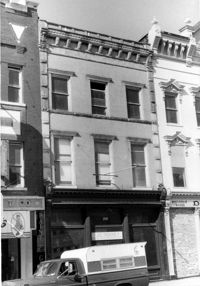
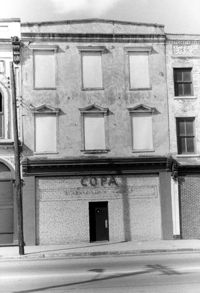
Cast Iron District, 207-235 Meeting Street - Detail of 215. View of NW (Front) elevation, looking North. Charleston, S.C.;10" x 6.5" B/W photo. Box 9, Folder 2-1-159. Three copies.
Cast Iron District, 207-235 Meeting Street - Detail of 217. View of NW (Front) elevation, looking North. Charleston, S.C.;10" x 6.5" B/W photo. Box 9, Folder 2-1-159. Three copies.
Cast Iron District, 207-235 Meeting Street - Detail of 209. View of NW (Front) elevation, looking North. Charleston, S.C.;10" x 6.5" B/W photo. Box 9, Folder 2-1-159. Three copies.
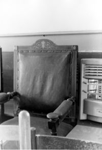
Old Bethel Methodist Church, 222 Calhoun Street. Interior View - Detail of Old Bishop's Chair. South (Rear) elevation. Charleston, S.C.;10" x 6.5" B/W photo. Box 7, Folder 2-1-43. One copy.
Magnolia Cemetery, Huguenin Avenue and Algonquin Road. Pump House and Gazebo - View of NW (Front and Side) elevation. Charleston, S.C.;8" x 10" B/W photo. Box 5, Folder 2-1-3. One copy.
Comingtee Rice Barn (Mill), Located along the Western branch of the Cooper River. Contact Sheet 9 - Multiple Views. Berkeley County, S.C.;6" x 1" B/W photo. Box 20, Folder: Miscellaneous Photos: Scanned Contact Sheets. One copy.
Old Rectory (Gourdin House). Interior View - Detail of Mantle on East Side, 2nd Floor. ENE elevation. Pineville Historic District. St. Stephen, SC.;6.5" x 9.5" B/W photo. Box 3, Folder 1-9-1 (I). One copy.
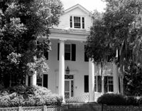
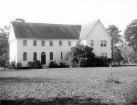
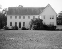
Rockville Historic District - Stevens House (Major Daniel Jenkins House), Maybank Highway. View of South (Front) elevation. Wadmalaw, S.C.;6.5" x 10" (and 8" x 10") B/W photo. Box 17, Folder 2-14-17. Two copies.
Cast Iron District, 207-235 Meeting Street - Detail of 231. View of NW (Front) elevation, looking North. Charleston, S.C.;10" x 6.5" B/W photo. Box 9, Folder 2-1-159. Three copies.
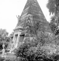
Magnolia Cemetery, Huguenin Avenue and Algonquin Road. William B. Smith Mausoleum. View of Side and Front elevation. Charleston, S.C.;8" x 8" B/W photo. Box 5, Folder 2-1-3. One copy.
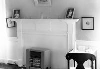
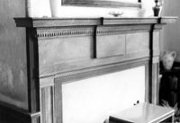
Lawson's Pond Plantation, Lawson Pond Lane. Interior View - Detail of mantle in East Front Room. NW elevation. Cross, SC.;6.5" x 9.5" B/W photo. Box 2, Folder 1-4-3. One copy.
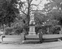
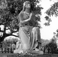
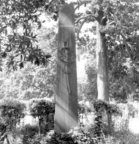
Magnolia Cemetery, Huguenin Avenue and Algonquin Road. Tombstone of Micah Jenkins. View of Front elevation. Charleston, S.C.;8" x 8" B/W photo. Box 5, Folder 2-1-3. One copy.
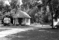
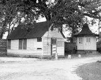
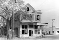
Firetag's Store (Mappus' Store, Six Mile Store) - View of NE (Front and Side) elevation. North Charleston, S.C.;6.5" x 10" B/W photo. Box 5, Folder 2-1-7. One copy.
Johns Island Presbyterian Church, 2550 Bohicket Road. Church - Interior View. Sanctuary, Front elevation. Johns Island, S.C.;8" x 10" B/W photo. Box 12, Folder 2-5-4. One copy.
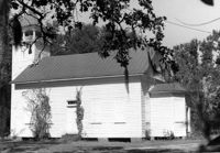
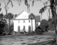
Johns Island Presbyterian Church, 2550 Bohicket Road. Church - View of Front elevation. Johns Island, S.C.;8" x 10" B/W photo. Box 12, Folder 2-5-4. Two copies.
Johns Island Presbyterian Church, 2550 Bohicket Road. Church - View of Front elevation. Johns Island, S.C.;8" x 10" B/W photo. Box 12, Folder 2-5-4. One copy.
Johns Island Presbyterian Church, 2550 Bohicket Road. Church - View of Front elevation. Johns Island, S.C.;8" x 10" B/W photo. Box 12, Folder 2-5-4. One copy.
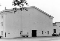
Johns Island Presbyterian Church, 2550 Bohicket Road. Church - View of Rear elevation. Johns Island, S.C.;8" x 10" B/W photo. Box 12, Folder 2-5-4. One copy.
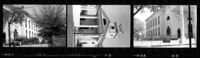
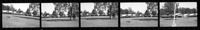
Cathedral of St. Luke and St. Paul, 126 Coming Street. Contact Sheet 7 - Views of Front and Sides elevations. Charleston, S.C.;1" x 4.5" B/W photo. Box 20, Folder: Miscellaneous Photos: Scanned Contact Sheets. One copy.