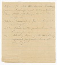
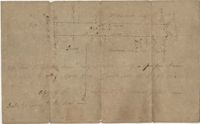
A record of tasks completed between 1731-1771 that includes placing shingles on the house at Comingtee Plantation, accounts with carpenters and work on the gardens at Comingtee and Kensington Plantations. Makes notation that the enslaved persons Salsbury, Manny, Easter and Pompey worked on the garden at Kensington Plantation.
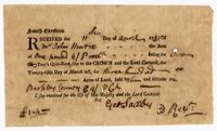
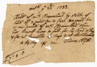
A receipt from Saxby stating that John Hentie paid one pound for two years "Quit-rent "due to the crown, and paid the Lord Carteret for three hundred acres of land.
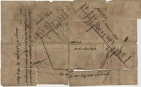
1100 acres of land belonging to Thomas Woodward on the east and west side of Fish Pond Creek known as Ashepoo River. Names associated with this plat are Thomas Woodward, Elizabeth Woodward, James St. John, Billinger, and Blaky, and William. Notable geographic locations include Ashepoo River and Fish Pond Creek.
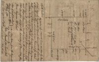
650 acres belonging to Thomas Cordes on eastwest side of Fishpond Creek/ Ashepoo River bounding northwest on Elizabeth Woodward and south by Captain John Gibbes. Names associated with this plat are Thomas Cordes, Elizabeth Woodward, Captain John Gibbes, and Robert Johnson. Notable geographic locations include Fishpond Creek, the Ashepoo River and St. Bartholomew's Parish.
Plat contains 700 acres in Colleton County on the north side of Round O Savannah. Grant dated September 30, 1736. Names associated with this plat are Robert Bath, James St. John, James Ferguson and Peter Bremar. Notable geographic locations include Colleton County and St. Bartholomew's Parish.
Copy of plat of 230 acres granted to Bryan Presly in Colleton County on Pon Pon River. Names associated with this plat are Bryan Presly, and John Bull, and Hendrich. Notable geographic locations include Pon Pon River and Colleton County.
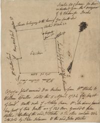
64 acre plot of land on the north side of the Ashley River, notes on the plat include some notes about stocks, shows surrounding tracts of lands, no land type or detail. Names associated with this plat are William Fuller, John Johnson, James Simmons, Stocks, William Fuller, George Smith, Henry Wood and John Hewson.
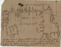
340 acres of land laid out to George Mitchell on the east side of a branch of Ashepoo River called the Horseshoe Creek. Names associated with this plat are George Mitchell, James St. John, Thomas Broughton and John Andrews. Notable geographic locations include the Ashepoo River and Horseshoe Creek.