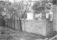
Backyard and cinder block wall on site affected by the construction of the Crosstown. Address: 180 Spring Street. Surveyor notations on back of photo: "Dkt.: 10.524. Property owner: Edward Keith. Tract: 29. Station: 66+95 Rt. Date: Oct. 13, 1964. Portion In R/W - Bought." [See collection description for explanation of surveyor notations.]
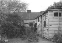
Backyard and rear view of portion of house on site affected by the construction of the Crosstown. Address: 159 President Street. Surveyor notations on back of photo: "Dkt.: 10.524. Property owner: James E. Campbell. Tract: 37. Station: 69± Lt. Date: Oct. 14, 1964." [See collection description for explanation of surveyor notations.]
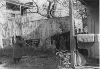
Backyard of house on site affected by the construction of the Crosstown. Address: 122 Sheppard Street. Surveyor notations on back of photo: "Dkt.: 10.524. Property owner: Archie B. Hollins. Tract: 136. Station: 17+40 Lt. S.B. lane. Date: Dec. 2, 1964. Outside R/W." [See collection description for explanation of surveyor notations.]
Right of way--South Carolina--Charleston County, Highway planning--South Carolina--Charleston County, Vernacular architecture--South Carolina--Charleston County, Lost architecture--South Carolina--Charleston County, Dwellings--South Carolina--Charleston County, Backyards--South Carolina--Charleston County✖[remove]3