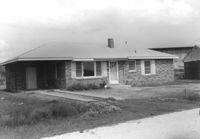
House on site affected by the construction of Interstate 26 (I-26). Building address number 34. Surveyor notations on back of photo: "Dkt.: 10.480. Property owner: Roy T. Reese. Tract: 159. Station: 5670+70 Rt. Date: May 2, 1961. In R/W - Bought." [See collection description for explanation of surveyor notations.]
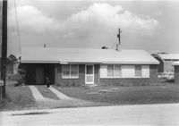
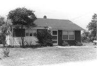
House on site affected by the construction of Interstate 26 (I-26). Building address number 36. Surveyor notations on back of photo: "Dkt.: 10.480. Property owner: Calvin L. Rogers. Tract: 160. Station: 5661+30 Rt. Date: May 2, 1961. In R/W - Bought." [See collection description for explanation of surveyor notations.]
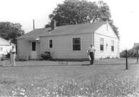
House (corner view, rear) on site affected by the construction of Interstate 26 (I-26). Surveyor notations on back of photo: "Dkt.: 10.480. Property owner: Amos P. Hardy Sr., Est. Tract: 282. Station: 5732+20 Lt. (Line B). Date: May 30, 1961. Proximity." [See collection description for explanation of surveyor notations.]
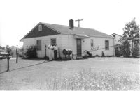
House (corner view, rear) on site affected by the construction of Interstate 26 (I-26). Surveyor notations on back of photo: "Dkt.: 10.480. Property owner: Tujax, Inc. Tract: 283. Station: 5732+70 Lt. (Line B). Date: May 30, 1961. In R/W - Bought." [See collection description for explanation of surveyor notations.]
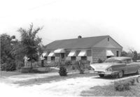
House on site affected by the construction of Interstate 26 (I-26). Building address number 109. Surveyor notations on back of photo: "Dkt.: 10.480. Property owner: Tujax, Inc. Tract: 283. Station: 5732+70 Lt. (Line B). Date: May 30, 1961. In R/W - Bought." [See collection description for explanation of surveyor notations.]
House (corner view, rear) on site affected by the construction of Interstate 26 (I-26). Surveyor notations on back of photo: "Dkt.: 10.480. Property owner: Norman Lubesky. Tract: 284. Station: 5733+50 Lt. (Line B). Date: May 30, 1961. In R/W - Bought." [See collection description for explanation of surveyor notations.]
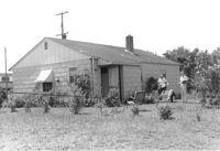
House on site affected by the construction of Interstate 26 (I-26). Building address number 105. Surveyor notations on back of photo: "Dkt.: 10.480. Property owner: Norman Lubesky. Tract: 284. Station: 5733+50 Lt. (Line B). Date: May 30, 1961. In R/W - Bought." [See collection description for explanation of surveyor notations.]
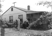
House (rear view) on site affected by the construction of Interstate 26 (I-26). Surveyor notations on back of photo: "Dkt.: 10.480. Property owner: Harold W. Cone. Tract: 285. Station: 5734+10 Lt. (Line B). Date: May 30, 1961. Proximity." [See collection description for explanation of surveyor notations.]
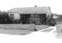
House on site affected by the construction of Interstate 26 (I-26). Surveyor notations on back of photo: "Dkt.: 10.480. Property owner: Mrs. Lovie Mae Smith. Tract: 287. Station: 5737+40 Lt. (Line B). Date: May 30, 1961. In R/W - Bought." [See collection description for explanation of surveyor notations.]
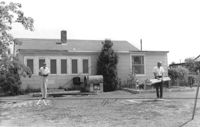
House (corner view, rear) and backyard, on site affected by the construction of Interstate 26 (I-26). Surveyor notations on back of photo: "Dkt.: 10.480. Property owner: Mrs. Lovie Mae Smith. Tract: 287. Station: 5737+40 Lt. (Line B). Date: May 30, 1961. In R/W - Bought." [See collection description for explanation of surveyor notations.]
Right of way--South Carolina--Charleston County, Highway planning--South Carolina--Charleston County, Vernacular architecture--South Carolina--Charleston County, Lost architecture--South Carolina--Charleston County, Dwellings--South Carolina--Charleston County✖[remove]282