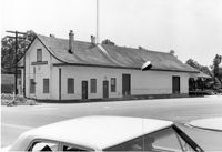
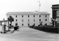
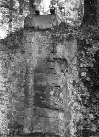
Moncks Corner Railroad Station. View of West (Front) elevation - taken from the SE. Moncks Corner, SC.;6.5" x 9.5" B/W photo. Box 2, Folder 1-8-15. Three copies.
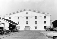
Moncks Corner Railroad Station. View of West (Front) elevation - taken from the NE. Moncks Corner, SC.;6.5" x 9.5" B/W photo. Box 2, Folder 1-8-15. Three copies.
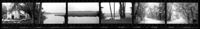
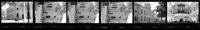
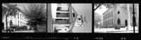
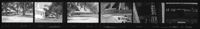
Ashley River Historic District (Highway 61 Historical District). Contact Sheet 6 - Views of Ashley Hall Plantation, Old St. Andrews Parish Church, and Ashley River Road. Charleston, S.C.;1" x 9" B/W photo. Box 20, Folder: Miscellaneous Photos: Scanned Contact Sheets. One copy.
Ashley River Historic District (Highway 61 Historical District). Contact Sheet 6 - Views of Drayton Hall and Ashley River Road. Charleston, S.C.;1" x 9" B/W photo. Box 20, Folder: Miscellaneous Photos: Scanned Contact Sheets. One copy.
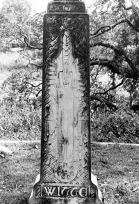
Magnolia Cemetery, Huguenin Avenue and Algonquin Road. Tombstone of Elizabeth DeSaussure Tucker. Charleston, S.C.;10" x 8" B/W photo. Box 5, Folder 2-1-3. One copy.
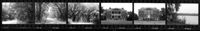
Cathedral of St. Luke and St. Paul, 126 Coming Street. Contact Sheet 7 - Views of Rear and Sides elevations. Charleston, S.C.;1" x 9" B/W photo. Box 20, Folder: Miscellaneous Photos: Scanned Contact Sheets. One copy.
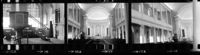
Cathedral of St. Luke and St. Paul, 126 Coming Street. Contact Sheet 7 - Views of Interior. Charleston, S.C.;1" x 4.5" B/W photo. Box 20, Folder: Miscellaneous Photos: Scanned Contact Sheets. One copy.
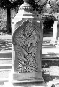
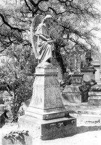
Magnolia Cemetery, Huguenin Avenue and Algonquin Road. Monument of Ellen Turner, ca. 1898. View of Front and Side elevation. Charleston, S.C.;10" x 6.5" B/W photo. Box 5, Folder 2-1-3. One copy.
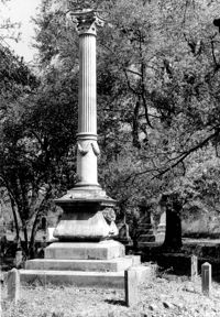
Magnolia Cemetery, Huguenin Avenue and Algonquin Road. Monument of Hugh Swinton Legare. View of Front and Side elevation. Charleston, S.C.;10" x 6.5" B/W photo. Box 5, Folder 2-1-3. One copy.
Cathedral of St. Luke and St. Paul, 126 Coming Street. Contact Sheet 7 - Views of Front and Sides elevations. Charleston, S.C.;1" x 4.5" B/W photo. Box 20, Folder: Miscellaneous Photos: Scanned Contact Sheets. One copy.
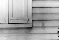
Church of the Redeemer (Pineville Chapel), Matilda Circle. Detail View of Window Sash and Shutter Dog - SE (Front) elevation. Pineville Historic District. Pineville, SC.;6.5" x 9.5" B/W photo. Box 3, Folder 1-9-1 (I). One copy.
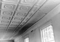
Church of the Redeemer (Pineville Chapel), Matilda Circle. Interior View - Detail of Chancel. SSE (Front and Side) elevation. Pineville Historic District. Pineville, SC.;6.5" x 9.5" B/W photo. Box 3, Folder 1-9-1 (I). One copy.
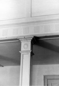
Church of the Redeemer (Pineville Chapel), Matilda Circle. Interior View - Detail of Column and Molding on Balcony. West (Rear) elevation. Pineville Historic District. Pineville, SC.;9.5" x 6.5" B/W photo. Box 3, Folder 1-9-1 (I). One copy.
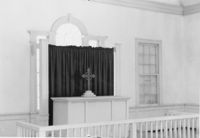
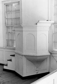
Church of the Redeemer (Pineville Chapel), Matilda Circle. Interior View - Detail of Pulpit. SSE (Front and Side) elevation. Pineville Historic District. Pineville, SC.;9.5" x 6.5" B/W photo. Box 3, Folder 1-9-1 (I). One copy.
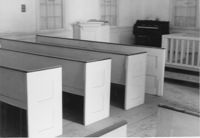
Church of the Redeemer (Pineville Chapel), Matilda Circle. Interior View - Detail of Pews. NNE (Side and Rear) elevation. Pineville Historic District. Pineville, SC.;6.5" x 9.5" B/W photo. Box 3, Folder 1-9-1 (I). One copy.
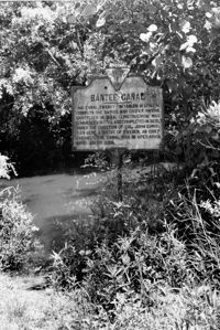
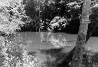
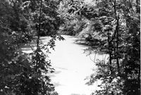
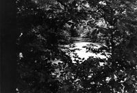
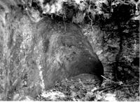
White Oak Lock. View down canal from White Oak lock showing cypress planking to retain water. Tailrace Canal, Old Santee Canal Park. Berkeley, SC.;6.5" x 9.5" B/W photo. Box 3, Folder 1-9-2. One copy.
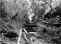
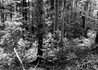
White Oak Lock. Santee Canal Section - General View; Trees in foreground are on Tow path. Tailrace Canal, Old Santee Canal Park. Berkeley, SC.;6.5" x 9.5" B/W photo. Box 3, Folder 1-9-2. One copy.
White Oak Lock. Lock #2 - Detail View of floodgate pintel. Tailrace Canal, Old Santee Canal Park. Berkeley, SC.;9.5" x 6.5" B/W photo. Box 3, Folder 1-9-2. One copy.
White Oak Lock. Lock #2 - View of water sluice. Tailrace Canal, Old Santee Canal Park. Berkeley, SC.;6.5" x 9.5" B/W photo. Box 3, Folder 1-9-2. One copy.
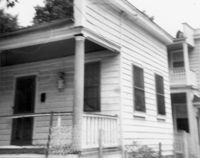
Johns Island Presbyterian Church, 2550 Bohicket Road. Church - Detail View of door and lamppost, Front elevation. Johns Island, S.C.;8" x 10" B/W photo. Box 12, Folder 2-5-4. One copy.