Search
« Previous |
81 - 100 of 1,145
|
Next »
Search Results
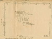
- Description:
- Map of area bounded by Wentworth, King, Beaufain, and St. Philip Street.
- Date:
- 1940s
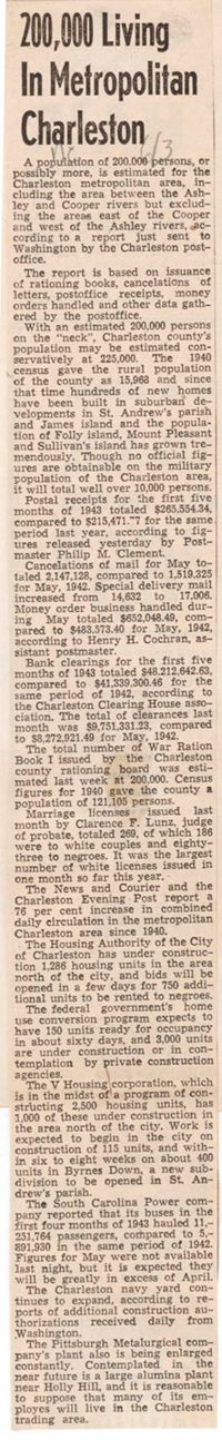
- Description:
- Article entitled "200,000 Living in Metropolitan Charleston."
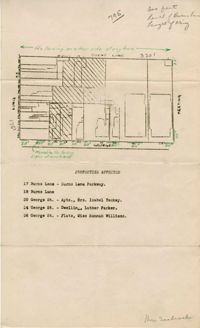
- Description:
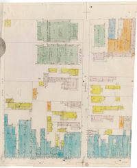
- Map of area bounded by Burns Lane, George, Meeting, and King Street.
- Description:
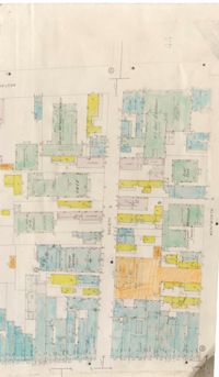
- Map of area bounded by Society, Meeting, Wentworth, and King Street.
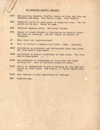
- Description:
- Assignment of tasks to complete traffic studies.
- Description:
- Notes on preservation of historic buildings in England lecture by Mr. Underwood.
- Description:
- Notes from "Regional and Town Planning" by W.H. McLean.
- Description:
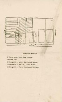
- Color-coded map of area between George Street and Burns Lane, where they meet King Street.
- Description:
- Color-coded map of area between Society Street and Wentworth Street at Meeting Street..
- Description:
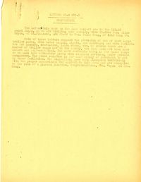
- Disposition by the Community Development Council of listener suggestion about crowded buses in Charleston.
- Description:
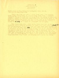
- Disposition by the Community Development Council of two listener suggestions regarding the provision on trailer park camps.
- Description:
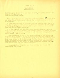
- Disposition by the Community Development Council of listerner suggestion regarding transportation.
- Description:
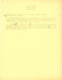
- Disposition by the Community Development Council of listener suggestion regarding housing for war workers.
- Description:
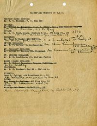
- Ex-Officio membership list for the Civic Services Committee.
- Description:
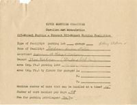
- Off-street parking facilities survey filled out for Goldman's Service Station.
- Description:
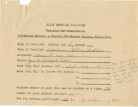
- Off-street parking facilities survey filled out for Condon's Filling Station.
- Description:
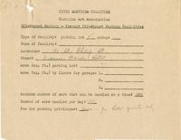
- Off-street parking facilities survey filled out for Francis Marion Hotel.
- Description:
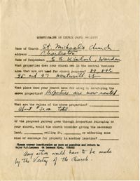
- Church owned property questionnaire filled out for St. Michael's Church.
- Description:
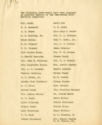
- List of individuals proposed to become members of the Charleston Civic Services Committee.
- Description:
- Map of area bounded by George Street, King Street, Burns Lane, and Meeting Street.